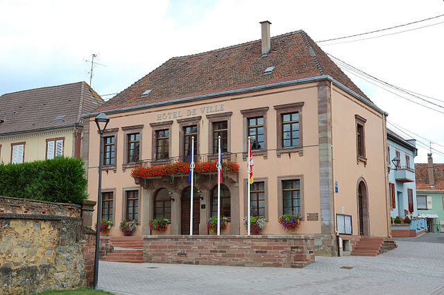
Schaffhouse-sur-Zorn (Schaffhouse-sur-Zorn)

- former commune in Bas-Rhin, France
- Country:

- Postal Code: 67270
- Coordinates: 48° 43' 57" N, 7° 33' 48" E


- GPS tracks (wikiloc): [Link]
- Area: 3.67 sq km
- Population: 414
- Wikipedia en: wiki(en)
- Wikipedia: wiki(fr)
- Wikidata storage: Wikidata: Q21352
- Wikipedia Commons Category: [Link]
- Freebase ID: [/m/03m9bvt]
- Freebase ID: [/m/03m9bvt]
- GeoNames ID: Alt: [6441340]
- GeoNames ID: Alt: [6441340]
- BnF ID: [152715813]
- BnF ID: [152715813]
- VIAF ID: Alt: [239209321]
- VIAF ID: Alt: [239209321]
- INSEE municipality code: 67439
- INSEE municipality code: 67439
Shares border with regions:


Ingenheim
- commune in Bas-Rhin, France
- Country:
- Postal Code: 67270
- Coordinates: 48° 44' 5" N, 7° 31' 14" E
- GPS tracks (wikiloc): [Link]
- Area: 5.37 sq km
- Population: 326


Mutzenhouse
- commune in Bas-Rhin, France
- Country:
- Postal Code: 67270
- Coordinates: 48° 44' 27" N, 7° 35' 19" E
- GPS tracks (wikiloc): [Link]
- Area: 2.21 sq km
- Population: 439


Hohfrankenheim
- commune in Bas-Rhin, France
- Country:
- Postal Code: 67270
- Coordinates: 48° 43' 48" N, 7° 34' 35" E
- GPS tracks (wikiloc): [Link]
- Area: 2.76 sq km
- Population: 255

Hochfelden
- former commune in Bas-Rhin, France
- Country:
- Postal Code: 67270
- Coordinates: 48° 45' 34" N, 7° 34' 12" E
- GPS tracks (wikiloc): [Link]
- Area: 12.09 sq km
- Population: 3516

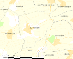
Duntzenheim
- commune in Bas-Rhin, France
- Country:
- Postal Code: 67270
- Coordinates: 48° 42' 43" N, 7° 32' 6" E
- GPS tracks (wikiloc): [Link]
- Area: 6.21 sq km
- Population: 630