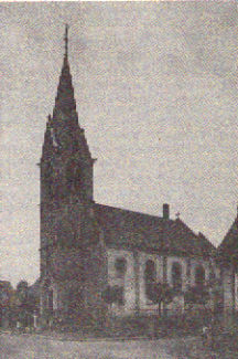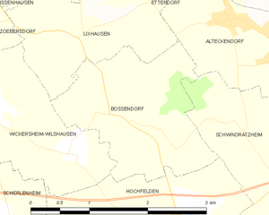
Hochfelden (Hochfelden)
- former commune in Bas-Rhin, France
- Country:

- Postal Code: 67270
- Coordinates: 48° 45' 34" N, 7° 34' 12" E


- GPS tracks (wikiloc): [Link]
- Area: 12.09 sq km
- Population: 3516
- Wikipedia en: wiki(en)
- Wikipedia: wiki(fr)
- Wikidata storage: Wikidata: Q21503
- Wikipedia Commons Category: [Link]
- Freebase ID: [/m/03m98h5]
- Freebase ID: [/m/03m98h5]
- GeoNames ID: Alt: [6441151]
- GeoNames ID: Alt: [6441151]
- BnF ID: [15271344b]
- BnF ID: [15271344b]
- VIAF ID: Alt: [282914843]
- VIAF ID: Alt: [282914843]
- GND ID: Alt: [1028218125]
- GND ID: Alt: [1028218125]
- WOEID: [594866]
- WOEID: [594866]
- INSEE municipality code: 67202
- INSEE municipality code: 67202
Shares border with regions:


Schwindratzheim
- commune in Bas-Rhin, France
- Country:

- Postal Code: 67270
- Coordinates: 48° 45' 25" N, 7° 36' 6" E


- GPS tracks (wikiloc): [Link]
- Area: 9.14 sq km
- Population: 1620
Schaffhouse-sur-Zorn
- former commune in Bas-Rhin, France
- Country:

- Postal Code: 67270
- Coordinates: 48° 43' 57" N, 7° 33' 48" E


- GPS tracks (wikiloc): [Link]
- Area: 3.67 sq km
- Population: 414


Ingenheim
- commune in Bas-Rhin, France
- Country:

- Postal Code: 67270
- Coordinates: 48° 44' 5" N, 7° 31' 14" E


- GPS tracks (wikiloc): [Link]
- Area: 5.37 sq km
- Population: 326


Mutzenhouse
- commune in Bas-Rhin, France
- Country:

- Postal Code: 67270
- Coordinates: 48° 44' 27" N, 7° 35' 19" E


- GPS tracks (wikiloc): [Link]
- Area: 2.21 sq km
- Population: 439


Hohfrankenheim
- commune in Bas-Rhin, France
- Country:

- Postal Code: 67270
- Coordinates: 48° 43' 48" N, 7° 34' 35" E


- GPS tracks (wikiloc): [Link]
- Area: 2.76 sq km
- Population: 255
Scherlenheim
- commune in Bas-Rhin, France
- Country:

- Postal Code: 67270
- Coordinates: 48° 45' 52" N, 7° 32' 5" E


- GPS tracks (wikiloc): [Link]
- Area: 2.32 sq km
- Population: 129


Melsheim
- commune in Bas-Rhin, France
- Country:

- Postal Code: 67270
- Coordinates: 48° 45' 27" N, 7° 31' 18" E


- GPS tracks (wikiloc): [Link]
- Area: 5.21 sq km
- Population: 582


Bossendorf
- commune in Bas-Rhin, France
- Country:

- Postal Code: 67270
- Coordinates: 48° 46' 51" N, 7° 33' 32" E


- GPS tracks (wikiloc): [Link]
- Area: 3.98 sq km
- Population: 401


Wickersheim-Wilshausen
- commune in Bas-Rhin, France
- Country:

- Postal Code: 67270
- Coordinates: 48° 46' 59" N, 7° 31' 55" E


- GPS tracks (wikiloc): [Link]
- AboveSeaLevel: 185 м m
- Area: 5.45 sq km
- Population: 418
- Web site: [Link]
