Senargent-Mignafans (Senargent-Mignafans)

- commune in Haute-Saône, France
- Country:

- Postal Code: 70110
- Coordinates: 47° 33' 54" N, 6° 31' 34" E


- GPS tracks (wikiloc): [Link]
- AboveSeaLevel: 302 м m
- Area: 10.77 sq km
- Population: 300
- Wikipedia en: wiki(en)
- Wikipedia: wiki(fr)
- Wikidata storage: Wikidata: Q113274
- Wikipedia Commons Category: [Link]
- Freebase ID: [/m/03nvsrh]
- GeoNames ID: Alt: [6617500]
- SIREN number: [217004878]
- BnF ID: [15272879m]
- INSEE municipality code: 70487
Shares border with regions:
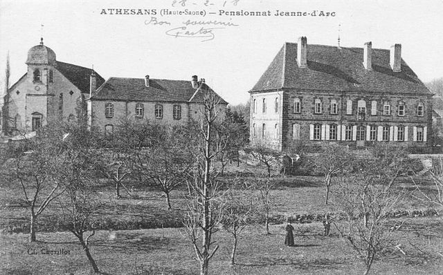

Athesans-Étroitefontaine
- commune in Haute-Saône, France
- Country:
- Postal Code: 70110
- Coordinates: 47° 35' 48" N, 6° 30' 37" E
- GPS tracks (wikiloc): [Link]
- AboveSeaLevel: 390 м m
- Area: 12.88 sq km
- Population: 662

Villafans
- commune in Haute-Saône, France
- Country:
- Postal Code: 70110
- Coordinates: 47° 34' 52" N, 6° 28' 20" E
- GPS tracks (wikiloc): [Link]
- Area: 6.44 sq km
- Population: 208

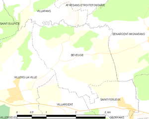
Beveuge
- commune in Haute-Saône, France
- Country:
- Postal Code: 70110
- Coordinates: 47° 33' 30" N, 6° 28' 58" E
- GPS tracks (wikiloc): [Link]
- Area: 5.18 sq km
- Population: 82


Mignavillers
- commune in Haute-Saône, France
- Country:
- Postal Code: 70400
- Coordinates: 47° 34' 50" N, 6° 33' 6" E
- GPS tracks (wikiloc): [Link]
- Area: 7.59 sq km
- Population: 337


Vellechevreux-et-Courbenans
- commune in Haute-Saône, France
 Hiking in Vellechevreux-et-Courbenans
Vellechevreux-et-Courbenans is a small commune located in the Bourgogne-Franche-Comté region of eastern France. While it may not be as widely known as other hiking destinations, it offers a charming experience for those looking to explore rural France....
- Country:
- Postal Code: 70110
- Coordinates: 47° 32' 24" N, 6° 32' 19" E
- GPS tracks (wikiloc): [Link]
- AboveSeaLevel: 288 м m
- Area: 9.14 sq km
- Population: 133


Saint-Ferjeux
- commune in Haute-Saône, France
- Country:
- Postal Code: 70110
- Coordinates: 47° 32' 37" N, 6° 30' 36" E
- GPS tracks (wikiloc): [Link]
- Area: 1.77 sq km
- Population: 78


Secenans
- commune in Haute-Saône, France
Hiking in Secenans
I’m sorry, but it appears there may be a typo in your query regarding "Secenans." If you meant "Sicily," "Sedona," or another specific hiking destination, please clarify, and I’d be happy to provide information on hiking in that area! If it is a specific local area or trail, please provide more details so I can assist you better....
- Country:
- Postal Code: 70400
- Coordinates: 47° 33' 12" N, 6° 34' 28" E
- GPS tracks (wikiloc): [Link]
- Area: 2.88 sq km
- Population: 176

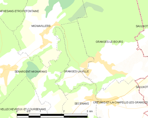
Granges-la-Ville
- commune in Haute-Saône, France
- Country:
- Postal Code: 70400
- Coordinates: 47° 34' 0" N, 6° 34' 21" E
- GPS tracks (wikiloc): [Link]
- Area: 2.61 sq km
- Population: 193