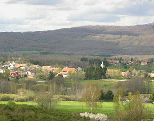
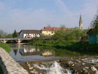
Sermamagny (Sermamagny)

- commune in Territoire de Belfort, France
- Country:

- Postal Code: 90300
- Coordinates: 47° 41' 32" N, 6° 50' 9" E


- GPS tracks (wikiloc): [Link]
- Area: 7.9 sq km
- Population: 817
- Web site: http://www.sermamagny.fr
- Wikipedia en: wiki(en)
- Wikipedia: wiki(fr)
- Wikidata storage: Wikidata: Q753691
- Wikipedia Commons Category: [Link]
- Freebase ID: [/m/03mhh25]
- Freebase ID: [/m/03mhh25]
- Freebase ID: [/m/03mhh25]
- GeoNames ID: Alt: [6451936]
- GeoNames ID: Alt: [6451936]
- GeoNames ID: Alt: [6451936]
- SIREN number: [219000932]
- SIREN number: [219000932]
- SIREN number: [219000932]
- BnF ID: [152800345]
- BnF ID: [152800345]
- BnF ID: [152800345]
- MusicBrainz area ID: [48379413-4e5d-4235-9a39-6a40f731ad75]
- MusicBrainz area ID: [48379413-4e5d-4235-9a39-6a40f731ad75]
- MusicBrainz area ID: [48379413-4e5d-4235-9a39-6a40f731ad75]
- INSEE municipality code: 90093
- INSEE municipality code: 90093
- INSEE municipality code: 90093
Shares border with regions:

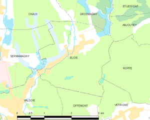
Éloie
- commune in Territoire de Belfort, France
- Country:
- Postal Code: 90300
- Coordinates: 47° 41' 26" N, 6° 52' 25" E
- GPS tracks (wikiloc): [Link]
- Area: 5.55 sq km
- Population: 958
- Web site: [Link]

Évette-Salbert
- commune in Territoire de Belfort, France
- Country:
- Postal Code: 90350
- Coordinates: 47° 40' 30" N, 6° 47' 54" E
- GPS tracks (wikiloc): [Link]
- AboveSeaLevel: 391 м m
- Area: 9.16 sq km
- Population: 2073
- Web site: [Link]


Chaux
- commune in Territoire de Belfort, France
- Country:
- Postal Code: 90330
- Coordinates: 47° 42' 20" N, 6° 50' 15" E
- GPS tracks (wikiloc): [Link]
- AboveSeaLevel: 463 м m
- Area: 9.26 sq km
- Population: 1109
- Web site: [Link]


Lachapelle-sous-Chaux
- commune in Territoire de Belfort, France
- Country:
- Postal Code: 90300
- Coordinates: 47° 42' 17" N, 6° 49' 16" E
- GPS tracks (wikiloc): [Link]
- Area: 11.16 sq km
- Population: 718
- Web site: [Link]

Valdoie
- commune in Territoire de Belfort, France
- Country:
- Postal Code: 90300
- Coordinates: 47° 40' 2" N, 6° 50' 31" E
- GPS tracks (wikiloc): [Link]
- Area: 4.66 sq km
- Population: 5382
- Web site: [Link]