Sion-les-Mines (Sion-les-Mines)

- commune in Loire-Atlantique, France
- Country:

- Postal Code: 44590
- Coordinates: 47° 44' 6" N, 1° 35' 31" E


- GPS tracks (wikiloc): [Link]
- Area: 54.71 sq km
- Population: 1612
- Web site: http://www.mairie-sionlesmines.fr
- Wikipedia en: wiki(en)
- Wikipedia: wiki(fr)
- Wikidata storage: Wikidata: Q945573
- Wikipedia Commons Category: [Link]
- Freebase ID: [/m/0f07dl]
- Freebase ID: [/m/0f07dl]
- GeoNames ID: Alt: [6434546]
- GeoNames ID: Alt: [6434546]
- SIREN number: [214401978]
- SIREN number: [214401978]
- BnF ID: [152603666]
- BnF ID: [152603666]
- VIAF ID: Alt: [129164069]
- VIAF ID: Alt: [129164069]
- PACTOLS thesaurus ID: [pcrtGxjYOLvkn7]
- PACTOLS thesaurus ID: [pcrtGxjYOLvkn7]
- INSEE municipality code: 44197
- INSEE municipality code: 44197
Shares border with regions:

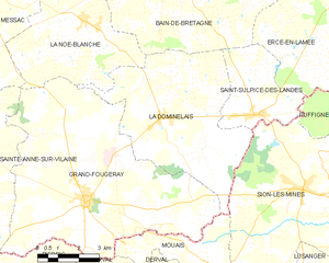
La Dominelais
- commune in Ille-et-Vilaine, France
- Country:
- Postal Code: 35390
- Coordinates: 47° 45' 45" N, 1° 41' 18" E
- GPS tracks (wikiloc): [Link]
- Area: 32.45 sq km
- Population: 1350


Ruffigné
- commune in Loire-Atlantique, France
- Country:
- Postal Code: 44660
- Coordinates: 47° 45' 25" N, 1° 29' 37" E
- GPS tracks (wikiloc): [Link]
- Area: 33.63 sq km
- Population: 714
- Web site: [Link]


Saint-Sulpice-des-Landes
- commune in Ille-et-Vilaine, France
- Country:
- Postal Code: 35390
- Coordinates: 47° 46' 0" N, 1° 37' 23" E
- GPS tracks (wikiloc): [Link]
- AboveSeaLevel: 45 м m
- Area: 11.19 sq km
- Population: 792


Lusanger
- commune in Loire-Atlantique, France
- Country:
- Postal Code: 44590
- Coordinates: 47° 40' 51" N, 1° 35' 18" E
- GPS tracks (wikiloc): [Link]
- Area: 35.38 sq km
- Population: 1027
- Web site: [Link]


Saint-Aubin-des-Châteaux
- commune in Loire-Atlantique, France
- Country:
- Postal Code: 44110
- Coordinates: 47° 43' 12" N, 1° 29' 11" E
- GPS tracks (wikiloc): [Link]
- Area: 47.56 sq km
- Population: 1765
- Web site: [Link]


Mouais
- commune in Loire-Atlantique, France
- Country:
- Postal Code: 44590
- Coordinates: 47° 41' 44" N, 1° 38' 40" E
- GPS tracks (wikiloc): [Link]
- Area: 9.93 sq km
- Population: 384
- Web site: [Link]