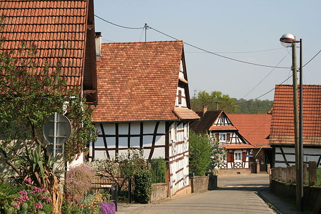
Soultz-sous-Forêts (Soultz-sous-Forêts)
- commune in Bas-Rhin, France
- Country:

- Postal Code: 67250
- Coordinates: 48° 56' 19" N, 7° 52' 50" E


- GPS tracks (wikiloc): [Link]
- Area: 15.15 sq km
- Population: 3127
- Web site: http://www.soultzsousforets.fr/
- Wikipedia en: wiki(en)
- Wikipedia: wiki(fr)
- Wikidata storage: Wikidata: Q381659
- Wikipedia Commons Category: [Link]
- Freebase ID: [/m/03m9c8x]
- Freebase ID: [/m/03m9c8x]
- Freebase ID: [/m/03m9c8x]
- GeoNames ID: Alt: [2973990]
- GeoNames ID: Alt: [2973990]
- GeoNames ID: Alt: [2973990]
- SIREN number: [216704742]
- SIREN number: [216704742]
- SIREN number: [216704742]
- BnF ID: [15271616x]
- BnF ID: [15271616x]
- BnF ID: [15271616x]
- VIAF ID: Alt: [129453464]
- VIAF ID: Alt: [129453464]
- VIAF ID: Alt: [129453464]
- archINFORM location ID: [11745]
- archINFORM location ID: [11745]
- archINFORM location ID: [11745]
- Library of Congress authority ID: Alt: [nr92014533]
- Library of Congress authority ID: Alt: [nr92014533]
- Library of Congress authority ID: Alt: [nr92014533]
- WOEID: [622595]
- WOEID: [622595]
- WOEID: [622595]
- INSEE municipality code: 67474
- INSEE municipality code: 67474
- INSEE municipality code: 67474
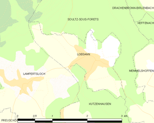
Shares border with regions:


Drachenbronn-Birlenbach
- commune in Bas-Rhin, France
- Country:

- Postal Code: 67160
- Coordinates: 48° 59' 11" N, 7° 52' 13" E


- GPS tracks (wikiloc): [Link]
- Area: 7.13 sq km
- Population: 836
- Web site: [Link]


Keffenach
- commune in Bas-Rhin, France
- Country:

- Postal Code: 67250
- Coordinates: 48° 57' 53" N, 7° 52' 56" E


- GPS tracks (wikiloc): [Link]
- Area: 2.39 sq km
- Population: 189
Memmelshoffen
- commune in Bas-Rhin, France
- Country:

- Postal Code: 67250
- Coordinates: 48° 57' 37" N, 7° 52' 11" E


- GPS tracks (wikiloc): [Link]
- Area: 1.82 sq km
- Population: 332


Lampertsloch
- commune in Bas-Rhin, France
- Country:

- Postal Code: 67250
- Coordinates: 48° 57' 30" N, 7° 48' 59" E


- GPS tracks (wikiloc): [Link]
- Area: 10.43 sq km
- Population: 736


Lobsann
- commune in Bas-Rhin, France
- Country:

- Postal Code: 67250
- Coordinates: 48° 57' 48" N, 7° 50' 46" E


- GPS tracks (wikiloc): [Link]
- Area: 2.73 sq km
- Population: 634
Retschwiller
- commune in Bas-Rhin, France
- Country:

- Postal Code: 67250
- Coordinates: 48° 57' 0" N, 7° 52' 45" E


- GPS tracks (wikiloc): [Link]
- Area: 3.26 sq km
- Population: 279


Cleebourg
- commune in Bas-Rhin, France
- Country:

- Postal Code: 67160
- Coordinates: 49° 0' 13" N, 7° 53' 28" E


- GPS tracks (wikiloc): [Link]
- Area: 10.59 sq km
- Population: 712


Surbourg
- commune in Bas-Rhin, France
- Country:

- Postal Code: 67250
- Coordinates: 48° 54' 32" N, 7° 50' 52" E


- GPS tracks (wikiloc): [Link]
- Area: 10.46 sq km
- Population: 1667


Betschdorf
- commune in Bas-Rhin, France
- Country:

- Postal Code: 67660
- Coordinates: 48° 53' 55" N, 7° 54' 21" E


- GPS tracks (wikiloc): [Link]
- Area: 28.11 sq km
- Population: 4113
- Web site: [Link]


Kutzenhausen
- commune in Bas-Rhin, France
- Country:

- Postal Code: 67250
- Coordinates: 48° 55' 59" N, 7° 51' 20" E


- GPS tracks (wikiloc): [Link]
- Area: 7.2 sq km
- Population: 923


Hoffen
- commune in Bas-Rhin, France
- Country:

- Postal Code: 67250
- Coordinates: 48° 55' 47" N, 7° 56' 32" E


- GPS tracks (wikiloc): [Link]
- Area: 9.45 sq km
- Population: 1138
