Sprockhövel (Sprockhövel)

- town in Ennepe-Ruhr-Kreis, North Rhine-Westphalia, Germany
 Hiking in Sprockhövel
Sprockhövel is a charming town located in North Rhine-Westphalia, Germany, and is surrounded by beautiful landscapes that are ideal for hiking enthusiasts. Here are some highlights and tips for hiking in the Sprockhövel area:
Hiking Trails
-
Surrounding Natural Areas: The town is adjacent to several natural parks and forests, including the nearby Ruhrgebiet region, which features various hiking paths, including scenic routes through woodlands, along streams, and across hills.
-
Forest Trails: There are numerous forest trails around Sprockhövel, providing a serene atmosphere ideal for nature walks. The trails are generally well-marked, making navigation easier for hikers of all skill levels.
-
Local Parks: The region contains several parks that offer shorter, more leisurely walks. These are particularly nice for families or casual hikers looking to enjoy the outdoors without embarking on strenuous hikes.
-
Distant Hiking Routes: For those looking to explore further, you can access longer-distance hiking routes that connect to larger networks, like the "Waldroute" (Forest Route) or the "Rheinischer Jakobsweg" (Rhineland Camino).
What to Expect
- Scenic Views: Trails often offer picturesque views, especially during the fall when the leaves change colors.
- Wildlife: Expect to see various wildlife, including birds and small mammals, particularly in the wooded areas.
- Cultural Sites: Along some trails, you might encounter historical landmarks and information boards detailing local flora and fauna or the history of the region.
Hiking Tips
- Gear: Wear sturdy hiking shoes and appropriate clothing for the weather. A good backpack and water bottle are essential for longer hikes.
- Weather: Check the local weather forecast before heading out. The weather can change quickly, so be prepared for rain or cooler temperatures.
- Leave No Trace: Always follow the Leave No Trace principles to preserve the natural beauty of the area.
Local Amenities
Sprockhövel has various facilities such as cafes and shops where you can rest and refresh after your hikes. It’s a good idea to pack some snacks and a picnic if you’re planning to spend the whole day outdoors.
Whether you're an experienced hiker or just looking for a peaceful walk in nature, Sprockhövel offers a delightful escape into the outdoors. Make sure to explore the local trails and enjoy the natural beauty of this quiet town!
- Country:

- Postal Code: 45549
- Local Dialing Code: 0202; 02324; 02339
- Licence Plate Code: EN, WIT
- Coordinates: 51° 21' 0" N, 7° 15' 0" E


- GPS tracks (wikiloc): [Link]
- AboveSeaLevel: 219 м m
- Area: 48 sq km
- Population: 24783
- Web site: https://www.sprockhoevel.de/
- Wikipedia en: wiki(en)
- Wikipedia: wiki(de)
- Wikidata storage: Wikidata: Q11340
- Wikipedia Commons Gallery: [Link]
- Wikipedia Commons Category: [Link]
- Wikipedia Commons Maps Category: [Link]
- Freebase ID: [/m/04m61f]
- GeoNames ID: Alt: [2829998]
- VIAF ID: Alt: [139610085]
- OSM relation ID: [162829]
- GND ID: Alt: [4056569-5]
- Library of Congress authority ID: Alt: [n84195946]
- WOEID: [695962]
- TGN ID: [1041274]
- UN/LOCODE: [DESPO]
- German municipality key: 05954028
Includes regions:

Gennebreck
- district of Sprockhövel, North Rhine-Westphalia, Germany
Hiking in Gennebreck
Gennebreck is a beautiful area located in Germany, particularly known for its scenic landscapes and hiking opportunities. Nestled in the region of North Rhine-Westphalia, it offers a variety of trails that cater to different skill levels, from beginners to experienced hikers....
- Country:
- Coordinates: 51° 18' 41" N, 7° 12' 10" E
- GPS tracks (wikiloc): [Link]
- AboveSeaLevel: 262 м m
Niedersprockhövel
- district of Sprockhövel, North Rhine-Westphalia, Germany
Hiking in Niedersprockhövel
Niedersprockhövel, located in North Rhine-Westphalia, Germany, is surrounded by natural beauty, making it a great spot for hiking. The area features a mix of forests, hills, and open spaces, offering various trails suitable for different skill levels....
- Country:
- Coordinates: 51° 21' 52" N, 7° 14' 47" E
- GPS tracks (wikiloc): [Link]
Obersprockhövel
- district of Sprockhövel, North Rhine-Westphalia, Germany
Hiking in Obersprockhövel
Obersprockhövel, located in the North Rhine-Westphalia region of Germany, offers a variety of hiking opportunities that showcase the scenic beauty of the surrounding area. While not as widely known as some larger hiking destinations, this area has its own charm and several intriguing routes....
- Country:

Haßlinghausen
- district of Sprockhövel, North Rhine-Westphalia, Germany
Hiking in Haßlinghausen
Haßlinghausen, a district in the municipality of Wetter, North Rhine-Westphalia, Germany, offers a charming environment for hiking enthusiasts. Nestled in the scenic Ruhr Valley, it provides a blend of natural beauty and local culture, making it a great destination for hikers of all levels....
- Country:
- Postal Code: 45549
- Local Dialing Code: 02339
- Coordinates: 51° 19' 57" N, 7° 16' 50" E
- GPS tracks (wikiloc): [Link]
- AboveSeaLevel: 263 м m

Hiddinghausen
- district of Sprockhövel, North Rhine-Westphalia, Germany
Hiking in Hiddinghausen
Hiddinghausen, a small village in North Rhine-Westphalia, Germany, offers a variety of hiking opportunities that showcase the natural beauty of the surrounding area. Here are some key points to consider when hiking in Hiddinghausen:...
- Country:
- Postal Code: 45549
- Local Dialing Code: 02324
- Coordinates: 51° 21' 22" N, 7° 17' 14" E
- GPS tracks (wikiloc): [Link]
- AboveSeaLevel: 232 м m
Shares border with regions:

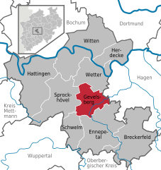
Gevelsberg
- town in Ennepe-Ruhr-Kreis, North Rhine-Westphalia, Germany
Hiking in Gevelsberg
Gevelsberg, a charming town located in North Rhine-Westphalia, Germany, offers several opportunities for hiking enthusiasts to explore its picturesque landscapes. Nestled in the Ruhr area, Gevelsberg is surrounded by beautiful natural settings, including rolling hills, forests, and scenic valleys....
- Country:
- Postal Code: 58285
- Local Dialing Code: 02332
- Licence Plate Code: EN
- Coordinates: 51° 18' 0" N, 7° 20' 0" E
- GPS tracks (wikiloc): [Link]
- AboveSeaLevel: 170 м m
- Area: 26.27 sq km
- Population: 30910
- Web site: [Link]


Wetter (Ruhr)
- town in the district of Ennepe-Ruhr-Kreis, in North Rhine-Westphalia, Germany
Hiking in Wetter (Ruhr)
Wetter (Ruhr) is a charming municipality located in the North Rhine-Westphalia region of Germany, offering a variety of outdoor recreation opportunities, including hiking. Nestled in the Ruhr area, it features scenic landscapes that appeal to outdoor enthusiasts. Here are some key points about hiking in Wetter (Ruhr):...
- Country:
- Postal Code: 58300
- Local Dialing Code: 02335
- Licence Plate Code: EN
- Coordinates: 51° 23' 17" N, 7° 23' 42" E
- GPS tracks (wikiloc): [Link]
- AboveSeaLevel: 110 м m
- Area: 31.47 sq km
- Population: 27628
- Web site: [Link]


Wuppertal
- city in North Rhine-Westphalia, Germany
Hiking in Wuppertal
Wuppertal, located in North Rhine-Westphalia, Germany, offers some unique hiking opportunities, particularly due to its hilly landscape and green spaces. While Wuppertal is more famous for its iconic suspension railway, it also has beautiful trails that cater to different skill levels....
- Country:
- Postal Code: 42001–42399
- Local Dialing Code: 02053; 02058; 0202
- Licence Plate Code: W
- Coordinates: 51° 15' 38" N, 7° 10' 22" E
- GPS tracks (wikiloc): [Link]
- AboveSeaLevel: 157 м m
- Area: 168.39 sq km
- Population: 352390
- Web site: [Link]

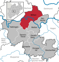
Witten
- town in the district of Ennepe-Ruhr-Kreis, in North Rhine-Westphalia, Germany
Hiking in Witten
Witten, located in North Rhine-Westphalia, Germany, offers a variety of hiking opportunities that showcase the region's natural beauty and historical sites. Here are some highlights for hiking in and around Witten:...
- Country:
- Postal Code: 58456; 58455; 58454; 58453; 58452
- Local Dialing Code: 02302
- Coordinates: 51° 26' 0" N, 7° 20' 0" E
- GPS tracks (wikiloc): [Link]
- AboveSeaLevel: 104 м m
- Area: 72.37 sq km
- Population: 96565
- Web site: [Link]