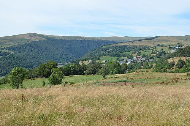
Thérondels (Thérondels)

- commune in Aveyron, France
- Country:

- Postal Code: 12600
- Coordinates: 44° 53' 45" N, 2° 45' 31" E


- GPS tracks (wikiloc): [Link]
- Area: 38.47 sq km
- Population: 411
- Web site: http://www.therondels.fr
- Wikipedia en: wiki(en)
- Wikipedia: wiki(fr)
- Wikidata storage: Wikidata: Q569252
- Wikipedia Commons Category: [Link]
- Freebase ID: [/m/03m962d]
- GeoNames ID: Alt: [6612277]
- SIREN number: [211202809]
- BnF ID: [15247256w]
- VIAF ID: Alt: [246970431]
- INSEE municipality code: 12280
Shares border with regions:


Cantoin
- commune in Aveyron, France
- Country:
- Postal Code: 12420
- Coordinates: 44° 50' 10" N, 2° 48' 45" E
- GPS tracks (wikiloc): [Link]
- Area: 42.37 sq km
- Population: 309

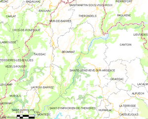
Brommat
- commune in Aveyron, France
- Country:
- Postal Code: 12600
- Coordinates: 44° 49' 47" N, 2° 41' 5" E
- GPS tracks (wikiloc): [Link]
- Area: 43.28 sq km
- Population: 639


Sainte-Geneviève-sur-Argence
- former commune in Aveyron, France
- Country:
- Postal Code: 12420
- Coordinates: 44° 48' 7" N, 2° 45' 31" E
- GPS tracks (wikiloc): [Link]
- Area: 43.4 sq km
- Population: 962
Narnhac
- commune in Cantal, France
- Country:
- Postal Code: 15230
- Coordinates: 44° 55' 43" N, 2° 46' 44" E
- GPS tracks (wikiloc): [Link]
- Area: 10.29 sq km
- Population: 75
Lacapelle-Barrès
- commune in Cantal, France
- Country:
- Postal Code: 15230
- Coordinates: 44° 56' 3" N, 2° 43' 24" E
- GPS tracks (wikiloc): [Link]
- Area: 6.3 sq km
- Population: 58
Malbo
- commune in Cantal, France
- Country:
- Postal Code: 15230
- Coordinates: 44° 58' 24" N, 2° 45' 22" E
- GPS tracks (wikiloc): [Link]
- Area: 29.34 sq km
- Population: 103


Mur-de-Barrez
- commune in Aveyron, France
- Country:
- Postal Code: 12600
- Coordinates: 44° 50' 32" N, 2° 39' 42" E
- GPS tracks (wikiloc): [Link]
- AboveSeaLevel: 803 м m
- Area: 20.18 sq km
- Population: 785
- Web site: [Link]


Saint-Martin-sous-Vigouroux
- commune in Cantal, France
- Country:
- Postal Code: 15230
- Coordinates: 44° 55' 23" N, 2° 48' 10" E
- GPS tracks (wikiloc): [Link]
- Area: 19.29 sq km
- Population: 245


Pailherols
- commune in Cantal, France
- Country:
- Postal Code: 15800
- Coordinates: 44° 57' 3" N, 2° 41' 3" E
- GPS tracks (wikiloc): [Link]
- Area: 25.98 sq km
- Population: 133

Paulhenc
- commune in Cantal, France
- Country:
- Postal Code: 15230
- Coordinates: 44° 53' 23" N, 2° 49' 2" E
- GPS tracks (wikiloc): [Link]
- Area: 23.69 sq km
- Population: 246