Vannes-le-Châtel (Vannes-le-Châtel)

- commune in Meurthe-et-Moselle, France
- Country:

- Postal Code: 54112
- Coordinates: 48° 32' 45" N, 5° 46' 46" E


- GPS tracks (wikiloc): [Link]
- Area: 17.3 sq km
- Population: 574
- Wikipedia en: wiki(en)
- Wikipedia: wiki(fr)
- Wikidata storage: Wikidata: Q920268
- Wikipedia Commons Category: [Link]
- Freebase ID: [/m/03qdnp1]
- Freebase ID: [/m/03qdnp1]
- GeoNames ID: Alt: [6436895]
- GeoNames ID: Alt: [6436895]
- SIREN number: [215405481]
- SIREN number: [215405481]
- BnF ID: [152646153]
- BnF ID: [152646153]
- VIAF ID: Alt: [145242287]
- VIAF ID: Alt: [145242287]
- INSEE municipality code: 54548
- INSEE municipality code: 54548
Shares border with regions:
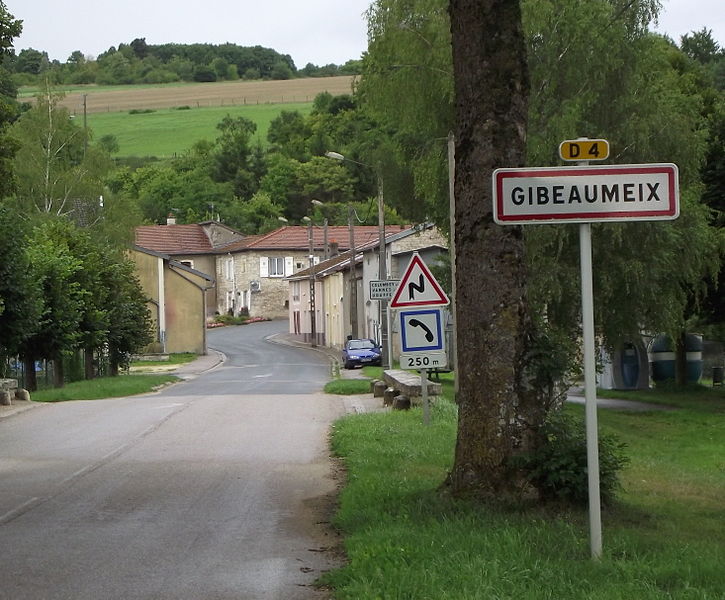

Gibeaumeix
- commune in Meurthe-et-Moselle, France
- Country:
- Postal Code: 54112
- Coordinates: 48° 34' 55" N, 5° 43' 57" E
- GPS tracks (wikiloc): [Link]
- Area: 7.8 sq km
- Population: 167

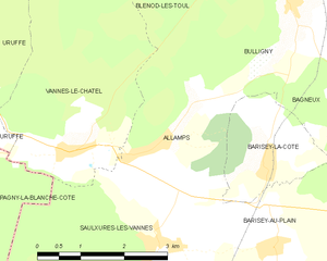
Allamps
- commune in Meurthe-et-Moselle, France
- Country:
- Postal Code: 54112
- Coordinates: 48° 32' 50" N, 5° 48' 34" E
- GPS tracks (wikiloc): [Link]
- Area: 7.21 sq km
- Population: 523
- Web site: [Link]


Pagny-la-Blanche-Côte
- commune in Meuse, France
- Country:
- Postal Code: 55140
- Coordinates: 48° 32' 27" N, 5° 43' 16" E
- GPS tracks (wikiloc): [Link]
- Area: 12.43 sq km
- Population: 242
Uruffe
- commune in Meurthe-et-Moselle, France
- Country:
- Postal Code: 54112
- Coordinates: 48° 34' 9" N, 5° 44' 38" E
- GPS tracks (wikiloc): [Link]
- Area: 13.05 sq km
- Population: 396
- Web site: [Link]


Saulxures-lès-Vannes
- commune in Meurthe-et-Moselle, France
- Country:
- Postal Code: 54170
- Coordinates: 48° 31' 35" N, 5° 48' 26" E
- GPS tracks (wikiloc): [Link]
- Area: 18.04 sq km
- Population: 371


Rigny-Saint-Martin
- commune in Meuse, France
- Country:
- Postal Code: 55140
- Coordinates: 48° 36' 40" N, 5° 42' 51" E
- GPS tracks (wikiloc): [Link]
- Area: 16.11 sq km
- Population: 56

Blénod-lès-Toul
- commune in Meurthe-et-Moselle, France
- Country:
- Postal Code: 54113
- Coordinates: 48° 35' 58" N, 5° 50' 0" E
- GPS tracks (wikiloc): [Link]
- Area: 17.6 sq km
- Population: 1089