Verdigny (Verdigny)

- commune in Cher, France
- Country:

- Postal Code: 18300
- Coordinates: 47° 20' 49" N, 2° 48' 30" E


- GPS tracks (wikiloc): [Link]
- Area: 4.99 sq km
- Population: 315
- Wikipedia en: wiki(en)
- Wikipedia: wiki(fr)
- Wikidata storage: Wikidata: Q1423243
- Wikipedia Commons Category: [Link]
- Freebase ID: [/m/03mffhx]
- GeoNames ID: Alt: [6428326]
- SIREN number: [211802749]
- BnF ID: [15249620g]
- WOEID: [12641368]
- INSEE municipality code: 18274
Shares border with regions:
Menetou-Râtel
- commune in Cher, France
- Country:
- Postal Code: 18300
- Coordinates: 47° 21' 4" N, 2° 45' 21" E
- GPS tracks (wikiloc): [Link]
- Area: 28.01 sq km
- Population: 492

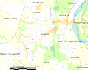
Sancerre
- commune in Cher, France
- Country:
- Postal Code: 18300
- Coordinates: 47° 19' 52" N, 2° 50' 20" E
- GPS tracks (wikiloc): [Link]
- Area: 16.27 sq km
- Population: 1425
- Web site: [Link]


Sury-en-Vaux
- commune in Cher, France
- Country:
- Postal Code: 18300
- Coordinates: 47° 22' 5" N, 2° 48' 17" E
- GPS tracks (wikiloc): [Link]
- Area: 15.82 sq km
- Population: 713
- Web site: [Link]


Saint-Satur
- commune in Cher, France
- Country:
- Postal Code: 18300
- Coordinates: 47° 20' 28" N, 2° 51' 12" E
- GPS tracks (wikiloc): [Link]
- Area: 7.86 sq km
- Population: 1460