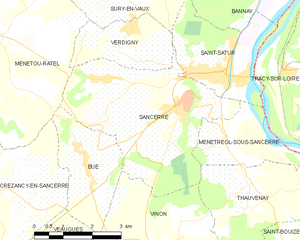
Sancerre (Sancerre)
- commune in Cher, France
- Country:

- Postal Code: 18300
- Coordinates: 47° 19' 52" N, 2° 50' 20" E


- GPS tracks (wikiloc): [Link]
- Area: 16.27 sq km
- Population: 1425
- Web site: http://www.ville-sancerre.com
- Wikipedia en: wiki(en)
- Wikipedia: wiki(fr)
- Wikidata storage: Wikidata: Q459683
- Wikipedia Commons Gallery: [Link]
- Wikipedia Commons Category: [Link]
- Freebase ID: [/m/07_10l]
- GeoNames ID: Alt: [2976251]
- SIREN number: [211802418]
- BnF ID: [15249587g]
- VIAF ID: Alt: [153607654]
- OSM relation ID: [304118]
- Library of Congress authority ID: Alt: [n80125409]
- MusicBrainz area ID: [67063e18-1f89-4f5f-b9d7-28f271e630ef]
- Encyclopædia Britannica Online ID: [place/Sancerre]
- INSEE municipality code: 18241
Shares border with regions:


Bué
- commune in Cher, France
- Country:

- Postal Code: 18300
- Coordinates: 47° 18' 35" N, 2° 47' 35" E


- GPS tracks (wikiloc): [Link]
- Area: 6.3 sq km
- Population: 307
Menetou-Râtel
- commune in Cher, France
- Country:

- Postal Code: 18300
- Coordinates: 47° 21' 4" N, 2° 45' 21" E


- GPS tracks (wikiloc): [Link]
- Area: 28.01 sq km
- Population: 492


Vinon
- commune in Cher, France
- Country:

- Postal Code: 18300
- Coordinates: 47° 17' 7" N, 2° 49' 34" E


- GPS tracks (wikiloc): [Link]
- Area: 18.01 sq km
- Population: 308


Verdigny
- commune in Cher, France
- Country:

- Postal Code: 18300
- Coordinates: 47° 20' 49" N, 2° 48' 30" E


- GPS tracks (wikiloc): [Link]
- Area: 4.99 sq km
- Population: 315


Ménétréol-sous-Sancerre
- commune in Cher, France
- Country:

- Postal Code: 18300
- Coordinates: 47° 19' 4" N, 2° 51' 22" E


- GPS tracks (wikiloc): [Link]
- Area: 5.67 sq km
- Population: 317


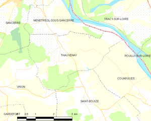
Thauvenay
- commune in Cher, France
- Country:

- Postal Code: 18300
- Coordinates: 47° 18' 18" N, 2° 52' 5" E


- GPS tracks (wikiloc): [Link]
- Area: 9.86 sq km
- Population: 338
- Web site: [Link]


Saint-Satur
- commune in Cher, France
- Country:

- Postal Code: 18300
- Coordinates: 47° 20' 28" N, 2° 51' 12" E


- GPS tracks (wikiloc): [Link]
- Area: 7.86 sq km
- Population: 1460
