Villandry (Villandry)

- commune in Indre-et-Loire, France
- Country:

- Postal Code: 37510
- Coordinates: 47° 20' 22" N, 0° 30' 40" E


- GPS tracks (wikiloc): [Link]
- Area: 17.8 sq km
- Population: 1099
- Web site: http://www.villandry.fr
- Wikipedia en: wiki(en)
- Wikipedia: wiki(fr)
- Wikidata storage: Wikidata: Q1138735
- Wikipedia Commons Category: [Link]
- Freebase ID: [/m/0bc491]
- GeoNames ID: Alt: [2969013]
- SIREN number: [213702723]
- BnF ID: [15257820r]
- VIAF ID: Alt: [147901686]
- Library of Congress authority ID: Alt: [n94013035]
- Encyclopædia Britannica Online ID: [place/Villandry]
- INSEE municipality code: 37272
Shares border with regions:

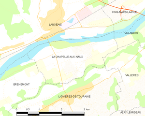
La Chapelle-aux-Naux
- commune in Indre-et-Loire, France
- Country:
- Postal Code: 37130
- Coordinates: 47° 19' 6" N, 0° 25' 39" E
- GPS tracks (wikiloc): [Link]
- Area: 5.25 sq km
- Population: 586
- Web site: [Link]

Berthenay
- commune in Indre-et-Loire, France
- Country:
- Postal Code: 37510
- Coordinates: 47° 21' 47" N, 0° 31' 27" E
- GPS tracks (wikiloc): [Link]
- Area: 7.24 sq km
- Population: 724


Druye
- commune in Indre-et-Loire, France
- Country:
- Postal Code: 37190
- Coordinates: 47° 18' 33" N, 0° 32' 17" E
- GPS tracks (wikiloc): [Link]
- Area: 22.87 sq km
- Population: 970
- Web site: [Link]

Cinq-Mars-la-Pile
- commune in Indre-et-Loire, France
- Country:
- Postal Code: 37130
- Coordinates: 47° 20' 51" N, 0° 27' 42" E
- GPS tracks (wikiloc): [Link]
- Area: 20.11 sq km
- Population: 3461
- Web site: [Link]


Savonnières
- commune in Indre-et-Loire, France
- Country:
- Postal Code: 37510
- Coordinates: 47° 20' 52" N, 0° 32' 54" E
- GPS tracks (wikiloc): [Link]
- Area: 16.46 sq km
- Population: 3141
- Web site: [Link]


Vallères
- commune in Indre-et-Loire, France
- Country:
- Postal Code: 37190
- Coordinates: 47° 18' 42" N, 0° 28' 27" E
- GPS tracks (wikiloc): [Link]
- Area: 14.72 sq km
- Population: 1193
- Web site: [Link]