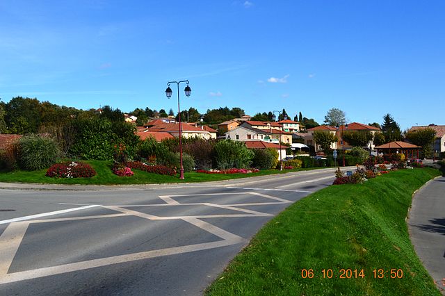
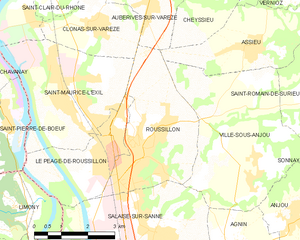
Ville-sous-Anjou (Ville-sous-Anjou)

- commune in Isère, France
 Hiking in Ville-sous-Anjou
Ville-sous-Anjou, located in the Auvergne-Rhône-Alpes region of France, offers a variety of beautiful hiking trails that showcase the natural beauty of the surrounding landscape. While specific trails in Ville-sous-Anjou may not be widely documented, the region is known for its picturesque countryside, rolling hills, and proximity to national parks and natural reserves. Here are some key points to consider when hiking in this area:
-
Scenic Trails: Look for local trails that may include well-marked paths through forests, alongside rivers, and past charming rural landscapes. The region’s diverse terrain provides opportunities for hikers of all skill levels.
-
Local Parks: The nearby Pilat Regional Natural Park offers numerous hiking opportunities with stunning views of the French Alps, deep valleys, and lush forests. This park is just a short drive or public transport ride away from Ville-sous-Anjou.
-
Preparation: As with any hiking adventure, make sure to wear appropriate footwear, carry sufficient water, snacks, and a map or GPS device. Mobile service might be limited in rural areas, so offline maps can be a good idea.
-
Wildlife and Flora: The region is home to various wildlife species and offers diverse flora. Be prepared to encounter both during your hike.
-
Guided Tours: If you're unfamiliar with the area, consider joining a guided hiking tour. Local guides can provide insights into the history and ecology of the region while ensuring you stay on safe and interesting routes.
-
Weather Considerations: Check the weather forecast before you head out, as conditions can change rapidly in mountainous regions. Dress in layers and be prepared for both sun and rain.
While the specific trails in Ville-sous-Anjou may not be widely promoted like more famous hiking destinations, exploring the surrounding countryside can provide a rewarding hiking experience. Always remember to follow local regulations, leave no trace, and respect the natural environment.
- Country:

- Postal Code: 38150
- Coordinates: 45° 21' 43" N, 4° 51' 49" E


- GPS tracks (wikiloc): [Link]
- Area: 18.25 sq km
- Population: 1203
- Wikipedia en: wiki(en)
- Wikipedia: wiki(fr)
- Wikidata storage: Wikidata: Q523513
- Wikipedia Commons Category: [Link]
- Freebase ID: [/m/03g_5nw]
- GeoNames ID: Alt: [2968294]
- SIREN number: [213805567]
- BnF ID: [15258356m]
- INSEE municipality code: 38556
Shares border with regions:


Assieu
- commune in Isère, France
- Country:
- Postal Code: 38150
- Coordinates: 45° 24' 26" N, 4° 52' 5" E
- GPS tracks (wikiloc): [Link]
- Area: 12.34 sq km
- Population: 1376
- Web site: [Link]

Salaise-sur-Sanne
- commune in Isère, France
- Country:
- Postal Code: 38150
- Coordinates: 45° 20' 40" N, 4° 49' 9" E
- GPS tracks (wikiloc): [Link]
- Area: 16.15 sq km
- Population: 4551
- Web site: [Link]


Saint-Romain-de-Surieu
- commune in Isère, France
Hiking in Saint-Romain-de-Surieu
Saint-Romain-de-Surieu is a picturesque village located in the Auvergne-Rhône-Alpes region of France, nestled in the Isère department. The area is characterized by its beautiful landscapes, rolling hills, and proximity to the French Alps, making it a great destination for hiking enthusiasts. Here are some highlights about hiking in this region:...
- Country:
- Postal Code: 38150
- Coordinates: 45° 23' 11" N, 4° 53' 0" E
- GPS tracks (wikiloc): [Link]
- Area: 4.71 sq km
- Population: 346

Agnin
- commune in Isère, France
- Country:
- Postal Code: 38150
- Coordinates: 45° 20' 24" N, 4° 51' 26" E
- GPS tracks (wikiloc): [Link]
- Area: 7.96 sq km
- Population: 1091
- Web site: [Link]

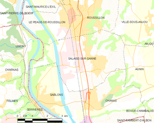
Roussillon
- commune in Isère, France
- Country:
- Postal Code: 38150
- Coordinates: 45° 22' 19" N, 4° 48' 42" E
- GPS tracks (wikiloc): [Link]
- Area: 11.62 sq km
- Population: 8272
- Web site: [Link]


Sonnay
- commune in Isère, France
Hiking in Sonnay
Sonnay is a charming village located in the Isère department of the Auvergne-Rhône-Alpes region in southeastern France. While Sonnay itself may not be as well-known as some other hiking destinations, it serves as a great starting point for exploring the surrounding natural beauty of the region....
- Country:
- Postal Code: 38150
- Coordinates: 45° 21' 17" N, 4° 54' 25" E
- GPS tracks (wikiloc): [Link]
- Area: 14.17 sq km
- Population: 1236
- Web site: [Link]


Anjou
- commune in Isère, France
Hiking in Anjou
Anjou, located in the Isère department in the Auvergne-Rhône-Alpes region of southeastern France, offers a variety of beautiful landscapes and hiking opportunities. The area is known for its picturesque scenery, mixed forests, rolling hills, and views of the surrounding mountains, including the Alps....
- Country:
- Postal Code: 38150
- Coordinates: 45° 20' 49" N, 4° 52' 55" E
- GPS tracks (wikiloc): [Link]
- AboveSeaLevel: 182 м m
- Area: 5.03 sq km
- Population: 1012
- Web site: [Link]