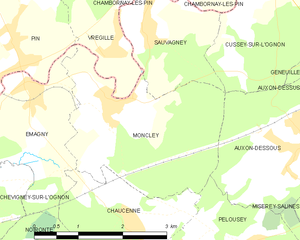
Vregille (Vregille)

- commune in Haute-Saône, France
 Hiking in Vregille
It seems that there may be a misunderstanding, as "Vregille" does not appear to be a widely recognized hiking destination or location. It's possible that you may be referring to a specific area or a less-known region. If you can provide more details or clarify the name, I would be happy to assist you with hiking information regarding that location.
If you’re looking for hiking information in a nearby popular area, feel free to mention that as well! Otherwise, I can provide some general hiking tips and advice.
- Country:

- Postal Code: 70150
- Coordinates: 47° 19' 11" N, 5° 53' 30" E


- GPS tracks (wikiloc): [Link]
- Area: 4.28 sq km
- Population: 171
- Wikipedia en: wiki(en)
- Wikipedia: wiki(fr)
- Wikidata storage: Wikidata: Q904013
- Wikipedia Commons Category: [Link]
- Freebase ID: [/m/03nw16w]
- GeoNames ID: Alt: [2967576]
- SIREN number: [217005784]
- BnF ID: [15272969k]
- PACTOLS thesaurus ID: [pcrtLhsiq9SkS4]
- INSEE municipality code: 70578
Shares border with regions:


Chambornay-lès-Pin
- commune in Haute-Saône, France
- Country:
- Postal Code: 70150
- Coordinates: 47° 20' 15" N, 5° 54' 25" E
- GPS tracks (wikiloc): [Link]
- Area: 4.85 sq km
- Population: 347


Gézier-et-Fontenelay
- commune in Haute-Saône, France
- Country:
- Postal Code: 70700
- Coordinates: 47° 21' 26" N, 5° 53' 50" E
- GPS tracks (wikiloc): [Link]
- Area: 12.1 sq km
- Population: 201


Pin
- commune in Haute-Saône, France
- Country:
- Postal Code: 70150
- Coordinates: 47° 19' 22" N, 5° 51' 52" E
- GPS tracks (wikiloc): [Link]
- AboveSeaLevel: 228 м m
- Area: 14.04 sq km
- Population: 687


Sauvagney
- commune in Doubs, France
Hiking in Sauvagney
Sauvagney is a small village in the Haute-Saône department in the Bourgogne-Franche-Comté region of eastern France. While it might not be as well-known as some larger hiking destinations, the surrounding countryside offers opportunities for hiking enthusiasts to explore scenic landscapes, forests, and charming rural settings....
- Country:
- Postal Code: 25170
- Coordinates: 47° 19' 25" N, 5° 54' 14" E
- GPS tracks (wikiloc): [Link]
- Area: 3.95 sq km
- Population: 178

Moncley
- commune in Doubs, France
Hiking in Moncley
Moncley isn't a widely recognized hiking destination, so it's important to clarify if you are referring to a specific region or a local area that may have hiking opportunities. However, I can provide general guidance on what to look for when exploring hiking locations:...
- Country:
- Postal Code: 25170
- Coordinates: 47° 18' 30" N, 5° 53' 30" E
- GPS tracks (wikiloc): [Link]
- Area: 7.92 sq km
- Population: 293