Vron (Vron)

- commune in Somme, France
- Country:

- Postal Code: 80120
- Coordinates: 50° 18' 47" N, 1° 45' 13" E


- GPS tracks (wikiloc): [Link]
- Area: 20.67 sq km
- Population: 840
- Wikipedia en: wiki(en)
- Wikipedia: wiki(fr)
- Wikidata storage: Wikidata: Q985158
- Wikipedia Commons Category: [Link]
- Freebase ID: [/m/03m6m8r]
- GeoNames ID: Alt: [2967557]
- SIREN number: [218007664]
- BnF ID: [15277286f]
- OSM relation ID: [1377054]
- PACTOLS thesaurus ID: [pcrt3HSafBxLbR]
- INSEE municipality code: 80815
Shares border with regions:


Argoules
- commune in Somme, France
- Country:
- Postal Code: 80120
- Coordinates: 50° 20' 34" N, 1° 49' 58" E
- GPS tracks (wikiloc): [Link]
- Area: 9.45 sq km
- Population: 324


Arry
- commune in Somme, France
- Country:
- Postal Code: 80120
- Coordinates: 50° 16' 42" N, 1° 43' 14" E
- GPS tracks (wikiloc): [Link]
- Area: 7.34 sq km
- Population: 205
- Web site: [Link]

Regnière-Écluse
- commune in Somme, France
- Country:
- Postal Code: 80120
- Coordinates: 50° 16' 51" N, 1° 46' 2" E
- GPS tracks (wikiloc): [Link]
- Area: 9.54 sq km
- Population: 128

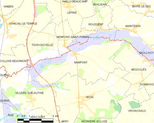
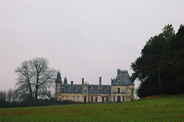
Nampont
- commune in Somme, France
- Country:
- Postal Code: 80120
- Coordinates: 50° 20' 56" N, 1° 44' 44" E
- GPS tracks (wikiloc): [Link]
- AboveSeaLevel: 10 м m
- Area: 19.39 sq km
- Population: 247

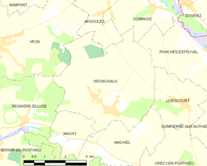
Vironchaux
- commune in Somme, France
- Country:
- Postal Code: 80150
- Coordinates: 50° 17' 20" N, 1° 49' 19" E
- GPS tracks (wikiloc): [Link]
- Area: 16.14 sq km
- Population: 478

Villers-sur-Authie
- commune in Somme, France
- Country:
- Postal Code: 80120
- Coordinates: 50° 19' 1" N, 1° 41' 36" E
- GPS tracks (wikiloc): [Link]
- Area: 12.01 sq km
- Population: 472
- Web site: [Link]