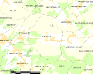
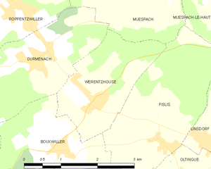
Werentzhouse (Werentzhouse)
- commune in Haut-Rhin, France
Werentzhouse, located in the Alsace region of France, is not a widely known hiking destination, but the surrounding area offers beautiful landscapes and opportunities for outdoor activities. The region is characterized by its rolling hills, vineyards, and picturesque villages, making it a lovely place to explore on foot. Here are some key points to consider when hiking in and around Werentzhouse:
Trails and Routes:
-
Local Paths: There are several walking paths that allow you to explore the countryside and take in the scenic views. These trails often connect to vineyard routes, offering a chance to enjoy local wine culture.
-
Forest Trails: The nearby forests provide numerous trails for hikers of varying skill levels. Be sure to check local maps for marked paths.
-
Regional Parks: Consider venturing into nearby regional parks like Parc Naturel Régional des Ballons des Vosges, which is only a short drive away. This park offers extensive trails suitable for day hikes and multi-day treks.
Tips for Hiking in Werentzhouse:
- Weather: Always check the weather conditions before heading out, as they can change rapidly in the region.
- Gear: Wear sturdy hiking boots and dress in layers to stay comfortable. A good hat and sunscreen are also advisable, especially in summer.
- Navigation: Although many paths are well-marked, having a map or a GPS-enabled device can help ensure you stay on track.
- Hydration & Snacks: Carry enough water and some snacks to keep your energy up during your hike.
Attractions Nearby:
- Vineyards: Take time to explore the local vineyards, which are often accessible by foot from Werentzhouse. Wine tasting can be a pleasant way to relax after a long hike.
- Cultural Sites: Explore local historical sites and charming villages, which can add cultural richness to your outdoor adventures.
Safety Considerations:
- Inform someone of your hiking plans and expected return time.
- Be mindful of local wildlife and plants; know which to avoid.
Overall, while Werentzhouse itself may not have extensive hiking facilities, the surrounding areas offer excellent opportunities for hiking enthusiasts to enjoy the natural beauty and charm of the Alsace region.
- Country:

- Postal Code: 68480
- Coordinates: 47° 31' 1" N, 7° 21' 27" E


- GPS tracks (wikiloc): [Link]
- Area: 4.5 sq km
- Population: 560
- Wikipedia en: wiki(en)
- Wikipedia: wiki(fr)
- Wikidata storage: Wikidata: Q609221
- Wikipedia Commons Category: [Link]
- Freebase ID: [/m/03nsv9n]
- Freebase ID: [/m/03nsv9n]
- Freebase ID: [/m/03nsv9n]
- GeoNames ID: Alt: [6441666]
- GeoNames ID: Alt: [6441666]
- GeoNames ID: Alt: [6441666]
- SIREN number: [216803635]
- SIREN number: [216803635]
- SIREN number: [216803635]
- BnF ID: [15272065q]
- BnF ID: [15272065q]
- BnF ID: [15272065q]
- INSEE municipality code: 68363
- INSEE municipality code: 68363
- INSEE municipality code: 68363
Shares border with regions:


Muespach
- commune in Haut-Rhin, France
Muespach is a charming village located in the Alsace region of France, close to the border with Switzerland. This picturesque area offers several hiking opportunities for various skill levels, and the surrounding nature is known for its stunning landscapes, lush forests, and rolling hills....
- Country:

- Postal Code: 68640
- Coordinates: 47° 32' 51" N, 7° 22' 50" E


- GPS tracks (wikiloc): [Link]
- AboveSeaLevel: 400 м m
- Area: 11.37 sq km
- Population: 873
- Web site: [Link]


Bouxwiller
- commune in Haut-Rhin, France
Bouxwiller is a charming village located in the Haut-Rhin department of France, known for its beautiful landscapes and scenic hiking opportunities. The region offers a variety of trails that cater to different skill levels, making it suitable for both beginner and experienced hikers....
- Country:

- Postal Code: 68480
- Coordinates: 47° 30' 18" N, 7° 20' 45" E


- GPS tracks (wikiloc): [Link]
- Area: 6.47 sq km
- Population: 463


Fislis
- commune in Haut-Rhin, France
Fislis is not a well-documented hiking destination, so it's possible you might be referring to a specific area, trail, or region that goes by a similar name. However, if you're looking for hiking information in a general context, here's what you can consider if you’re exploring a typical hiking geography:...
- Country:

- Postal Code: 68480
- Coordinates: 47° 30' 16" N, 7° 22' 54" E


- GPS tracks (wikiloc): [Link]
- Area: 7.53 sq km
- Population: 423
- Web site: [Link]


Durmenach
- commune in Haut-Rhin, France
Durmenach is a charming area surrounded by beautiful landscapes, ideal for hiking enthusiasts. While specific trail information may vary, here are general points about hiking in and around Durmenach:...
- Country:

- Postal Code: 68480
- Coordinates: 47° 31' 37" N, 7° 20' 17" E


- GPS tracks (wikiloc): [Link]
- Area: 5.76 sq km
- Population: 859

