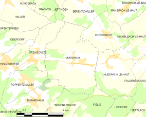
Muespach (Muespach)
- commune in Haut-Rhin, France
Muespach is a charming village located in the Alsace region of France, close to the border with Switzerland. This picturesque area offers several hiking opportunities for various skill levels, and the surrounding nature is known for its stunning landscapes, lush forests, and rolling hills.
Popular Hiking Routes:
-
Les Sentiers de Muespach: There are local marked trails that often lead hikers through the beautiful countryside, showcasing the unique flora and fauna of the region.
-
Grand Ballon: A bit further afield, the Grand Ballon (the highest peak in the Vosges Mountains) offers a range of hiking challenges and breathtaking views. Trails here can vary from moderate to difficult, and the summit provides panoramic vistas.
-
Nature Reserves: The nearby nature reserves, like the Regional Natural Park of the Ballons des Vosges, offer additional hiking paths that intertwine with rich biodiversity, and you may encounter wildlife along the way.
Tips for Hiking in Muespach:
- Seasonal Considerations: Spring and autumn are ideal for hiking in the region, with mild weather and beautiful scenery. Summer can be warm, while winter may bring snow, so prepare accordingly.
- Trail Maps: Always carry a map or a GPS device to stay on track as some paths may not be well-marked.
- Local Guidelines: Respect local trail guidelines and wildlife regulations.
- Safety First: Wear appropriate hiking gear, stay hydrated, and inform someone about your hiking plans.
Nearby Attractions:
If you are spending time in Muespach, consider exploring nearby towns, like Mulhouse, which has rich industrial history, or the picturesque villages along the Alsace Wine Route for some cultural enrichment post-hike.
Overall, Muespach offers a wonderful base for hiking and immersing yourself in the natural beauty of the Alsace region. Enjoy your hiking adventure!
- Country:

- Postal Code: 68640
- Coordinates: 47° 32' 51" N, 7° 22' 50" E


- GPS tracks (wikiloc): [Link]
- AboveSeaLevel: 400 м m
- Area: 11.37 sq km
- Population: 873
- Web site: http://www.muespach.fr
- Wikipedia en: wiki(en)
- Wikipedia: wiki(fr)
- Wikidata storage: Wikidata: Q149329
- Wikipedia Commons Category: [Link]
- Freebase ID: [/m/03m4l6g]
- Freebase ID: [/m/03m4l6g]
- Freebase ID: [/m/03m4l6g]
- GeoNames ID: Alt: [6617442]
- GeoNames ID: Alt: [6617442]
- GeoNames ID: Alt: [6617442]
- SIREN number: [216802215]
- SIREN number: [216802215]
- SIREN number: [216802215]
- BnF ID: [152719231]
- BnF ID: [152719231]
- BnF ID: [152719231]
- INSEE municipality code: 68221
- INSEE municipality code: 68221
- INSEE municipality code: 68221
Shares border with regions:


Knœringue
- commune in Haut-Rhin, France
Knœringue is a picturesque village located in the Alsace region of France, near the border with Germany and Switzerland. It serves as a launching point for various hiking opportunities in the surrounding areas, particularly in the Vosges mountains and the Jura region....
- Country:

- Postal Code: 68220
- Coordinates: 47° 33' 49" N, 7° 24' 10" E


- GPS tracks (wikiloc): [Link]
- Area: 4.68 sq km
- Population: 381


Muespach-le-Haut
- commune in Haut-Rhin, France
Muespach-le-Haut is a charming commune in the Haut-Rhin department of Alsace, in northeastern France. The area is known for its picturesque landscapes, rolling hills, and rich natural surroundings, making it a great destination for hiking enthusiasts....
- Country:

- Postal Code: 68640
- Coordinates: 47° 32' 42" N, 7° 24' 11" E


- GPS tracks (wikiloc): [Link]
- Area: 6.91 sq km
- Population: 1089
- Web site: [Link]


Roppentzwiller
- commune in Haut-Rhin, France
Roppentzwiller is a small village located in the Alsace region of France, near the border with Switzerland. This area boasts beautiful landscapes and offers a variety of hiking opportunities for outdoor enthusiasts. Here are some key points to consider when hiking in and around Roppentzwiller:...
- Country:

- Postal Code: 68480
- Coordinates: 47° 32' 25" N, 7° 19' 55" E


- GPS tracks (wikiloc): [Link]
- Area: 4.15 sq km
- Population: 696


Berentzwiller
- commune in Haut-Rhin, France
Berentzwiller is a small village located in the Alsace region of France, near the border with Switzerland. While it might not be as widely known as some larger hiking destinations, the surrounding area offers some beautiful trails and a chance to explore the picturesque landscape of Alsace....
- Country:

- Postal Code: 68130
- Coordinates: 47° 35' 9" N, 7° 23' 1" E


- GPS tracks (wikiloc): [Link]
- Area: 6.08 sq km
- Population: 322


Fislis
- commune in Haut-Rhin, France
Fislis is not a well-documented hiking destination, so it's possible you might be referring to a specific area, trail, or region that goes by a similar name. However, if you're looking for hiking information in a general context, here's what you can consider if you’re exploring a typical hiking geography:...
- Country:

- Postal Code: 68480
- Coordinates: 47° 30' 16" N, 7° 22' 54" E


- GPS tracks (wikiloc): [Link]
- Area: 7.53 sq km
- Population: 423
- Web site: [Link]


Durmenach
- commune in Haut-Rhin, France
Durmenach is a charming area surrounded by beautiful landscapes, ideal for hiking enthusiasts. While specific trail information may vary, here are general points about hiking in and around Durmenach:...
- Country:

- Postal Code: 68480
- Coordinates: 47° 31' 37" N, 7° 20' 17" E


- GPS tracks (wikiloc): [Link]
- Area: 5.76 sq km
- Population: 859


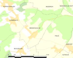
Werentzhouse
- commune in Haut-Rhin, France
Werentzhouse, located in the Alsace region of France, is not a widely known hiking destination, but the surrounding area offers beautiful landscapes and opportunities for outdoor activities. The region is characterized by its rolling hills, vineyards, and picturesque villages, making it a lovely place to explore on foot. Here are some key points to consider when hiking in and around Werentzhouse:...
- Country:

- Postal Code: 68480
- Coordinates: 47° 31' 1" N, 7° 21' 27" E


- GPS tracks (wikiloc): [Link]
- Area: 4.5 sq km
- Population: 560


Steinsoultz
- commune in Haut-Rhin, France
Steinsoultz, located in the Alsace region of France near the Vosges mountains, offers a picturesque setting for hiking enthusiasts. The region is known for its stunning landscapes, charming villages, and diverse trails that cater to various skill levels....
- Country:

- Postal Code: 68640
- Coordinates: 47° 33' 14" N, 7° 20' 15" E


- GPS tracks (wikiloc): [Link]
- Area: 4.06 sq km
- Population: 788

