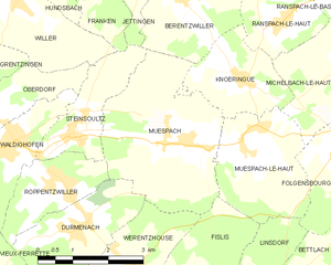
Durmenach (Durmenach)

- commune in Haut-Rhin, France
 Hiking in Durmenach
Durmenach is a charming area surrounded by beautiful landscapes, ideal for hiking enthusiasts. While specific trail information may vary, here are general points about hiking in and around Durmenach:
Trail Types
- Scenic Trails: Enjoy picturesque views of the countryside, forests, and perhaps nearby waterways.
- Mountain Trails: If you're looking for a challenge, explore trails that lead into nearby hills or mountainous regions.
- Nature Walks: Shorter, easier routes are often available for families or those looking to enjoy a casual stroll through nature.
Hiking Difficulty
Routes can vary in difficulty from easy to challenging. Be sure to choose a trail that matches your fitness level and experience.
Wildlife and Flora
Durmenach and the surrounding areas may host diverse wildlife and a variety of plant species. Look out for local flora, like wildflowers, and enjoy the chance to spot birds and other animals.
Best Time to Hike
The best time for hiking typically depends on local weather patterns, but spring and fall usually provide mild temperatures and beautiful scenery.
Preparation Tips
- Gear: Wear appropriate hiking footwear and dress in layers to accommodate changing weather conditions.
- Supplies: Carry enough water, snacks, and a first-aid kit.
- Navigation: Consider bringing a map or downloading a hiking app to stay on course.
Local Accommodation and Services
If you need somewhere to stay, check for local inns or campsites that cater to hikers. Local tourist information can also offer guidance on trail conditions and any necessary permits.
Safety
Always let someone know your hiking plans, stay on marked trails, and be mindful of the weather. Carry a fully charged phone in case of emergencies.
For the best and latest information, consider checking local hiking clubs, tourist information centers, or online resources dedicated to hiking in Durmenach. Enjoy your hike!
- Country:

- Postal Code: 68480
- Coordinates: 47° 31' 37" N, 7° 20' 17" E


- GPS tracks (wikiloc): [Link]
- Area: 5.76 sq km
- Population: 859
- Wikipedia en: wiki(en)
- Wikipedia: wiki(fr)
- Wikidata storage: Wikidata: Q457073
- Wikipedia Commons Category: [Link]
- Freebase ID: [/m/03nss77]
- Freebase ID: [/m/03nss77]
- Freebase ID: [/m/03nss77]
- GeoNames ID: Alt: [6450691]
- GeoNames ID: Alt: [6450691]
- GeoNames ID: Alt: [6450691]
- SIREN number: [216800755]
- SIREN number: [216800755]
- SIREN number: [216800755]
- BnF ID: [15271777d]
- BnF ID: [15271777d]
- BnF ID: [15271777d]
- VIAF ID: Alt: [248343220]
- VIAF ID: Alt: [248343220]
- VIAF ID: Alt: [248343220]
- INSEE municipality code: 68075
- INSEE municipality code: 68075
- INSEE municipality code: 68075
Shares border with regions:


Vieux-Ferrette
- commune in Haut-Rhin, France
Hiking in Vieux-Ferrette
Vieux-Ferrette is a charming village located in the Alsace region of northeastern France, near the border with Switzerland and Germany. This area is often celebrated for its picturesque landscapes, rich history, and diverse outdoor activities, making it a great destination for hiking enthusiasts....
- Country:
- Postal Code: 68480
- Coordinates: 47° 30' 9" N, 7° 17' 57" E
- GPS tracks (wikiloc): [Link]
- Area: 6.63 sq km
- Population: 673

Muespach
- commune in Haut-Rhin, France
Hiking in Muespach
Muespach is a charming village located in the Alsace region of France, close to the border with Switzerland. This picturesque area offers several hiking opportunities for various skill levels, and the surrounding nature is known for its stunning landscapes, lush forests, and rolling hills....
- Country:
- Postal Code: 68640
- Coordinates: 47° 32' 51" N, 7° 22' 50" E
- GPS tracks (wikiloc): [Link]
- AboveSeaLevel: 400 м m
- Area: 11.37 sq km
- Population: 873
- Web site: [Link]


Roppentzwiller
- commune in Haut-Rhin, France
Hiking in Roppentzwiller
Roppentzwiller is a small village located in the Alsace region of France, near the border with Switzerland. This area boasts beautiful landscapes and offers a variety of hiking opportunities for outdoor enthusiasts. Here are some key points to consider when hiking in and around Roppentzwiller:...
- Country:
- Postal Code: 68480
- Coordinates: 47° 32' 25" N, 7° 19' 55" E
- GPS tracks (wikiloc): [Link]
- Area: 4.15 sq km
- Population: 696


Bouxwiller
- commune in Haut-Rhin, France
Hiking in Bouxwiller
Bouxwiller is a charming village located in the Haut-Rhin department of France, known for its beautiful landscapes and scenic hiking opportunities. The region offers a variety of trails that cater to different skill levels, making it suitable for both beginner and experienced hikers....
- Country:
- Postal Code: 68480
- Coordinates: 47° 30' 18" N, 7° 20' 45" E
- GPS tracks (wikiloc): [Link]
- Area: 6.47 sq km
- Population: 463

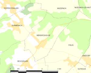
Werentzhouse
- commune in Haut-Rhin, France
Hiking in Werentzhouse
Werentzhouse, located in the Alsace region of France, is not a widely known hiking destination, but the surrounding area offers beautiful landscapes and opportunities for outdoor activities. The region is characterized by its rolling hills, vineyards, and picturesque villages, making it a lovely place to explore on foot. Here are some key points to consider when hiking in and around Werentzhouse:...
- Country:
- Postal Code: 68480
- Coordinates: 47° 31' 1" N, 7° 21' 27" E
- GPS tracks (wikiloc): [Link]
- Area: 4.5 sq km
- Population: 560