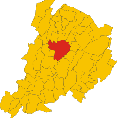
Zola Predosa (Zola Predosa)
.svg)
- Italian comune
 Hiking in Zola Predosa
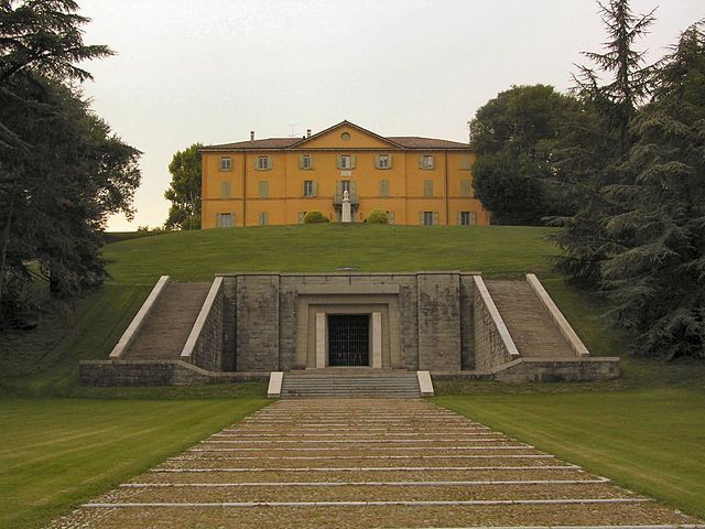
Zola Predosa, located in the metropolitan area of Bologna in Italy, offers a variety of hiking opportunities amidst its picturesque landscapes. The area is characterized by rolling hills, vineyards, and olive groves, making it an appealing destination for outdoor enthusiasts. Here are some key points about hiking in Zola Predosa:
1. Trails and Routes
- Natural Pathways: The region has numerous well-marked trails that range in difficulty, suitable for both beginners and experienced hikers. Many of these paths offer scenic views of the surrounding countryside.
- Parco dei Gessi Bolognesi e Calanchi dell’Abbadessa: This nearby park offers trails that showcase unique geological formations and diverse flora and fauna. It’s a great spot for both hiking and nature watching.
2. Scenic Views
- Hikers can expect stunning views of the Apennine Mountains and the fertile valleys of Emilia-Romagna. The vistas are particularly beautiful during sunrise and sunset when the light casts a golden glow over the landscape.
3. Cultural Attractions
- Along the hiking routes, there may be opportunities to explore local historical sites, countryside villas, or small agriturismos (farm-stays) where you can taste local cuisine and wines.
4. Accessibility
- Zola Predosa is easily accessible from Bologna, making it a convenient destination for a day hike or a weekend getaway. Public transportation options include trains and buses that connect the area to the city.
5. Best Times to Hike
- Spring (April to June) and autumn (September to October) are ideal for hiking due to mild temperatures and vibrant colors in the landscape. Summer can be quite hot, while winter may present challenges due to snowfall at higher elevations.
6. Safety Tips
- Make sure to wear appropriate footwear and bring sufficient water and snacks, as well as sun protection for warmer days. Always check the weather forecast before heading out, and consider bringing a map or GPS for navigation.
Hiking in Zola Predosa can be a rewarding experience, allowing you to enjoy nature, culture, and the beauty of the Italian countryside.
- Country:

- Postal Code: 40069
- Local Dialing Code: 051
- Licence Plate Code: BO
- Coordinates: 44° 29' 18" N, 11° 13' 5" E


- GPS tracks (wikiloc): [Link]
- AboveSeaLevel: 74 м m
- Area: 37 sq km
- Population: 15105
- Web site: http://www.comune.zolapredosa.bo.it/
- Wikipedia en: wiki(en)
- Wikipedia: wiki(it)
- Wikidata storage: Wikidata: Q95000
- Wikipedia Commons Category: [Link]
- Freebase ID: [/m/0gkhyk]
- GeoNames ID: Alt: [6541539]
- VIAF ID: Alt: [144360831]
- OSM relation ID: [43186]
- Quora topic ID: [Zola-Predosa]
- UN/LOCODE: [ITZOL]
- ISTAT ID: 037060
- Italian cadastre code: M185
Shares border with regions:
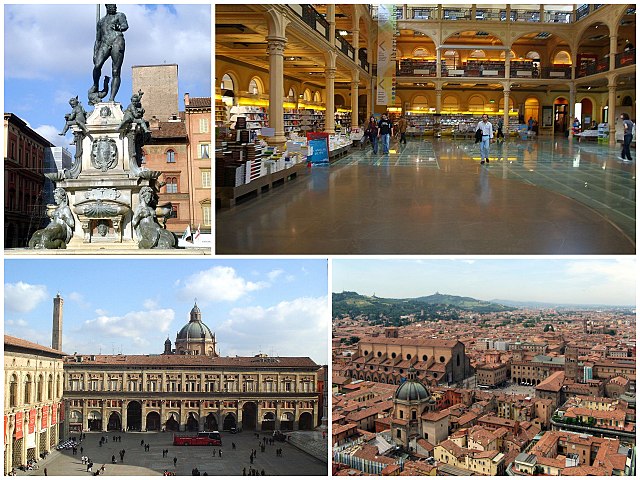
Bologna
- city in Emilia-Romagna, Italy
Hiking in Bologna
Bologna, known for its rich culture, gastronomy, and history, also offers some lovely opportunities for hiking and outdoor activities in its surrounding areas. Here's a guide to hiking in and around Bologna:...
- Country:
- Postal Code: 40121–40141
- Local Dialing Code: 051
- Licence Plate Code: BO
- Coordinates: 44° 29' 38" N, 11° 20' 34" E
- GPS tracks (wikiloc): [Link]
- AboveSeaLevel: 54 м m
- Area: 140.86 sq km
- Population: 388367
- Web site: [Link]
Anzola dell'Emilia
- Italian comune
Hiking in Anzola dell'Emilia
Anzola dell'Emilia is a charming town located in the Emilia-Romagna region of Italy, known for its rich cultural heritage and beautiful landscapes. While it may not be as famous for hiking as some of the more mountainous regions of Italy, there are certainly opportunities for outdoor activities in and around Anzola dell'Emilia....
- Country:
- Postal Code: 40011
- Local Dialing Code: 051
- Licence Plate Code: BO
- Coordinates: 44° 32' 50" N, 11° 11' 44" E
- GPS tracks (wikiloc): [Link]
- AboveSeaLevel: 38 м m
- Area: 36.6 sq km
- Population: 12310
- Web site: [Link]


Casalecchio di Reno
- Italian comune
Hiking in Casalecchio di Reno
Casalecchio di Reno is a town located in the Emilia-Romagna region of Italy, near Bologna. It offers a variety of hiking opportunities, particularly for those interested in combining nature with the charm of local culture....
- Country:
- Postal Code: 40033
- Local Dialing Code: 051
- Licence Plate Code: BO
- Coordinates: 44° 29' 0" N, 11° 17' 0" E
- GPS tracks (wikiloc): [Link]
- AboveSeaLevel: 61 м m
- Area: 17 sq km
- Population: 36456
- Web site: [Link]
Crespellano
- Italian comune
Hiking in Crespellano
Crespellano is a charming village located in the Emilia-Romagna region of Italy, not far from Bologna. It offers several opportunities for hiking enthusiasts who want to explore the natural beauty and scenic landscapes of the surrounding area....
- Country:
- Postal Code: 40056
- Local Dialing Code: 051
- Licence Plate Code: BO
- Coordinates: 44° 30' 41" N, 11° 7' 53" E
- GPS tracks (wikiloc): [Link]
- AboveSeaLevel: 64 м m
- Area: 37.5 sq km
- Web site: [Link]
Monte San Pietro
- Italian comune
Hiking in Monte San Pietro
Monte San Pietro, located in the Emilia-Romagna region of Italy, offers a variety of hiking opportunities for outdoor enthusiasts. The area is characterized by its beautiful landscapes, rolling hills, and picturesque views, making it an ideal spot for both casual walkers and experienced hikers....
- Country:
- Postal Code: 40050
- Local Dialing Code: 051
- Licence Plate Code: BO
- Coordinates: 44° 26' 19" N, 11° 8' 3" E
- GPS tracks (wikiloc): [Link]
- AboveSeaLevel: 112 м m
- Area: 74.69 sq km
- Population: 10960
- Web site: [Link]

Sasso Marconi
- Italian comune
Hiking in Sasso Marconi
Sasso Marconi, located in the Emilia-Romagna region of Italy, is a great area for hiking enthusiasts. Nestled in the Apennine Mountains, it offers a range of trails suited for different skill levels, with beautiful landscapes that include hills, forests, and panoramic views of the surrounding countryside....
- Country:
- Postal Code: 40037
- Local Dialing Code: 051
- Licence Plate Code: BO
- Coordinates: 44° 24' 0" N, 11° 15' 0" E
- GPS tracks (wikiloc): [Link]
- AboveSeaLevel: 128 м m
- Area: 96.45 sq km
- Population: 14903
- Web site: [Link]