
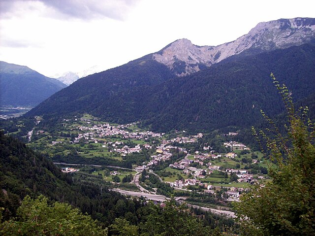
Zuglio (Zuglio)
.svg)
- Italian comune
 Hiking in Zuglio
Zuglio, located in the Friuli Venezia Giulia region of Italy, is a charming destination for hiking enthusiasts. This area is steeped in history and natural beauty, making it a perfect spot for both leisurely walks and more challenging hikes.
Key Highlights of Hiking in Zuglio:
-
Scenic Trails: Zuglio is surrounded by the beautiful landscapes of the Julian Alps and the Friulian plains. There are various trails ranging from easy walks to more strenuous hikes, catering to different skill levels.
-
Historical Significance: The area is rich in Roman history, featuring archaeological sites and remnants, such as the ancient city of Iulium Carnicum. You can combine your hiking adventure with exploration of these historic sites.
-
Natural Flora and Fauna: Hiking in Zuglio offers the opportunity to witness diverse ecosystems. You might encounter unique plant species, wildlife, and breathtaking views of both mountains and valleys.
-
Accessibility: Many trails in and around Zuglio are well-marked and accessible, making it easy for hikers to navigate the paths. Local tourist information centers can provide maps and guides to help plan your hike.
-
Best Times to Hike: The best hiking seasons are spring and autumn when the weather is mild, and the landscapes are particularly beautiful. Summer can be quite warm, and winter offers opportunities for snowshoeing or winter hiking.
-
Local Culture: Don’t miss the chance to experience local cuisine at nearby traditional restaurants or agriturismi after a long hike. You can sample regional dishes and engage with the welcoming local culture.
-
Guided Hikes: For those who prefer a structured experience, local guides offer organized hiking tours that provide insights into the natural environment and local history.
Safety Tips:
- Always check the weather forecast before heading out.
- Wear appropriate hiking gear, including sturdy footwear and layered clothing.
- Carry enough water and snacks, especially for longer hikes.
- Inform someone about your hiking plans and expected return time.
Zuglio is a hidden gem for hikers looking for a blend of nature and history, making it a rewarding destination in the Italian Alps.
- Country:

- Postal Code: 33020
- Local Dialing Code: 0433
- Licence Plate Code: UD
- Coordinates: 46° 27' 44" N, 13° 1' 30" E


- GPS tracks (wikiloc): [Link]
- AboveSeaLevel: 425 м m
- Area: 18.21 sq km
- Population: 583
- Web site: http://www.comune.zuglio.ud.it
- Wikipedia en: wiki(en)
- Wikipedia: wiki(it)
- Wikidata storage: Wikidata: Q53402
- Wikipedia Commons Category: [Link]
- Freebase ID: [/m/0gkby6]
- GeoNames ID: Alt: [6538402]
- VIAF ID: Alt: [145857258]
- OSM relation ID: [79143]
- Digital Atlas of the Roman Empire ID: [10651]
- ISTAT ID: 030136
- Italian cadastre code: M200
Shares border with regions:

Arta Terme
- Italian comune
Hiking in Arta Terme
Arta Terme, located in the Friuli Venezia Giulia region of northeastern Italy, is a beautiful destination for hiking enthusiasts. This picturesque area is surrounded by the Carnic Alps and offers a range of trails suitable for all levels, from beginners to experienced hikers....
- Country:
- Postal Code: 33022
- Local Dialing Code: 0433
- Licence Plate Code: UD
- Coordinates: 46° 29' 0" N, 13° 1' 0" E
- GPS tracks (wikiloc): [Link]
- AboveSeaLevel: 422 м m
- Area: 42.77 sq km
- Population: 2076
- Web site: [Link]


Lauco
- Italian comune
Hiking in Lauco
Lauco, a beautiful area located in the Friuli Venezia Giulia region of northeastern Italy, is known for its stunning landscapes, rich biodiversity, and scenic trails. Here are some key points to consider if you’re planning to hike in Lauco:...
- Country:
- Postal Code: 33029
- Local Dialing Code: 0433
- Licence Plate Code: UD
- Coordinates: 46° 25' 0" N, 12° 56' 0" E
- GPS tracks (wikiloc): [Link]
- AboveSeaLevel: 719 м m
- Area: 34.76 sq km
- Population: 726
- Web site: [Link]


Sutrio
- Italian comune
Hiking in Sutrio
Sutrio is a charming village located in the Friuli Venezia Giulia region of northeastern Italy, and it's known for its stunning natural landscapes and rich cultural heritage. Hiking in this area can be a delightful experience, as it offers a variety of trails suitable for different skill levels....
- Country:
- Postal Code: 33020
- Local Dialing Code: 0433
- Licence Plate Code: UD
- Coordinates: 46° 30' 50" N, 12° 59' 25" E
- GPS tracks (wikiloc): [Link]
- AboveSeaLevel: 565 м m
- Area: 20.75 sq km
- Population: 1296
- Web site: [Link]
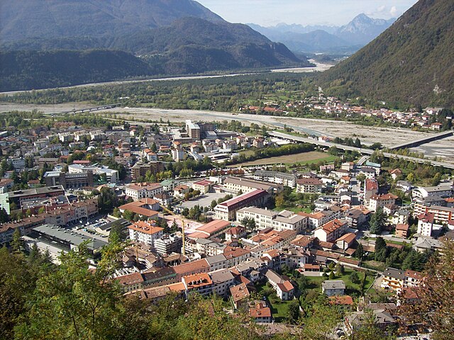

Tolmezzo
- Italian comune
Hiking in Tolmezzo
Tolmezzo, located in the Carnia region of the Friuli Venezia Giulia area of northeastern Italy, is a fantastic destination for hiking enthusiasts. Surrounded by the stunning Carnic Alps and lush valleys, it offers a variety of trails catering to all experience levels, from beginners to seasoned hikers....
- Country:
- Postal Code: 33028
- Local Dialing Code: 0433 487911
- Licence Plate Code: UD
- Coordinates: 46° 24' 0" N, 13° 1' 0" E
- GPS tracks (wikiloc): [Link]
- AboveSeaLevel: 323 м m
- Area: 64.62 sq km
- Population: 10191
- Web site: [Link]