
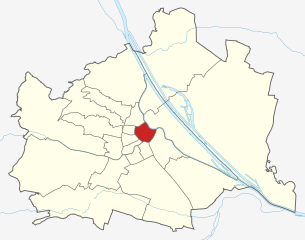
Alsergrund (Alsergrund)

- 9. district of Vienna
 Hiking in Alsergrund
Alsergrund is one of the 23 districts of Vienna, Austria, and while it's not primarily known for hiking in the traditional sense of wilderness trails, it does offer some enjoyable walking opportunities, particularly for urban hiking or strolling through green spaces.
Here are some highlights for walking and hiking enthusiasts in Alsergrund:
-
Parks and Green Spaces:
- Schlosspark: Surrounding the Alsergrund Palace, the park is a lovely spot for a leisurely walk. It features well-maintained paths, fountains, and gardens.
- Pötzleinsdorfer Schlosspark: While not directly in Alsergrund, it's nearby and offers extended walking trails through a more natural landscape.
-
Walking Along the Danube Canal:
- The Danube Canal runs through the district and has paths along its banks that are ideal for walking, jogging, or cycling. This area often features art installations and spots to relax by the water.
-
Historical Walks:
- Alsergrund is home to many historic buildings and sites, including the Votivkirche (Votive Church) and the University of Vienna. You can create a historical walking route that allows you to appreciate the architecture and history of the area.
-
Urban Hiking:
- You can explore the various neighborhoods in Alsergrund on foot, enjoying the mix of modern and historic Vienna. There are several steep streets in the district that can offer a bit of a workout.
-
Nearby Hiking Trails:
- If you're willing to venture outside of Alsergrund, you can find hiking opportunities in the surrounding areas, such as the Vienna Woods (Wienerwald) which offers a much more extensive network of trails and natural landscapes.
Tips for Hiking in Alsergrund:
- Footwear: Since you’ll be in an urban area, comfortable walking shoes are recommended, but if you head to the outskirts for more challenging trails, consider sturdier hiking boots.
- Navigation: Use a map or a smartphone app to navigate through the area, especially if you are exploring less well-marked paths or parks.
- Local Regulations: Always observe local guidelines and regulations, especially in parks and natural areas.
While Alsergrund may not be a typical hiking destination, it offers a unique urban experience that combines nature and culture through walking and exploring.
- Country:

- Postal Code: 1090
- Licence Plate Code: W
- Coordinates: 48° 13' 31" N, 16° 21' 25" E


- GPS tracks (wikiloc): [Link]
- AboveSeaLevel: 179 м m
- Area: 2.99 sq km
- Web site: http://www.wien.gv.at/alsergrund/
- Wikipedia en: wiki(en)
- Wikipedia: wiki(de)
- Wikidata storage: Wikidata: Q257780
- Wikipedia Commons Gallery: [Link]
- Wikipedia Commons Category: [Link]
- Freebase ID: [/m/0125kp]
- GeoNames ID: Alt: [2782729]
- VIAF ID: Alt: [154817790]
- GND ID: Alt: [4066013-8]
- archINFORM location ID: [3689]
- Library of Congress authority ID: Alt: [n84049650]
- MusicBrainz area ID: [b49e74af-e7b6-44d2-ae4a-dea6fbb55008]
- Austrian municipality key: [90901]
Includes regions:
Thurygrund
- quarter of Vienna
Hiking in Thurygrund
Thurygrund is a picturesque area known for its natural beauty and hiking opportunities. Nestled in the Czech Republic, it offers diverse trails that cater to different skill levels, making it an ideal destination for both novice and experienced hikers....
- Country:
- Coordinates: 48° 13' 33" N, 16° 21' 28" E
- GPS tracks (wikiloc): [Link]

Alservorstadt
- quarter of Vienna
Hiking in Alservorstadt
Alservorstadt is a district in Vienna, Austria, known for its central location and proximity to both urban amenities and natural areas. While Alservorstadt itself may not be a major hiking destination, there are several nearby options for hiking enthusiasts. Here’s a guide to some hiking opportunities you can explore in and around the area:...
- Country:
- Coordinates: 48° 12' 59" N, 16° 21' 24" E
- GPS tracks (wikiloc): [Link]
Althangrund
- quarter of Vienna
Hiking in Althangrund
Althangrund is a beautiful and lesser-known hiking area, located in the heart of Vienna, Austria. Nestled along the Danube Canal, it offers a mix of natural scenery and urban charm, making it an interesting destination for both local and visiting hikers....
- Country:
- Coordinates: 48° 13' 48" N, 16° 21' 32" E
- GPS tracks (wikiloc): [Link]
Rossau
- quarter of Vienna
Hiking in Rossau
Rossau is a charming district in Vienna, Austria, situated along the banks of the Danube Canal. While Rossau itself is more urban and residential, its proximity to the beautiful natural landscapes of the Vienna Woods and the Danube offers excellent opportunities for hiking and outdoor activities....
- Country:
- Coordinates: 48° 13' 18" N, 16° 21' 50" E
- GPS tracks (wikiloc): [Link]
Michelbeuern
- quarter of Vienna
Hiking in Michelbeuern
Michelbeuern is a neighborhood in Vienna, Austria, and while it is primarily urban, there are several outdoor opportunities nearby for hiking enthusiasts. If you're looking for a hiking experience in and around the Michelbeuern area, here are some suggestions:...
- Country:
- Coordinates: 48° 13' 19" N, 16° 21' 4" E
- GPS tracks (wikiloc): [Link]
Himmelpfortgrund
- quarter of Vienna
Hiking in Himmelpfortgrund
Himmelpfortgrund, often referred to as a hidden gem for hiking enthusiasts, is located near the Austrian capital of Vienna. The area is characterized by its lush landscapes, scenic views, and a combination of hills and wooded areas, making it a perfect destination for both novice and experienced hikers....
- Country:
- Coordinates: 48° 13' 37" N, 16° 21' 6" E
- GPS tracks (wikiloc): [Link]
Lichtental
- quarter of Vienna
Hiking in Lichtental
Lichtental is a beautiful district located in the town of Baden-Baden in Germany, known for its stunning scenery, lush landscapes, and peaceful atmosphere. While Lichtental itself might not be synonymous with extensive hiking trails, it does serve as a great starting point for various hiking opportunities in the surrounding regions, particularly in the Black Forest....
- Country:
- Coordinates: 48° 13' 41" N, 16° 21' 28" E
- GPS tracks (wikiloc): [Link]
Shares border with regions:
Josefstadt
- 8. district of Vienna
Hiking in Josefstadt
Josefstadt is a district in Vienna, Austria, known more for its urban characteristics rather than hiking trails. However, its proximity to the Vienna Woods (Wienerwald) offers great opportunities for hiking enthusiasts. While the district itself may not have dedicated hiking trails, you can easily access various trails in the nearby areas....
- Country:
- Postal Code: 1080
- Licence Plate Code: W
- Coordinates: 48° 12' 39" N, 16° 20' 53" E
- GPS tracks (wikiloc): [Link]
- AboveSeaLevel: 209 м m
- Area: 1.08 sq km
- Web site: [Link]


Leopoldstadt
- 2nd municipal District of Vienna, Austria
Hiking in Leopoldstadt
Leopoldstadt is the second district of Vienna, Austria, known for its vibrant culture, parks, and proximity to the Danube River. While it may not offer traditional hiking trails found in mountainous regions, there are still great opportunities for outdoor activities and leisurely walks....
- Country:
- Postal Code: 1020
- Licence Plate Code: W
- Coordinates: 48° 12' 37" N, 16° 24' 44" E
- GPS tracks (wikiloc): [Link]
- AboveSeaLevel: 158 м m
- Area: 19.27 sq km
- Web site: [Link]
Hernals
- 17. district of Vienna
Hiking in Hernals
Hernals is a district in Vienna, Austria, known for its charming neighborhoods and proximity to nature. While Hernals itself is primarily urban, the nearby areas, especially the Vienna Woods (Wienerwald), offer excellent hiking opportunities....
- Country:
- Postal Code: 1170
- Licence Plate Code: W
- Coordinates: 48° 13' 57" N, 16° 16' 46" E
- GPS tracks (wikiloc): [Link]
- AboveSeaLevel: 224 м m
- Area: 11.35 sq km
- Web site: [Link]
Brigittenau
- 20. district of Vienna
Hiking in Brigittenau
Brigittenau is a 20th district of Vienna, Austria, situated on the northern banks of the Danube Canal. While it is an urban area and not traditionally associated with hiking, it still offers some opportunities for walking and enjoying the outdoors. Here are some aspects to consider if you’re interested in hiking or walking in and around Brigittenau:...
- Country:
- Postal Code: 1200
- Licence Plate Code: W
- Coordinates: 48° 14' 12" N, 16° 22' 10" E
- GPS tracks (wikiloc): [Link]
- AboveSeaLevel: 165 м m
- Area: 5.67 sq km
- Web site: [Link]

Innere Stadt
- first district of Vienna
Hiking in Innere Stadt
Innere Stadt, the historic city center of Vienna, Austria, is not typically known for hiking in the traditional sense; however, it offers plenty of opportunities for urban exploration and walking that can be quite enjoyable and fulfilling. The area is rich in history, culture, and stunning architecture, making it an ideal destination for long strolls and leisurely walks....
- Country:
- Postal Code: 1010
- Licence Plate Code: W
- Coordinates: 48° 12' 35" N, 16° 22' 12" E
- GPS tracks (wikiloc): [Link]
- AboveSeaLevel: 192 м m
- Area: 3.01 sq km
- Web site: [Link]


Döbling
- 19. district of Vienna
Hiking in Döbling
Döbling is a charming district in Vienna, Austria, known for its scenic landscapes, vineyards, and proximity to the Vienna Woods (Wienerwald). Here are some highlights and tips for hiking in Döbling:...
- Country:
- Postal Code: 1190
- Licence Plate Code: W
- Coordinates: 48° 15' 59" N, 16° 19' 22" E
- GPS tracks (wikiloc): [Link]
- AboveSeaLevel: 247 м m
- Area: 24.9 sq km
- Web site: [Link]
Währing
- 18th district of Vienna
Hiking in Währing
Währing is a district in Vienna, Austria, known for its beautiful parks and hills, making it a delightful destination for hiking enthusiasts. Here are some highlights and tips for hiking in Währing:...
- Country:
- Postal Code: 1180
- Licence Plate Code: W
- Coordinates: 48° 13' 59" N, 16° 18' 53" E
- GPS tracks (wikiloc): [Link]
- AboveSeaLevel: 247 м m
- Area: 6.28 sq km
- Web site: [Link]