
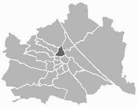
Innere Stadt (Innere Stadt)
.svg)
- first district of Vienna
 Hiking in Innere Stadt
Innere Stadt, the historic city center of Vienna, Austria, is not typically known for hiking in the traditional sense; however, it offers plenty of opportunities for urban exploration and walking that can be quite enjoyable and fulfilling. The area is rich in history, culture, and stunning architecture, making it an ideal destination for long strolls and leisurely walks.
Urban Walking Routes in Innere Stadt
-
Ringstraße: This grand boulevard encircles the Innere Stadt and is lined with impressive buildings such as the Vienna State Opera, the Austrian Parliament, and the Vienna University. Walking along this route allows you to appreciate the architectural beauty while enjoying the atmosphere of the city.
-
Stephansplatz: At the heart of the Innere Stadt is St. Stephen's Cathedral (Stephansdom). You can climb the cathedral's towers for panoramic views of the city or wander through the adjacent streets, where you’ll find charming shops, cafes, and historical landmarks.
-
Graben and Kohlmarkt: These pedestrian streets are great for strolling and window shopping. You'll encounter historical sites, vibrant street life, and some lovely outdoor cafes.
-
Burggarten and Volksgarten: These parks provide a nice break from urban scenery, with beautiful gardens, sculptures, and walking paths. They are perfect for a relaxing walk amidst nature, even in the heart of the city.
Tips for Your Urban Hike
-
Comfortable Footwear: Since you’ll be walking on cobblestones and uneven surfaces, wear comfortable walking shoes.
-
Stay Hydrated: Bring a water bottle or take breaks at cafes to stay hydrated.
-
Maps and Apps: While it’s easy to navigate in the city, consider using a map or a navigation app to make the most of your walking route.
-
Timing: Early mornings or late afternoons can be less crowded and offer a more peaceful experience.
Nearby Hiking Options
If you are looking to escape the urban environment for actual hiking, consider traveling a bit outside the city:
-
Vienna Woods (Wienerwald): A short trip can take you to the Vienna Woods where you can find numerous hiking trails with varying difficulty levels, offering beautiful views and a chance to enjoy nature.
-
Kahlenberg: A popular hiking destination that overlooks the city, Kahlenberg has well-marked trails and is easily accessible via public transportation.
In summary, while Innere Stadt may not offer traditional hiking trails, it presents a fantastic urban walking experience filled with cultural immersion. For actual hiking, the nearby Vienna Woods are a great option! Enjoy your time exploring!
- Country:

- Postal Code: 1010
- Licence Plate Code: W
- Coordinates: 48° 12' 35" N, 16° 22' 12" E


- GPS tracks (wikiloc): [Link]
- AboveSeaLevel: 192 м m
- Area: 3.01 sq km
- Web site: https://www.wien.gv.at/bezirke/innerestadt/
- Wikipedia en: wiki(en)
- Wikipedia: wiki(de)
- Wikidata storage: Wikidata: Q267329
- Wikipedia Commons Gallery: [Link]
- Wikipedia Commons Category: [Link]
- Freebase ID: [/m/04zhv1]
- GeoNames ID: Alt: [2775259]
- VIAF ID: Alt: [132819562]
- GND ID: Alt: [4302711-8]
- archINFORM location ID: [3681]
- Library of Congress authority ID: Alt: [no94037555]
- Encyclopædia Britannica Online ID: [place/Innere-Stadt]
- Austrian municipality key: [90101]
Shares border with regions:
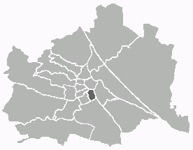
Josefstadt
- 8. district of Vienna
Hiking in Josefstadt
Josefstadt is a district in Vienna, Austria, known more for its urban characteristics rather than hiking trails. However, its proximity to the Vienna Woods (Wienerwald) offers great opportunities for hiking enthusiasts. While the district itself may not have dedicated hiking trails, you can easily access various trails in the nearby areas....
- Country:
- Postal Code: 1080
- Licence Plate Code: W
- Coordinates: 48° 12' 39" N, 16° 20' 53" E
- GPS tracks (wikiloc): [Link]
- AboveSeaLevel: 209 м m
- Area: 1.08 sq km
- Web site: [Link]

Alsergrund
- 9. district of Vienna
Hiking in Alsergrund
Alsergrund is one of the 23 districts of Vienna, Austria, and while it's not primarily known for hiking in the traditional sense of wilderness trails, it does offer some enjoyable walking opportunities, particularly for urban hiking or strolling through green spaces....
- Country:
- Postal Code: 1090
- Licence Plate Code: W
- Coordinates: 48° 13' 31" N, 16° 21' 25" E
- GPS tracks (wikiloc): [Link]
- AboveSeaLevel: 179 м m
- Area: 2.99 sq km
- Web site: [Link]


Leopoldstadt
- 2nd municipal District of Vienna, Austria
Hiking in Leopoldstadt
Leopoldstadt is the second district of Vienna, Austria, known for its vibrant culture, parks, and proximity to the Danube River. While it may not offer traditional hiking trails found in mountainous regions, there are still great opportunities for outdoor activities and leisurely walks....
- Country:
- Postal Code: 1020
- Licence Plate Code: W
- Coordinates: 48° 12' 37" N, 16° 24' 44" E
- GPS tracks (wikiloc): [Link]
- AboveSeaLevel: 158 м m
- Area: 19.27 sq km
- Web site: [Link]

Wieden
- 4. district of Vienna
Hiking in Wieden
Wieden is a charming district in Vienna, Austria, known for its historic architecture, vibrant atmosphere, and cultural significance. While it's not primarily known as a hiking destination, you can find some lovely walking and exploration opportunities in and around Wieden. Here are some suggestions for enjoying the outdoors in and around this area:...
- Country:
- Postal Code: 1040
- Licence Plate Code: W
- Coordinates: 48° 11' 22" N, 16° 21' 42" E
- GPS tracks (wikiloc): [Link]
- AboveSeaLevel: 184 м m
- Area: 1.8 sq km
- Web site: [Link]
Landstraße
- 3rd municipal District of Vienna, Austria
Hiking in Landstraße
Landstraße, located in Vienna, Austria, is not traditionally known for hiking, as it is primarily an urban district. However, there are plenty of walking and exploration opportunities in and around this area, especially for those interested in urban hikes or scenic walks....
- Country:
- Postal Code: 1030
- Licence Plate Code: W
- Coordinates: 48° 11' 47" N, 16° 23' 45" E
- GPS tracks (wikiloc): [Link]
- AboveSeaLevel: 178 м m
- Area: 7.39 sq km
- Web site: [Link]
Mariahilf
- 6. district of Vienna
Hiking in Mariahilf
Mariahilf, a vibrant district in Vienna, Austria, is better known for its urban landscape, cultural offerings, and shopping rather than hiking. However, if you’re looking for hiking opportunities near Mariahilf, you can explore nearby natural areas and trails within the larger Vienna region....
- Country:
- Postal Code: 1060
- Licence Plate Code: W
- Coordinates: 48° 11' 43" N, 16° 20' 59" E
- GPS tracks (wikiloc): [Link]
- AboveSeaLevel: 198 м m
- Area: 1.48 sq km
- Web site: [Link]
Neubau
- 7. district of Vienna
Hiking in Neubau
Neubau, a vibrant district in Vienna, Austria, is not traditionally known for its hiking trails like the surrounding nature areas. However, it offers access to some scenic routes and nearby parks that can provide a pleasant experience for those looking to enjoy a nature walk or light hiking within the urban environment....
- Country:
- Postal Code: 1070
- Licence Plate Code: W
- Coordinates: 48° 12' 9" N, 16° 20' 53" E
- GPS tracks (wikiloc): [Link]
- AboveSeaLevel: 214 м m
- Area: 1.61 sq km
- Web site: [Link]