Amberg-Sulzbach (Landkreis Amberg-Sulzbach)
- district of Bavaria, Germany
Amberg-Sulzbach, located in Bavaria, Germany, is a picturesque district known for its beautiful landscapes, rich culture, and numerous outdoor activities, including hiking. The area offers a variety of hiking trails that cater to different skill levels, from easy walks suitable for families to more challenging paths for experienced hikers.
Key Features of Hiking in Amberg-Sulzbach:
-
Scenic Landscapes: The region is characterized by rolling hills, dense forests, and charming villages. Hikers can enjoy breathtaking views of the surrounding countryside and the charming architecture of the local towns.
-
Well-Marked Trails: The hiking paths in Amberg-Sulzbach are generally well-maintained and clearly marked. Popular trails include sections of the Franconian Way and local nature trails that guide you through the district’s natural beauty.
-
Cultural Highlights: While hiking, you’ll have the opportunity to explore historical sites, including castles, churches, and traditional Bavarian farms. Many trails incorporate cultural landmarks that reflect the rich heritage of the region.
-
Nature Reserves: The area is home to several nature reserves, where hikers can observe local wildlife and diverse plant species. This is an excellent choice for those interested in nature and photography.
-
Seasonal Hiking: Depending on the season, hiking in Amberg-Sulzbach would offer different experiences. In spring and summer, the trails are lush and vibrant, whereas, in autumn, the colorful foliage creates a stunning backdrop.
-
Local Recommendations: Certain trails, like those around the Forest of Schwenk or near the town of Amberg itself, are recommended for their accessibility and beauty. Always check local guides or visitor centers for updated trail conditions.
-
Safety and Preparation: As with any hiking activity, it’s important to prepare adequately. Wear appropriate footwear, check the weather conditions, and carry essential supplies, such as water and snacks. Inform someone about your hiking plans.
-
Hiking Groups and Events: Look for local hiking clubs or organized hikes, where you can join other outdoor enthusiasts. These events can provide an added level of safety and companionship on the trails.
Overall, hiking in Amberg-Sulzbach provides a wonderful combination of natural beauty, cultural richness, and outdoor adventure. Whether you’re a seasoned hiker or just looking for a leisurely stroll, this Bavarian district has something to offer everyone. Enjoy your time on the trails!
- Country:

- Capital: Amberg
- Licence Plate Code: SUL; NAB; ESB; BUL; AS
- Coordinates: 49° 30' 0" N, 11° 45' 0" E


- GPS tracks (wikiloc): [Link]
- AboveSeaLevel: 380 м m
- Area: 1255.00 sq km
- Population: 94617
- Web site: http://www.kreis-as.de/
- Wikipedia en: wiki(en)
- Wikipedia: wiki(de)
- Wikidata storage: Wikidata: Q10421
- Wikipedia Commons Category: [Link]
- Wikipedia Commons Maps Category: [Link]
- Freebase ID: [/m/01bgnx]
- GeoNames ID: Alt: [3220855]
- VIAF ID: Alt: [244998864]
- OSM relation ID: [62765]
- GND ID: Alt: [4085672-0]
- archINFORM location ID: [2311]
- TGN ID: [7077097]
- Bavarikon ID: [ODB_A00001702]
- NUTS code: [DE234]
- BabelNet ID: [01206231n]
- German district key: 09371
Includes regions:
Hirschwald
- former unincorporated area in Germany
Hirschwald is a picturesque forested area that offers a variety of hiking options suitable for both novice and experienced hikers. Here are some key points to keep in mind when planning a hike in Hirschwald:...
- Country:

- Coordinates: 49° 22' 0" N, 11° 52' 0" E


- GPS tracks (wikiloc): [Link]

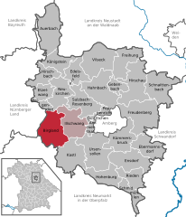
Birgland
- municipality of Germany
Birgland, located in Bavaria, Germany, is a beautiful area for hiking, offering a mix of scenic landscapes, forests, and rolling hills. Here are some aspects to consider for hiking in the Birgland region:...
- Country:

- Postal Code: 92262
- Local Dialing Code: 09666
- Licence Plate Code: AS
- Coordinates: 49° 25' 0" N, 11° 38' 0" E


- GPS tracks (wikiloc): [Link]
- AboveSeaLevel: 390 м m
- Area: 62.40 sq km
- Population: 1601
- Web site: [Link]


Neukirchen bei Sulzbach-Rosenberg
- municipality in Landkreis Amberg-Sulzbach in Germany
 Hiking in Neukirchen bei Sulzbach-Rosenberg
Neukirchen bei Sulzbach-Rosenberg is situated in the picturesque Upper Palatinate region of Bavaria, Germany. This area is known for its beautiful landscape, characterized by rolling hills, forests, and meadows, making it a great destination for hiking enthusiasts....
- Country:

- Postal Code: 92259
- Local Dialing Code: 09663
- Licence Plate Code: AS
- Coordinates: 49° 32' 0" N, 11° 38' 0" E


- GPS tracks (wikiloc): [Link]
- AboveSeaLevel: 439 м m
- Area: 45.76 sq km
- Population: 2657
- Web site: [Link]


Ammerthal
- municipality in Landkreis Amberg-Sulzbach in Germany
Ammerthal, located in Bavaria, Germany, offers a variety of hiking opportunities set against a picturesque backdrop of rolling hills, lush forests, and scenic landscapes. Here are some highlights for hiking in the Ammerthal area:...
- Country:

- Postal Code: 92260
- Local Dialing Code: 09628
- Licence Plate Code: AS
- Coordinates: 49° 26' 28" N, 11° 45' 43" E


- GPS tracks (wikiloc): [Link]
- AboveSeaLevel: 430 м m
- Area: 8.14 sq km
- Population: 2083
- Web site: [Link]

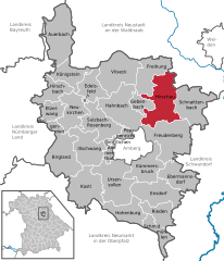
Hirschau
- municipality in Landkreis Amberg-Sulzbach in Germany
Hirschau, located in the upper Palatinate region of Bavaria, Germany, is surrounded by beautiful landscapes that offer a variety of hiking opportunities. The area is known for its natural beauty, characterized by forested hills, meadows, and rivers. Here are some highlights and tips for hiking in Hirschau:...
- Country:

- Postal Code: 92242
- Local Dialing Code: 09622
- Licence Plate Code: AS
- Coordinates: 49° 32' 0" N, 11° 57' 0" E


- GPS tracks (wikiloc): [Link]
- AboveSeaLevel: 411 м m
- Area: 74.96 sq km
- Population: 5783
- Web site: [Link]


Hahnbach
- municipality in Landkreis Amberg-Sulzbach in Germany
Hahnbach is a charming village located in Bavaria, Germany, and it's surrounded by picturesque landscapes, making it a great spot for hiking enthusiasts. The region features a variety of trails that cater to hikers of all levels, offering scenic views of the countryside, forests, and nearby hills....
- Country:

- Postal Code: 92256
- Local Dialing Code: 09664
- Licence Plate Code: AS
- Coordinates: 49° 31' 0" N, 11° 48' 0" E


- GPS tracks (wikiloc): [Link]
- AboveSeaLevel: 386 м m
- Area: 67.38 sq km
- Population: 4594
- Web site: [Link]

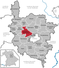
Sulzbach-Rosenberg
- municipality in Landkreis Amberg-Sulzbach in Germany
Sulzbach-Rosenberg, located in the lovely Bavarian region of Germany, offers a variety of hiking opportunities that cater to different skill levels and preferences. The region is characterized by its scenic landscapes, historical sites, and rich natural surroundings. Here are some highlights about hiking in Sulzbach-Rosenberg:...
- Country:

- Postal Code: 92237
- Local Dialing Code: 09661
- Coordinates: 49° 30' 0" N, 11° 45' 0" E


- GPS tracks (wikiloc): [Link]
- AboveSeaLevel: 394 м m
- Area: 53.12 sq km
- Population: 18139
- Web site: [Link]


Schnaittenbach
- municipality in Landkreis Amberg-Sulzbach in Germany
Schnaittenbach is a small town located in Bavaria, Germany, surrounded by picturesque landscapes that are perfect for hiking enthusiasts. The region offers a variety of trails suitable for different skill levels, from gentle walks to more challenging hikes....
- Country:

- Postal Code: 92253
- Local Dialing Code: 09622
- Licence Plate Code: AS
- Coordinates: 49° 33' 0" N, 12° 1' 0" E


- GPS tracks (wikiloc): [Link]
- AboveSeaLevel: 406 м m
- Area: 63.41 sq km
- Population: 4266
- Web site: [Link]


Vilseck
- municipality in Landkreis Amberg-Sulzbach in Germany
Vilseck, located in Bavaria, Germany, is surrounded by beautiful landscapes that offer a variety of hiking opportunities. The region is characterized by rolling hills, forests, and farmland, making it an excellent destination for both casual walkers and more experienced hikers. Here are some key points about hiking in and around Vilseck:...
- Country:

- Postal Code: 92249
- Local Dialing Code: 09662
- Licence Plate Code: AS
- Coordinates: 49° 36' 0" N, 11° 48' 0" E


- GPS tracks (wikiloc): [Link]
- AboveSeaLevel: 402 м m
- Area: 64.7 sq km
- Population: 5541
- Web site: [Link]

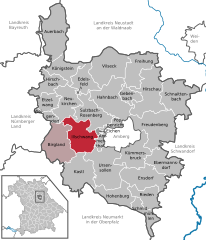
Illschwang
- municipality in Landkreis Amberg-Sulzbach in Germany
Illschwang is a picturesque village located in Bavaria, Germany, known for its beautiful landscapes and proximity to hiking trails. The region offers numerous opportunities for outdoor enthusiasts, whether you're a seasoned hiker or just looking for a leisurely stroll in nature....
- Country:

- Postal Code: 92278
- Local Dialing Code: 09666
- Licence Plate Code: AS
- Coordinates: 49° 27' 0" N, 11° 41' 0" E


- GPS tracks (wikiloc): [Link]
- AboveSeaLevel: 488 м m
- Area: 54.22 sq km
- Population: 1585
- Web site: [Link]


Kümmersbruck
- municipality in Landkreis Amberg-Sulzbach in Germany
Kümmersbruck is a small municipality in Bavaria, Germany, near the city of Amberg. While it may not be a major destination for hiking, the surrounding areas offer some wonderful trails and opportunities to explore nature....
- Country:

- Postal Code: 92245
- Local Dialing Code: 09624; 09621
- Licence Plate Code: AS
- Coordinates: 49° 25' 0" N, 11° 53' 0" E


- GPS tracks (wikiloc): [Link]
- AboveSeaLevel: 396 м m
- Area: 47.3 sq km
- Population: 9855
- Web site: [Link]


Ebermannsdorf
- municipality of Germany
Ebermannsdorf is located in the Upper Palatinate region of Bavaria, Germany, and offers a variety of hiking opportunities that showcase the area's natural beauty and charming landscapes. While it may not be as widely known as some larger hiking destinations, the region around Ebermannsdorf is ideal for outdoor enthusiasts looking for scenic trails and a peaceful environment....
- Country:

- Postal Code: 92263
- Local Dialing Code: 09624
- Licence Plate Code: AS
- Coordinates: 49° 23' 35" N, 11° 56' 15" E


- GPS tracks (wikiloc): [Link]
- AboveSeaLevel: 383 м m
- Area: 45.39 sq km
- Population: 1990
- Web site: [Link]

Freihung
- municipality in Landkreis Amberg-Sulzbach in Germany
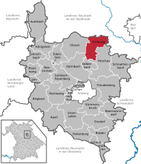
Freihung is a picturesque municipality located in Bavaria, Germany, renowned for its beautiful landscapes and hiking opportunities. The region features rolling hills, lush forests, and scenic trails that cater to various skill levels, making it an excellent destination for hikers of all experience levels....
- Country:

- Postal Code: 92271
- Local Dialing Code: 09646; 09622
- Licence Plate Code: AS
- Coordinates: 49° 37' 0" N, 11° 55' 0" E


- GPS tracks (wikiloc): [Link]
- AboveSeaLevel: 433 м m
- Area: 46.35 sq km
- Population: 2538
- Web site: [Link]

Poppenricht
- municipality in Landkreis Amberg-Sulzbach in Germany
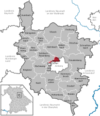
Poppenricht is a small village in Bavaria, Germany, located near the city of Amberg. While it may not be widely known for extensive hiking trails like some of the larger national parks, there are still opportunities for walking and exploring the natural beauty of the surrounding area....
- Country:

- Postal Code: 92284
- Local Dialing Code: 09621
- Licence Plate Code: AS
- Coordinates: 49° 28' 32" N, 11° 47' 58" E


- GPS tracks (wikiloc): [Link]
- AboveSeaLevel: 406 м m
- Area: 11.58 sq km
- Population: 3041
- Web site: [Link]

Schmidmühlen
- municipality in Landkreis Amberg-Sulzbach in Germany
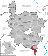
Schmidmühlen is a small picturesque village in Bavaria, Germany, surrounded by beautiful landscapes ideal for hiking. Here are some highlights and tips for hiking in and around Schmidmühlen:...
- Country:

- Postal Code: 92287
- Local Dialing Code: 09474
- Licence Plate Code: AS
- Coordinates: 49° 16' 0" N, 11° 56' 0" E


- GPS tracks (wikiloc): [Link]
- AboveSeaLevel: 358 м m
- Area: 25.33 sq km
- Population: 2217
- Web site: [Link]

Hohenburg
- municipality in Landkreis Amberg-Sulzbach in Germany
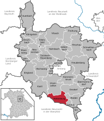
Hohenburg, located in Bavaria, Germany, is a charming village surrounded by beautiful natural landscapes, making it an excellent destination for hiking enthusiasts. The region features rolling hills, lush forests, and picturesque vistas, providing various hiking trails for all skill levels....
- Country:

- Postal Code: 92277
- Local Dialing Code: 09626
- Licence Plate Code: AS
- Coordinates: 49° 17' 44" N, 11° 47' 52" E


- GPS tracks (wikiloc): [Link]
- AboveSeaLevel: 382 м m
- Area: 41.49 sq km
- Population: 1563
- Web site: [Link]

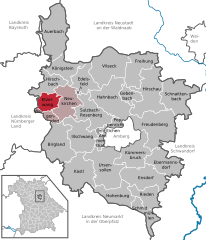
Etzelwang
- municipality in Landkreis Amberg-Sulzbach in Germany
Etzelwang, located in the beautiful region of Bavaria, Germany, offers some fantastic hiking opportunities for nature enthusiasts and outdoor adventurers. The area is characterized by picturesque landscapes, lush forests, rolling hills, and tranquil meadows, making it an excellent destination for hikers of all skill levels....
- Country:

- Postal Code: 92268
- Local Dialing Code: 09663
- Licence Plate Code: AS
- Coordinates: 49° 32' 0" N, 11° 35' 0" E


- GPS tracks (wikiloc): [Link]
- AboveSeaLevel: 426 м m
- Area: 21.68 sq km
- Population: 1367
- Web site: [Link]
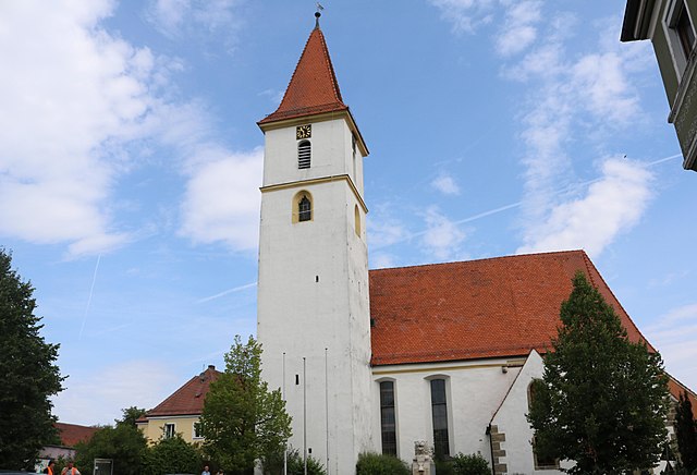

Edelsfeld
- municipality in Landkreis Amberg-Sulzbach in Germany
Edelsfeld is a charming village located in Bavaria, Germany, known for its scenic landscapes and access to several hiking opportunities. The surrounding areas are characterized by rolling hills, lush forests, and picturesque views. Here are some key points to consider if you're planning a hiking trip in and around Edelsfeld:...
- Country:

- Postal Code: 92265
- Local Dialing Code: 09665
- Licence Plate Code: AS
- Coordinates: 49° 34' 0" N, 11° 42' 0" E


- GPS tracks (wikiloc): [Link]
- AboveSeaLevel: 530 м m
- Area: 34.71 sq km
- Population: 1497
- Web site: [Link]

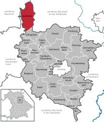
Auerbach in der Oberpfalz
- municipality in Landkreis Amberg-Sulzbach in Germany
 Hiking in Auerbach in der Oberpfalz
Auerbach in der Oberpfalz is a lovely town located in Bavaria, Germany, surrounded by beautiful landscapes ideal for hiking enthusiasts. The region features a mix of forested areas, rolling hills, and charming countryside, offering various trails suitable for different skill levels....
- Country:

- Postal Code: 91275
- Local Dialing Code: 09643
- Licence Plate Code: AS
- Coordinates: 49° 41' 31" N, 11° 38' 0" E


- GPS tracks (wikiloc): [Link]
- AboveSeaLevel: 441 м m
- Area: 78.26 sq km
- Population: 8900
- Web site: [Link]


Ensdorf
- municipality in Landkreis Amberg-Sulzbach in Germany
Ensdorf is a small town located in Bavaria, Germany, known for its picturesque landscapes and proximity to various hiking trails. The region offers a mix of forests, hills, and scenic views, making it an excellent destination for hiking enthusiasts. Here are some highlights and tips for hiking in and around Ensdorf:...
- Country:

- Postal Code: 92266
- Local Dialing Code: 09624
- Licence Plate Code: AS
- Coordinates: 49° 21' 0" N, 11° 56' 0" E


- GPS tracks (wikiloc): [Link]
- AboveSeaLevel: 370 м m
- Area: 56.12 sq km
- Population: 1934
- Web site: [Link]


Freudenberg
- municipality Landkreis Amberg-Sulzbach in Germany
Freudenberg is a picturesque village located in the Bavarian region of Germany, surrounded by stunning natural landscapes that make it a great destination for hiking enthusiasts. Here are some key points to consider if you’re looking to hike in Freudenberg:...
- Country:

- Postal Code: 92272
- Local Dialing Code: 09627
- Licence Plate Code: AS
- Coordinates: 49° 29' 0" N, 11° 59' 0" E


- GPS tracks (wikiloc): [Link]
- AboveSeaLevel: 466 м m
- Area: 82.04 sq km
- Population: 3545
- Web site: [Link]

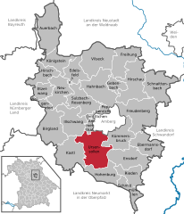
Ursensollen
- municipality Landkreis Amberg-Sulzbach in in Germany
Ursensollen, located in Bavaria, Germany, is a charming destination for hiking enthusiasts. The area is characterized by its picturesque landscapes, rolling hills, and lush forests that make it perfect for outdoor activities....
- Country:

- Postal Code: 92289
- Local Dialing Code: 09628
- Licence Plate Code: AS
- Coordinates: 49° 24' 4" N, 11° 45' 28" E


- GPS tracks (wikiloc): [Link]
- AboveSeaLevel: 539 м m
- Area: 74.65 sq km
- Population: 2991
- Web site: [Link]


Gebenbach
- municipality in Landkreis Amberg-Sulzbach in Germany
Gebenbach, a picturesque village in Bavaria, Germany, offers several hiking opportunities for outdoor enthusiasts. The region is characterized by its natural beauty, with lush forests, rolling hills, and scenic views. Here are some highlights and tips for hiking in Gebenbach:...
- Country:

- Postal Code: 92274
- Local Dialing Code: 09622
- Licence Plate Code: AS
- Coordinates: 49° 28' 0" N, 11° 53' 0" E


- GPS tracks (wikiloc): [Link]
- AboveSeaLevel: 448 м m
- Area: 18.13 sq km
- Population: 667
- Web site: [Link]


Weigendorf
- municipality of Germany
Weigendorf is a small village located in the northern part of Bavaria, Germany. It is surrounded by beautiful natural landscapes, making it a great place for hiking and outdoor activities. Here are some highlights and tips for hiking in and around Weigendorf:...
- Country:

- Postal Code: 91249
- Local Dialing Code: 09663; 09154
- Licence Plate Code: AS
- Coordinates: 49° 30' 0" N, 11° 34' 0" E


- GPS tracks (wikiloc): [Link]
- AboveSeaLevel: 384 м m
- Area: 12.58 sq km
- Population: 1125
- Web site: [Link]


Rieden
- municipality in Landkreis Amberg-Sulzbach in Germany
Rieden, located in the Upper Palatinate region of Bavaria, Germany, offers a scenic environment for hiking enthusiasts. The area is characterized by rolling hills, lush forests, and picturesque landscapes, making it ideal for outdoor activities....
- Country:

- Postal Code: 92286
- Local Dialing Code: 09624
- Licence Plate Code: AS
- Coordinates: 49° 19' 0" N, 11° 57' 0" E


- GPS tracks (wikiloc): [Link]
- AboveSeaLevel: 365 м m
- Area: 32.3 sq km
- Population: 2303
- Web site: [Link]


Königstein
- municipality Landkreis Amberg-Sulzbach in Germany
Königstein is a picturesque town located in the Bavarian region of Germany, near the border with the Czech Republic. Positioned in the stunning landscape of the Saxon Switzerland National Park, it is a fantastic location for hiking enthusiasts. Here are some highlights and essential information about hiking in Königstein:...
- Country:

- Postal Code: 92281
- Local Dialing Code: 09665
- Licence Plate Code: AS
- Coordinates: 49° 37' 0" N, 11° 38' 0" E


- GPS tracks (wikiloc): [Link]
- AboveSeaLevel: 490 м m
- Area: 35.13 sq km
- Population: 1561
- Web site: [Link]


Hirschbach
- municipality in Landkreis Amberg-Sulzbach in Germany
Hirschbach, located in Bavaria, Germany, is a picturesque area that offers various hiking opportunities amid stunning natural landscapes. Here's a guide to hiking in Hirschbach:...
- Country:

- Postal Code: 92275
- Local Dialing Code: 09665
- Licence Plate Code: AS
- Coordinates: 49° 33' 0" N, 11° 32' 0" E


- GPS tracks (wikiloc): [Link]
- AboveSeaLevel: 390 м m
- Area: 31.03 sq km
- Population: 1237
- Web site: [Link]
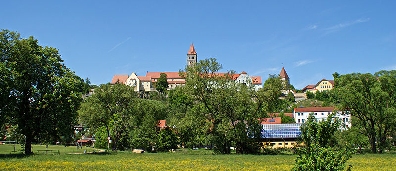

Kastl
- municipality in Landkreis Amberg-Sulzbach in Germany
Kastl, located in the Amberg-Sulzbach district of Bavaria, Germany, is an appealing destination for hiking enthusiasts. The region offers a picturesque landscape characterized by rolling hills, lush forests, and charming rural scenery....
- Country:

- Postal Code: 92280
- Local Dialing Code: 09625
- Licence Plate Code: AS
- Coordinates: 49° 22' 9" N, 11° 40' 49" E


- GPS tracks (wikiloc): [Link]
- AboveSeaLevel: 475 м m
- Area: 64.88 sq km
- Population: 2588
- Web site: [Link]
Eichen
- unincorporated area in Germany
Eichen is a gemeindefrei (municipality-free) area in Germany, specifically located in the southern part of the state of Hesse. While Eichen itself may not be as widely recognized as some other hiking destinations, it offers outdoor enthusiasts an opportunity to explore beautiful landscapes and nature....
- Country:

- Coordinates: 49° 27' 0" N, 11° 45' 0" E


- GPS tracks (wikiloc): [Link]
Shares border with regions:


Neustadt an der Waldnaab
- district of Bavaria, Germany
 Hiking in Neustadt an der Waldnaab
Neustadt an der Waldnaab, located in the Upper Palatinate region of Bavaria, Germany, is known for its picturesque scenery and natural beauty, making it an excellent destination for hiking enthusiasts. Here are some highlights and insights into hiking in this area:...
- Country:

- Capital: Neustadt an der Waldnaab
- Licence Plate Code: VOH; NEW; ESB
- Coordinates: 49° 40' 12" N, 12° 0' 0" E


- GPS tracks (wikiloc): [Link]
- AboveSeaLevel: 450 м m
- Area: 1430.00 sq km
- Population: 94486
- Web site: [Link]
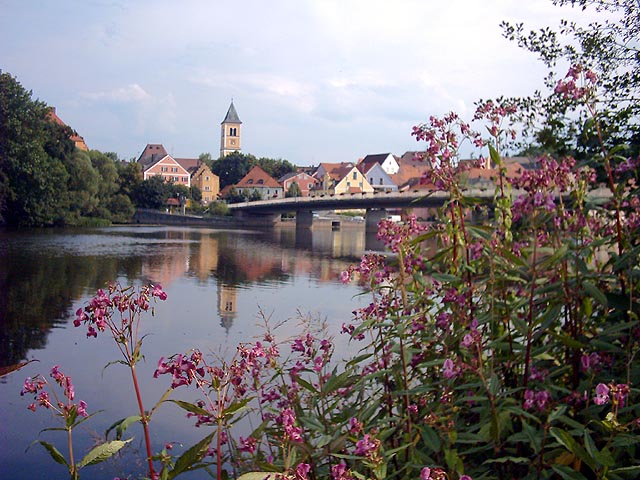

Schwandorf
- district of Bavaria, Germany
Schwandorf district, located in Bavaria, Germany, is a great area for hiking enthusiasts looking for scenic routes and beautiful landscapes. The region is characterized by rolling hills, forests, and rivers, providing a mix of terrain that caters to various hiking levels....
- Country:

- Capital: Schwandorf
- Licence Plate Code: SAD; ROD; OVI; NEN; NAB; BUL
- Coordinates: 49° 22' 12" N, 12° 15' 0" E


- GPS tracks (wikiloc): [Link]
- AboveSeaLevel: 465 м m
- Area: 1472.88 sq km
- Population: 131260
- Web site: [Link]


Neumarkt
- district of Bavaria, Germany
Neumarkt in der Oberpfalz, a district in Bavaria, Germany, is known for its picturesque landscapes and varied hiking opportunities. Set against a backdrop of rolling hills, lush forests, and charming villages, this area is ideal for both casual walkers and seasoned hikers....
- Country:

- Capital: Neumarkt in der Oberpfalz
- Licence Plate Code: PAR; NM
- Coordinates: 49° 15' 0" N, 11° 30' 0" E


- GPS tracks (wikiloc): [Link]
- AboveSeaLevel: 445 м m
- Area: 1344.00 sq km
- Population: 105346
- Web site: [Link]


Bayreuth
- district in Bavaria, Germany
Bayreuth, located in the northern part of Bavaria, Germany, offers a diverse range of hiking opportunities set against a backdrop of beautiful landscapes, forests, and cultural sites. The region is known for its rich history, stunning scenery, and well-marked trails suitable for hikers of all levels....
- Country:

- Capital: Bayreuth
- Licence Plate Code: PEG; MÜB; KEM; ESB; EBS; BT
- Coordinates: 49° 55' 12" N, 11° 30' 0" E


- GPS tracks (wikiloc): [Link]
- AboveSeaLevel: 507 м m
- Area: 1273.00 sq km
- Population: 96772
- Web site: [Link]
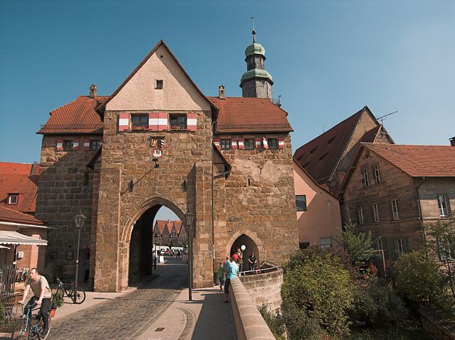

Nürnberger Land
- district in Bavaria, Germany
Nürnberger Land, located in Bavaria, Germany, is a fantastic area for hiking enthusiasts. It features a diverse landscape that includes forests, hills, and picturesque valleys, making it ideal for both casual walkers and seasoned hikers. Here are some key points about hiking in Nürnberger Land:...
- Country:

- Capital: Lauf an der Pegnitz
- Licence Plate Code: PEG; N; LAU; HEB; ESB
- Coordinates: 49° 30' 0" N, 11° 22' 0" E


- GPS tracks (wikiloc): [Link]
- AboveSeaLevel: 355 м m
- Area: 800.00 sq km
- Population: 149127
- Web site: [Link]
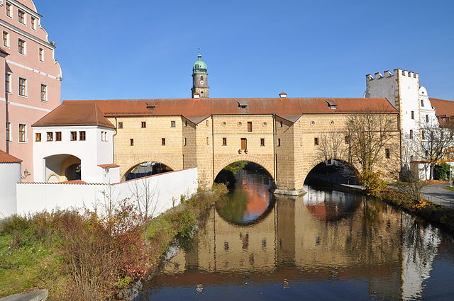

Amberg
- town in Bavaria, Germany
Amberg, located in Bavaria, Germany, offers picturesque landscapes ideal for hiking enthusiasts. The region is marked by its beautiful forests, rolling hills, and historical landmarks, making it a serene spot for both casual walkers and dedicated hikers....
- Postal Code: 92224
- Local Dialing Code: 09621
- Licence Plate Code: AM
- Coordinates: 49° 26' 40" N, 11° 50' 54" E


- GPS tracks (wikiloc): [Link]
- AboveSeaLevel: 374 м m
- Area: 5007 sq km
- Population: 42248
- Web site: [Link]

