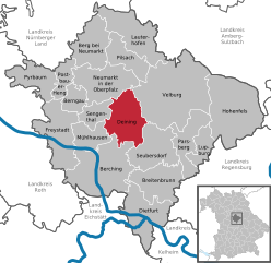
Neumarkt (Landkreis Neumarkt in der Oberpfalz)

- district of Bavaria, Germany
 Hiking in Neumarkt
Neumarkt in der Oberpfalz, a district in Bavaria, Germany, is known for its picturesque landscapes and varied hiking opportunities. Set against a backdrop of rolling hills, lush forests, and charming villages, this area is ideal for both casual walkers and seasoned hikers.
Popular Hiking Areas:
-
Franconian Jura (Fränkische Jura): This beautiful region features dramatic limestone formations, caves, and dense forests. Trails often lead to breathtaking viewpoints and historical sites, such as castles and ruins.
-
Nature Parks: The Naturpark Altmühltal, which is partially in Neumarkt, offers trails that meander along the Altmühl River, showcasing diverse flora and fauna.
-
Hiking Trails:
- The Neumarkt Loop (Neumarkter Rundweg): A well-marked trail offering a mix of easy and moderate segments. It features scenic views and passes through various natural and cultural attractions.
- Cultural Trails: Some routes focus on the historical and cultural aspects of the region, leading hikers through towns with old architecture and interesting local history.
Trail Difficulty:
The trails in the Neumarkt district range from easy walks suitable for families to more challenging hikes for experienced adventurers. Many paths are well-marked, and you can find detailed maps at local tourism offices or online.
Tips for Hiking in Neumarkt:
- Best Time to Hike: Spring and early autumn offer the best weather conditions for hiking. Summer can be warm, while winter may lead to snow-covered paths.
- Equipment: Good hiking boots, weather-appropriate clothing, and a backpack with water and snacks are essential.
- Local Flora and Fauna: Be on the lookout for various wildlife species and enjoy the blooming wildflowers in spring.
- Respect Nature: Follow Leave No Trace principles to keep the trails clean and preserve the natural beauty.
Whether you are a local or just visiting, the hiking opportunities in Neumarkt are sure to provide a fulfilling experience in nature.
- Country:

- Capital: Neumarkt in der Oberpfalz
- Licence Plate Code: PAR; NM
- Coordinates: 49° 15' 0" N, 11° 30' 0" E


- GPS tracks (wikiloc): [Link]
- AboveSeaLevel: 445 м m
- Area: 1344.00 sq km
- Population: 105346
- Web site: http://www.landkreis-neumarkt.de/
- Wikipedia en: wiki(en)
- Wikipedia: wiki(de)
- Wikidata storage: Wikidata: Q10427
- Wikipedia Commons Category: [Link]
- Freebase ID: [/m/0243bz]
- GeoNames ID: Alt: [2864548]
- VIAF ID: Alt: [159470225]
- OSM relation ID: [62620]
- GND ID: Alt: [4041840-6]
- archINFORM location ID: [3376]
- Library of Congress authority ID: Alt: [n82096308]
- TGN ID: [7125062]
- Historical Gazetteer (GOV) ID: [adm_139373]
- Bavarikon ID: [ODB_A00001770]
- NUTS code: [DE236]
- German district key: 09373
Includes regions:


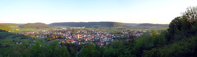
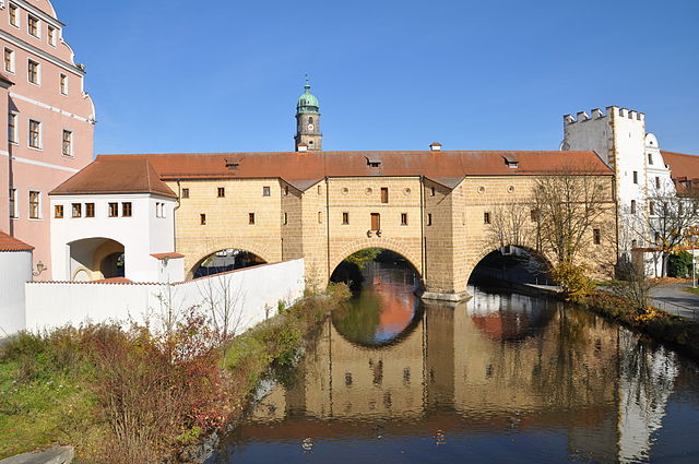
Neumarkt in der Oberpfalz
- town in Bavaria, Germany
Hiking in Neumarkt in der Oberpfalz
Neumarkt in der Oberpfalz, located in Bavaria, Germany, offers a variety of hiking opportunities set against picturesque landscapes and rich cultural heritage. Here are some highlights:...
- Country:
- Postal Code: 92318
- Local Dialing Code: 09181
- Licence Plate Code: NM
- Coordinates: 49° 17' 0" N, 11° 28' 0" E
- GPS tracks (wikiloc): [Link]
- AboveSeaLevel: 424 м m
- Area: 79.01 sq km
- Population: 41318
- Web site: [Link]


Postbauer-Heng
- municipality in Landkreis Neumarkt in der Oberpfalz in Germany
Hiking in Postbauer-Heng
Postbauer-Heng, located in Bavaria, Germany, offers a serene environment for hiking enthusiasts. The region is characterized by its picturesque landscapes, including rolling hills, forests, and fields, making it an excellent destination for outdoor activities....
- Country:
- Postal Code: 92353
- Local Dialing Code: 09188; 09180
- Licence Plate Code: NM
- Coordinates: 49° 18' 0" N, 11° 21' 0" E
- GPS tracks (wikiloc): [Link]
- AboveSeaLevel: 460 м m
- Area: 24.65 sq km
- Population: 5479
- Web site: [Link]

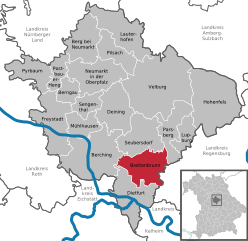
Berching
- municipality in Landkreis Neumarkt in der Oberpfalz in Germany
Hiking in Berching
Berching, located in Bavaria, Germany, is a charming town known for its medieval architecture and beautiful natural surroundings, making it an excellent destination for hiking and outdoor activities. Here are some highlights and tips for hiking in and around Berching:...
- Country:
- Postal Code: 92334
- Local Dialing Code: 08462
- Licence Plate Code: NM
- Coordinates: 49° 6' 0" N, 11° 26' 0" E
- GPS tracks (wikiloc): [Link]
- AboveSeaLevel: 385 м m
- Area: 131.18 sq km
- Population: 7475
- Web site: [Link]


Pyrbaum
- municipality in Landkreis Neumarkt in der Oberpfalz in Germany
Hiking in Pyrbaum
Pyrbaum, located in Bavaria, Germany, offers several opportunities for hiking enthusiasts to explore the beautiful landscapes of the region. While Pyrbaum itself is a small town, it is surrounded by scenic countryside, forests, and quaint villages that are ideal for hiking....
- Country:
- Postal Code: 90602
- Local Dialing Code: 09180
- Licence Plate Code: NM
- Coordinates: 49° 17' 54" N, 11° 17' 22" E
- GPS tracks (wikiloc): [Link]
- AboveSeaLevel: 438 м m
- Area: 50.29 sq km
- Population: 4379
- Web site: [Link]

Deining
- municipality in Landkreis Neumarkt in der Oberpfalz in Germany
Hiking in Deining
Deining, a small municipality in Bavaria, Germany, is surrounded by beautiful landscapes and nature, making it a great place for hiking enthusiasts. While it might not be as widely known as some of the larger hiking destinations in the Bavarian region, it offers several trails and routes that cater to different skill levels....
- Country:
- Postal Code: 92364
- Local Dialing Code: 09184
- Licence Plate Code: NM
- Coordinates: 49° 13' 0" N, 11° 31' 0" E
- GPS tracks (wikiloc): [Link]
- AboveSeaLevel: 471 м m
- Area: 71.38 sq km
- Population: 3360
- Web site: [Link]


Seubersdorf
- municipality in Landkreis Neumarkt in der Oberpfalz in Germany
Hiking in Seubersdorf
Seubersdorf is a small town located in Bavaria, Germany, and it offers a unique experience for hikers with its picturesque landscapes, hiking trails, and proximity to natural features. While it may not be as widely known as some major hiking destinations, it provides opportunities for exploration in the surrounding areas....
- Country:
- Postal Code: 92358
- Local Dialing Code: 09497
- Licence Plate Code: PAR; NM
- Coordinates: 49° 10' 0" N, 11° 37' 0" E
- GPS tracks (wikiloc): [Link]
- AboveSeaLevel: 521 м m
- Area: 68.28 sq km
- Population: 5055
- Web site: [Link]


Freystadt
- municipality in Landkreis Neumarkt in der Oberpfalz in Germany
Hiking in Freystadt
Freystadt is a picturesque town in Bavaria, Germany, known for its beautiful landscapes and outdoor activities, including hiking. The region offers a variety of hiking trails suitable for different skill levels, from leisurely walks to more challenging routes....
- Country:
- Postal Code: 92342
- Local Dialing Code: 09179
- Licence Plate Code: NM
- Coordinates: 49° 12' 0" N, 11° 19' 0" E
- GPS tracks (wikiloc): [Link]
- AboveSeaLevel: 410 м m
- Area: 80.56 sq km
- Population: 6417
- Web site: [Link]
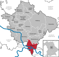
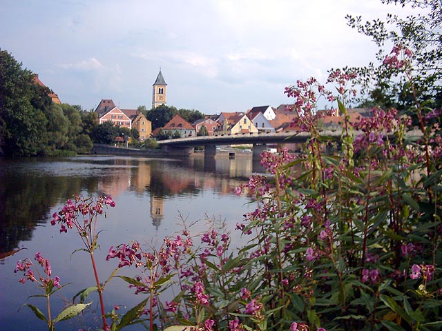
Dietfurt an der Altmühl
- municipality in Landkreis Neumarkt in der Oberpfalz in Germany
Hiking in Dietfurt an der Altmühl
Dietfurt, a charming town located in the Upper Palatinate region of Bavaria, Germany, offers some scenic hiking opportunities that cater to various skill levels. The area is characterized by beautiful landscapes, including rolling hills, forests, and meandering rivers, making it an excellent destination for nature lovers and hiking enthusiasts....
- Country:
- Postal Code: 92345
- Local Dialing Code: 08464
- Licence Plate Code: NM
- Coordinates: 49° 2' 0" N, 11° 35' 0" E
- GPS tracks (wikiloc): [Link]
- AboveSeaLevel: 365 м m
- Area: 78.71 sq km
- Population: 5257
- Web site: [Link]


Berngau
- municipality in Landkreis Neumarkt in der Oberpfalz in Germany
Hiking in Berngau
Berngau is a charming village located in Bavaria, Germany, providing a great backdrop for hiking enthusiasts. The surrounding countryside is characterized by rolling hills, lush forests, and scenic trails, making it an excellent destination for outdoor activities....
- Country:
- Postal Code: 92361
- Local Dialing Code: 09181
- Licence Plate Code: NM
- Coordinates: 49° 15' 0" N, 11° 24' 0" E
- GPS tracks (wikiloc): [Link]
- AboveSeaLevel: 433 м m
- Area: 27.12 sq km
- Population: 1668
- Web site: [Link]


Velburg
- municipality in Landkreis Neumarkt in der Oberpfalz in Germany
Hiking in Velburg
Velburg, located in Bavaria, Germany, offers a variety of hiking opportunities for outdoor enthusiasts. The region is characterized by its picturesque landscapes, rolling hills, and charming villages, making it an attractive destination for nature lovers and hikers alike....
- Country:
- Postal Code: 92355
- Local Dialing Code: 09182
- Licence Plate Code: NM
- Coordinates: 49° 13' 58" N, 11° 40' 19" E
- GPS tracks (wikiloc): [Link]
- AboveSeaLevel: 492 м m
- Area: 175.66 sq km
- Population: 4479
- Web site: [Link]


Pilsach
- municipality of Germany
Hiking in Pilsach
Pilsach is a quaint community in the Bavaria region of Germany, known for its picturesque landscapes and rich natural surroundings. While not as widely known as some larger hiking destinations in the Bavarian Alps, it offers beautiful trails for those looking to explore the countryside....
- Country:
- Postal Code: 92367
- Local Dialing Code: 09181
- Licence Plate Code: NM
- Coordinates: 49° 19' 0" N, 11° 30' 0" E
- GPS tracks (wikiloc): [Link]
- AboveSeaLevel: 445 м m
- Area: 47.65 sq km
- Population: 2212
- Web site: [Link]


Sengenthal
- municipality in Landkreis Neumarkt in der Oberpfalz in Germany
Hiking in Sengenthal
Sengenthal, located in Germany, is not typically known as a hiking hotspot, but there are several enjoyable options for those who seek a nature-filled experience in the area surrounding it. While Sengenthal itself may not have extensive trails, you'll find that nearby regions offer lovely hiking opportunities....
- Country:
- Postal Code: 92369
- Local Dialing Code: 09181
- Licence Plate Code: NM
- Coordinates: 49° 14' 0" N, 11° 28' 0" E
- GPS tracks (wikiloc): [Link]
- AboveSeaLevel: 434 м m
- Area: 28.51 sq km
- Population: 1971
- Web site: [Link]


Berg
- municipality in Landkreis Neumarkt in der Oberpfalz in Germany
Hiking in Berg
Hiking in Berg, located in the Upper Palatinate region of Bavaria, Germany, offers beautiful landscapes, charming villages, and a variety of trails suited for different skill levels. This area is known for its natural beauty, with rolling hills, forests, and scenic views of the surrounding countryside....
- Country:
- Postal Code: 92348
- Local Dialing Code: 09189; 09187; 09181
- Licence Plate Code: NM
- Coordinates: 49° 19' 0" N, 11° 26' 0" E
- GPS tracks (wikiloc): [Link]
- AboveSeaLevel: 407 м m
- Area: 65.14 sq km
- Population: 5739
- Web site: [Link]


Lupburg
- municipality in Landkreis Neumarkt in der Oberpfalz in Germany
Hiking in Lupburg
Lupburg is a quaint municipality in Bavaria, Germany, known for its picturesque landscapes and lush forests, making it a great destination for hiking enthusiasts. The region offers a variety of trails that cater to different skill levels, ranging from easy walks for beginners to more challenging hikes for experienced outdoor adventurers....
- Country:
- Postal Code: 92331
- Local Dialing Code: 09492
- Licence Plate Code: NM
- Coordinates: 49° 8' 59" N, 11° 45' 0" E
- GPS tracks (wikiloc): [Link]
- AboveSeaLevel: 532 м m
- Area: 30.71 sq km
- Population: 1979
- Web site: [Link]


Parsberg
- municipality in Landkreis Neumarkt in der Oberpfalz in Germany
Hiking in Parsberg
Parsberg, located in Bavaria, Germany, offers a variety of hiking opportunities that showcase the region's beautiful landscapes and charming villages. Here are some highlights about hiking in and around Parsberg:...
- Country:
- Postal Code: 92331
- Local Dialing Code: 09492
- Licence Plate Code: PAR; NM
- Coordinates: 49° 9' 0" N, 11° 43' 0" E
- GPS tracks (wikiloc): [Link]
- AboveSeaLevel: 553 м m
- Area: 57.32 sq km
- Population: 6731
- Web site: [Link]


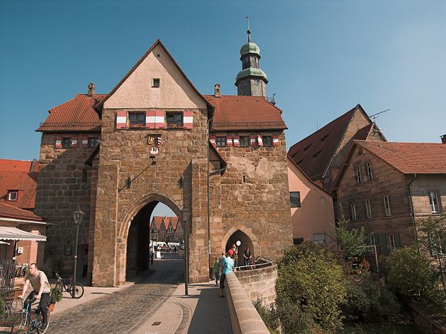
Lauterhofen
- municipality in Landkreis Neumarkt in der Oberpfalz in Germany
Hiking in Lauterhofen
Lauterhofen is a picturesque village located in the Upper Palatinate region of Bavaria, Germany. Surrounded by stunning natural landscapes, it offers a variety of hiking opportunities suitable for all skill levels. Here are some key points to consider when hiking in Lauterhofen:...
- Country:
- Postal Code: 92283
- Local Dialing Code: 09186
- Licence Plate Code: NM
- Coordinates: 49° 22' 0" N, 11° 37' 0" E
- GPS tracks (wikiloc): [Link]
- AboveSeaLevel: 480 м m
- Area: 82.97 sq km
- Population: 3167
- Web site: [Link]


Hohenfels
- municipality in Landkreis Neumarkt in der Oberpfalz in Germany
Hiking in Hohenfels
Hohenfels, located in Bavaria, Germany, is a picturesque region that offers a variety of hiking opportunities. This area is characterized by its rolling hills, dense forests, and stunning vistas, making it an appealing destination for outdoor enthusiasts. Here are some highlights of hiking in Hohenfels:...
- Country:
- Postal Code: 92366
- Local Dialing Code: 09472
- Licence Plate Code: NM
- Coordinates: 49° 12' 0" N, 11° 51' 0" E
- GPS tracks (wikiloc): [Link]
- AboveSeaLevel: 390 м m
- Area: 137.07 sq km
- Population: 2095
- Web site: [Link]

Breitenbrunn
- municipality in Landkreis Neumarkt in der Oberpfalz in Germany
Hiking in Breitenbrunn
Breitenbrunn, located in the Upper Palatinate region of Bavaria, Germany, is a lovely area for hiking enthusiasts. The landscape here features a mix of rolling hills, lush forests, and picturesque villages, making it an inviting destination for outdoor activities....
- Country:
- Postal Code: 92363
- Local Dialing Code: 09495
- Licence Plate Code: NM
- Coordinates: 49° 5' 1" N, 11° 37' 20" E
- GPS tracks (wikiloc): [Link]
- AboveSeaLevel: 401 м m
- Area: 70.78 sq km
- Population: 2965
- Web site: [Link]


Mühlhausen
- municipality in Landkreis Neumarkt in der Oberpfalz in Germany
Hiking in Mühlhausen
Mühlhausen, located in the Upper Palatinate region of Bavaria, Germany, is surrounded by beautiful landscapes that are perfect for hiking. The area is characterized by its rolling hills, forests, and picturesque villages, offering a variety of trails for all experience levels....
- Country:
- Postal Code: 92360
- Local Dialing Code: 09185
- Licence Plate Code: NM
- Coordinates: 49° 10' 0" N, 11° 26' 0" E
- GPS tracks (wikiloc): [Link]
- AboveSeaLevel: 406 м m
- Area: 36.96 sq km
- Population: 4937
- Web site: [Link]
Shares border with regions:
Amberg-Sulzbach
- district of Bavaria, Germany
Hiking in Amberg-Sulzbach
Amberg-Sulzbach, located in Bavaria, Germany, is a picturesque district known for its beautiful landscapes, rich culture, and numerous outdoor activities, including hiking. The area offers a variety of hiking trails that cater to different skill levels, from easy walks suitable for families to more challenging paths for experienced hikers....
- Country:
- Capital: Amberg
- Licence Plate Code: SUL; NAB; ESB; BUL; AS
- Coordinates: 49° 30' 0" N, 11° 45' 0" E
- GPS tracks (wikiloc): [Link]
- AboveSeaLevel: 380 м m
- Area: 1255.00 sq km
- Population: 94617
- Web site: [Link]

Schwandorf
- district of Bavaria, Germany
Hiking in Schwandorf
Schwandorf district, located in Bavaria, Germany, is a great area for hiking enthusiasts looking for scenic routes and beautiful landscapes. The region is characterized by rolling hills, forests, and rivers, providing a mix of terrain that caters to various hiking levels....
- Country:
- Capital: Schwandorf
- Licence Plate Code: SAD; ROD; OVI; NEN; NAB; BUL
- Coordinates: 49° 22' 12" N, 12° 15' 0" E
- GPS tracks (wikiloc): [Link]
- AboveSeaLevel: 465 м m
- Area: 1472.88 sq km
- Population: 131260
- Web site: [Link]

Regensburg
- district of Bavaria, Germany
Hiking in Regensburg
Regensburg is located in the state of Bavaria, Germany, and it offers a variety of hiking opportunities that showcase the region's natural beauty and historical significance. Here's what you can expect when hiking in and around the Regensburg district:...
- Country:
- Capital: Regensburg
- Licence Plate Code: R
- Coordinates: 49° 4' 48" N, 12° 10' 12" E
- GPS tracks (wikiloc): [Link]
- AboveSeaLevel: 390 м m
- Area: 1396.00 sq km
- Population: 144278
- Web site: [Link]
Nürnberger Land
- district in Bavaria, Germany
Hiking in Nürnberger Land
Nürnberger Land, located in Bavaria, Germany, is a fantastic area for hiking enthusiasts. It features a diverse landscape that includes forests, hills, and picturesque valleys, making it ideal for both casual walkers and seasoned hikers. Here are some key points about hiking in Nürnberger Land:...
- Country:
- Capital: Lauf an der Pegnitz
- Licence Plate Code: PEG; N; LAU; HEB; ESB
- Coordinates: 49° 30' 0" N, 11° 22' 0" E
- GPS tracks (wikiloc): [Link]
- AboveSeaLevel: 355 м m
- Area: 800.00 sq km
- Population: 149127
- Web site: [Link]

Roth
- district in Bavaria, Germany
Hiking in Roth
Roth district, located in Bavaria, Germany, offers a variety of beautiful landscapes and hiking opportunities that appeal to both novice and experienced hikers. The area is characterized by rolling hills, forests, and picturesque views. Here are some highlights and tips for hiking in Roth:...
- Country:
- Capital: Roth
- Licence Plate Code: RH; HIP
- Coordinates: 49° 15' 0" N, 11° 4' 48" E
- GPS tracks (wikiloc): [Link]
- AboveSeaLevel: 355 м m
- Area: 895.00 sq km
- Population: 103944
- Web site: [Link]

Kelheim
- district in Bavaria, Germany
Hiking in Kelheim
Kelheim, located in Bavaria, Germany, is a beautiful area for hiking, characterized by its stunning landscapes, historical sites, and natural attractions. Here are some highlights you might consider when planning a hiking trip in Kelheim:...
- Country:
- Capital: Kelheim
- Licence Plate Code: ROL; RID; PAR; MAI; KEH
- Coordinates: 48° 49' 48" N, 11° 49' 48" E
- GPS tracks (wikiloc): [Link]
- AboveSeaLevel: 369 м m
- Area: 1067.00 sq km
- Population: 90040
- Web site: [Link]
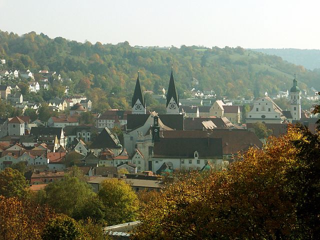
Eichstätt
- district of Bavaria, Germany
Hiking in Eichstätt
Eichstätt, located in Bavaria, Germany, is known for its scenic landscapes, historical towns, and rich natural beauty, making it a fantastic destination for hiking enthusiasts. Here are some highlights and tips for hiking in the Eichstätt district:...
- Country:
- Capital: Eichstätt
- Licence Plate Code: EI
- Coordinates: 48° 55' 12" N, 11° 19' 48" E
- GPS tracks (wikiloc): [Link]
- AboveSeaLevel: 475 м m
- Area: 1214.00 sq km
- Population: 97347
- Web site: [Link]