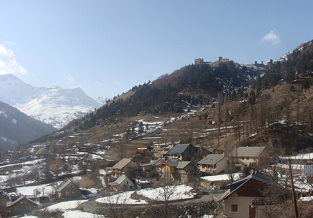
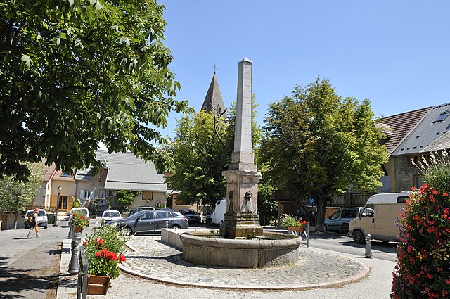
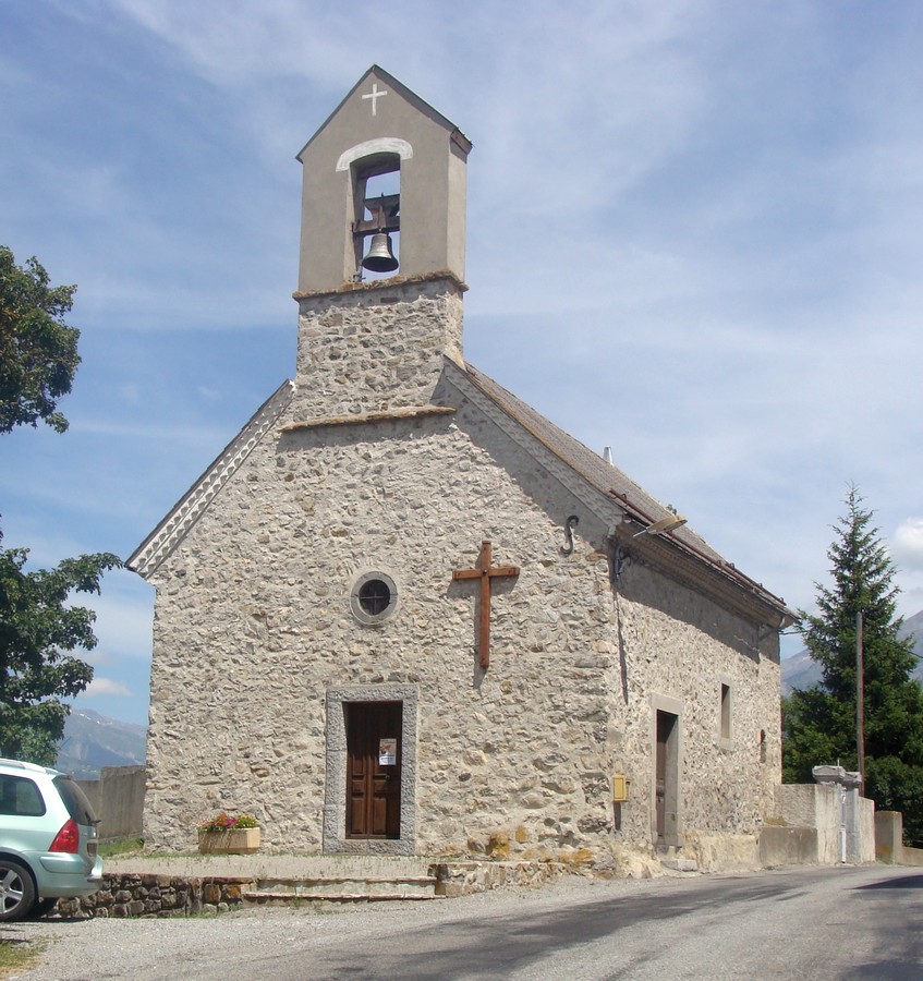
Ancelle (Ancelle)
- commune in Hautes-Alpes, France
 Hiking in Ancelle
Ancelle is a charming village located in the French Alps, specifically in the Hautes-Alpes department. It's a great destination for hiking enthusiasts looking for a mix of natural beauty, alpine scenery, and a variety of trails suitable for different skill levels. Here are some insights into hiking in Ancelle:
Trail Options
-
Easiest Trails:
- Le Sentier des Crêtes: This trail offers stunning views of the surrounding mountains and is relatively easy, making it suitable for families and beginners.
- Lac de Puy Aillaud: A short and accessible hike leading to a picturesque lake, perfect for a relaxing day out.
-
Moderate Trails:
- Col de la Gardette: This hike provides a bit more challenge with uphill sections and rewards hikers with panoramic views. It's great for those looking to experience more of the alpine environment.
- Circuit des Granges: A beautiful loop that takes you through picturesque alpine pastures and traditional shepherd huts.
-
Challenging Trails:
- Pointe de la Selle: A more demanding hike that leads you to a high peak, requiring good fitness and preparation. The views from the top are breathtaking and well worth the effort.
Best Time to Hike
- Summer (June to September): This is the ideal time for hiking, as the weather is generally warm, and most trails are accessible. Be sure to check the conditions, as some trails may still have snow at the beginning of June.
- Fall (October): Early October can also be a beautiful time to hike, with autumn colors enhancing the landscape. Just be aware that temperatures start to drop.
Preparation Tips
- Equipment: Good hiking boots, weather-appropriate clothing, a backpack, plenty of water, and snacks are crucial. If you plan on hiking at higher altitudes, consider carrying layers due to temperature changes.
- Maps and Guides: While many trails are well-marked, a map or a hiking guide app is helpful for navigation and ensuring you stay on track.
- Safety: Always inform someone of your hiking plans, especially if hiking alone. Check local weather conditions before heading out.
Local Attractions
In addition to hiking, Ancelle offers opportunities for mountain biking, paragliding, and exploring the village's charming architecture and local cuisine. The nearby ski resorts also mean that the area is popular year-round and provides various activities in each season.
Overall, Ancelle is a fantastic destination for hiking, offering a peaceful retreat in nature with trails for everyone to explore. Enjoy your adventure in the Alps!
- Country:

- Postal Code: 05260
- Coordinates: 44° 37' 24" N, 6° 12' 24" E


- GPS tracks (wikiloc): [Link]
- Area: 50.66 sq km
- Population: 905
- Wikipedia en: wiki(en)
- Wikipedia: wiki(fr)
- Wikidata storage: Wikidata: Q1017753
- Wikipedia Commons Category: [Link]
- Freebase ID: [/m/03m812d]
- Freebase ID: [/m/03m812d]
- GeoNames ID: Alt: [6452092]
- GeoNames ID: Alt: [6452092]
- SIREN number: [210500047]
- SIREN number: [210500047]
- PACTOLS thesaurus ID: [pcrtxGDief5P45]
- PACTOLS thesaurus ID: [pcrtxGDief5P45]
- INSEE municipality code: 05004
- INSEE municipality code: 05004
Shares border with regions:

Chabottes
- commune in Hautes-Alpes, France
Hiking in Chabottes
Chabottes is a charming village located in the Hautes-Alpes region of France, nestled in the stunning French Alps. The area around Chabottes offers a variety of hiking trails suitable for different skill levels, making it a great destination for outdoor enthusiasts....
- Country:
- Postal Code: 05260
- Coordinates: 44° 38' 37" N, 6° 10' 15" E
- GPS tracks (wikiloc): [Link]
- Area: 9.96 sq km
- Population: 834

Orcières
- commune in Hautes-Alpes, France
Hiking in Orcières
Orcières is a stunning destination located in the French Alps, nestled within the Écrins National Park in the Haute-Alpes region. It offers a variety of hiking opportunities suitable for all levels of experience. Here are some key points to consider:...
- Country:
- Postal Code: 05170
- Coordinates: 44° 41' 4" N, 6° 19' 30" E
- GPS tracks (wikiloc): [Link]
- Area: 98.27 sq km
- Population: 715

Saint-Léger-les-Mélèzes
- commune in Hautes-Alpes, France
Hiking in Saint-Léger-les-Mélèzes
Saint-Léger-les-Mélèzes is a charming alpine village located in the Hautes-Alpes region of southeastern France. It's an excellent destination for hiking enthusiasts, offering a mix of scenic trails, beautiful landscapes, and a variety of outdoor activities....
- Country:
- Postal Code: 05260
- Coordinates: 44° 38' 38" N, 6° 11' 54" E
- GPS tracks (wikiloc): [Link]
- Area: 6.76 sq km
- Population: 345
- Web site: [Link]

Saint-Jean-Saint-Nicolas
- commune in Hautes-Alpes, France
Hiking in Saint-Jean-Saint-Nicolas
Saint-Jean-Saint-Nicolas is a charming village located in the Hautes-Alpes region of France, and it's an excellent destination for hiking enthusiasts. Nestled at the foot of the Écrins mountain range, the area is known for its stunning natural scenery, diverse landscapes, and a variety of hiking trails suitable for different skill levels....
- Country:
- Postal Code: 05260
- Coordinates: 44° 40' 3" N, 6° 13' 43" E
- GPS tracks (wikiloc): [Link]
- Area: 37.17 sq km
- Population: 997
Réallon
- commune in Hautes-Alpes, France
Hiking in Réallon
Réallon is a picturesque village located in the French Alps, particularly in the Hautes-Alpes department. It’s a fantastic destination for hiking enthusiasts, offering a mix of stunning landscapes, diverse trails, and breathtaking views of the surrounding mountains and lakes. Here are some key details to consider when hiking in Réallon:...
- Country:
- Postal Code: 05160
- Coordinates: 44° 35' 44" N, 6° 21' 53" E
- GPS tracks (wikiloc): [Link]
- Area: 71.4 sq km
- Population: 260
- Web site: [Link]
Chorges
- commune in Hautes-Alpes, France
Hiking in Chorges
Chorges, located in the Hautes-Alpes region of France, is a beautiful destination for hiking enthusiasts. Nestled in the stunning natural environment of the French Alps, it offers a range of trails suitable for all levels of hikers, from beginners to experienced trekkers. Here’s what you need to know about hiking in Chorges:...
- Country:
- Postal Code: 05230
- Coordinates: 44° 32' 44" N, 6° 16' 35" E
- GPS tracks (wikiloc): [Link]
- AboveSeaLevel: 835 м m
- Area: 53.34 sq km
- Population: 2810
- Web site: [Link]

Forest-Saint-Julien
- commune in Hautes-Alpes, France
Hiking in Forest-Saint-Julien
Forest-Saint-Julien, located in the Rhône-Alpes region of France, is a picturesque area that offers a variety of hiking opportunities for outdoor enthusiasts. Known for its diverse landscapes, including lush forests, rolling hills, and scenic views of the surrounding mountains, it’s a great destination for nature lovers....
- Country:
- Postal Code: 05260
- Coordinates: 44° 38' 2" N, 6° 8' 8" E
- GPS tracks (wikiloc): [Link]
- Area: 6.95 sq km
- Population: 317

La Rochette
- commune in Hautes-Alpes, France
Hiking in La Rochette
La Rochette, located in the Hautes-Alpes region of southeastern France, offers a fantastic setting for hiking enthusiasts. The area is characterized by stunning alpine landscapes, diverse ecosystems, and a plethora of trails catering to various skill levels....
- Country:
- Postal Code: 05000
- Coordinates: 44° 35' 41" N, 6° 9' 22" E
- GPS tracks (wikiloc): [Link]
- Area: 10.34 sq km
- Population: 472

La Bâtie-Neuve
- commune in Hautes-Alpes, France
Hiking in La Bâtie-Neuve
La Bâtie-Neuve is a picturesque village located in the Hautes-Alpes region of southeastern France. It's an excellent destination for hiking enthusiasts due to its stunning natural surroundings, including the nearby Écrins National Park and the breathtaking landscapes of the Alps....
- Country:
- Postal Code: 05230
- Coordinates: 44° 34' 0" N, 6° 11' 45" E
- GPS tracks (wikiloc): [Link]
- Area: 27.99 sq km
- Population: 2487
- Web site: [Link]