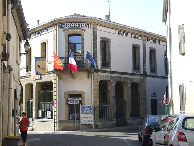
Aubais (Aubais)

- commune in Gard, France
- Country:

- Postal Code: 30250
- Coordinates: 43° 45' 18" N, 4° 8' 52" E


- GPS tracks (wikiloc): [Link]
- Area: 11.79 sq km
- Population: 2602
- Web site: http://www.aubais.fr
- Wikipedia en: wiki(en)
- Wikipedia: wiki(fr)
- Wikidata storage: Wikidata: Q679916
- Wikipedia Commons Category: [Link]
- Freebase ID: [/m/02w22ck]
- GeoNames ID: Alt: [6448178]
- SIREN number: [213000193]
- BnF ID: [15254660q]
- VIAF ID: Alt: [238749713]
- PACTOLS thesaurus ID: [pcrt4DUVwz73b3]
- WOEID: [577001]
- INSEE municipality code: 30019
Shares border with regions:


Saint-Sériès
- commune in Hérault, France
- Country:
- Postal Code: 34400
- Coordinates: 43° 43' 54" N, 4° 6' 19" E
- GPS tracks (wikiloc): [Link]
- Area: 4.56 sq km
- Population: 951
- Web site: [Link]


Villetelle
- commune in Hérault, France
- Country:
- Postal Code: 34400
- Coordinates: 43° 44' 2" N, 4° 8' 24" E
- GPS tracks (wikiloc): [Link]
- Area: 5.31 sq km
- Population: 1453
- Web site: [Link]

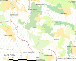
Junas
- commune in Gard, France
- Country:
- Postal Code: 30250
- Coordinates: 43° 46' 11" N, 4° 7' 22" E
- GPS tracks (wikiloc): [Link]
- Area: 7.75 sq km
- Population: 1070


Congénies
- commune in Gard, France
- Country:
- Postal Code: 30111
- Coordinates: 43° 46' 42" N, 4° 9' 36" E
- GPS tracks (wikiloc): [Link]
- Area: 8.64 sq km
- Population: 1637

Aigues-Vives
- commune in Gard, France
- Country:
- Postal Code: 30670
- Coordinates: 43° 44' 22" N, 4° 10' 50" E
- GPS tracks (wikiloc): [Link]
- Area: 12 sq km
- Population: 3211
- Web site: [Link]


Gallargues-le-Montueux
- commune in Gard, France
- Country:
- Postal Code: 30660
- Coordinates: 43° 43' 0" N, 4° 10' 0" E
- GPS tracks (wikiloc): [Link]
- AboveSeaLevel: 64 м m
- Area: 10.89 sq km
- Population: 3669
- Web site: [Link]