Aucelon (Aucelon)

- commune in Drôme, France
 Hiking in Aucelon
Aucelon is a small village located in the Ardèche region of France, known for its stunning natural beauty and diverse hiking opportunities. Here’s an overview of what to expect when hiking in Aucelon:
Scenic Trails
- Diverse Terrain: Aucelon features rolling hills, impressive cliffs, and lush forests. Trails vary in difficulty, making it suitable for both beginners and experienced hikers.
- Breathtaking Views: Many trails offer panoramic views of the surrounding landscapes, including the Gorge de l'Ardèche and the Monts d'Ardèche regional park.
Popular Hiking Routes
- GR4 Trail: This long-distance hiking trail passes through Aucelon, offering a section that connects to other beautiful regions, making it ideal for multi-day hikes.
- Local Circuit Trails: There are several shorter circuits available that can be explored in half a day, perfect for families or casual walkers.
Flora and Fauna
The region is rich in biodiversity, so hikers can enjoy observing various plant species, wildflowers, and local wildlife, including birds and small mammals. Spring and early summer are particularly lovely times for wildflower enthusiasts.
Tips for Hikers
- Seasonal Considerations: The best time to hike in Aucelon is during the spring (April to June) and fall (September to October) when temperatures are mild and the landscape is vibrant.
- Preparation: Make sure to check local weather conditions, carry enough water, and wear appropriate hiking shoes. It’s also advisable to carry a map or have a GPS device, as some trails may not be well-marked.
Local Attractions
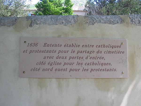
- Historical Sites: Combine your hiking with visits to nearby historical sites, including old churches and ruins that reflect the region's rich history.
- Local Culture: Take some time to explore the village itself, experiencing local cuisine and culture.
Whether you're a seasoned hiker or a newcomer, Aucelon offers a delightful hiking experience that allows you to immerse yourself in nature while enjoying the tranquility of the Ardèche region. Be sure to respect the environment by following Leave No Trace principles to preserve the beauty of this area for future adventurers.
- Country:

- Postal Code: 26340
- Coordinates: 44° 37' 27" N, 5° 20' 40" E


- GPS tracks (wikiloc): [Link]
- Area: 26.34 sq km
- Population: 14
- Wikipedia en: wiki(en)
- Wikipedia: wiki(fr)
- Wikidata storage: Wikidata: Q767581
- Wikipedia Commons Category: [Link]
- Freebase ID: [/m/03mgk31]
- GeoNames ID: Alt: [6447869]
- SIREN number: [212600175]
- BnF ID: [15252878v]
- INSEE municipality code: 26017
Shares border with regions:
Pennes-le-Sec
- commune in Drôme, France
Hiking in Pennes-le-Sec
Pennes-le-Sec, located in the southern French region of Provence, offers a unique and scenic environment for hiking enthusiasts. The area is characterized by its charming landscapes, diverse flora and fauna, and views of the surrounding mountains and valleys....
- Country:
- Postal Code: 26340
- Coordinates: 44° 38' 17" N, 5° 19' 6" E
- GPS tracks (wikiloc): [Link]
- Area: 9.31 sq km
- Population: 31


Barnave
- commune in Drôme, France
Hiking in Barnave
Barnave is a small village located in the Drôme department in the Auvergne-Rhône-Alpes region of southeastern France. The area is known for its stunning natural landscapes, making it an excellent destination for hiking enthusiasts. Here are some highlights about hiking in and around Barnave:...
- Country:
- Postal Code: 26310
- Coordinates: 44° 39' 36" N, 5° 22' 12" E
- GPS tracks (wikiloc): [Link]
- Area: 13.06 sq km
- Population: 185


Jonchères
- commune in Drôme, France
Hiking in Jonchères
Jonchères is a beautiful village located in the French Alps, specifically in the department of Isère. This area is known for its stunning natural landscapes, making it an excellent destination for hiking enthusiasts....
- Country:
- Postal Code: 26310
- Coordinates: 44° 34' 19" N, 5° 24' 19" E
- GPS tracks (wikiloc): [Link]
- Area: 16.68 sq km
- Population: 29


Recoubeau-Jansac
- commune in Drôme, France
Hiking in Recoubeau-Jansac
Recoubeau-Jansac is a picturesque village in the Drôme department of the Auvergne-Rhône-Alpes region in southeastern France. It is surrounded by beautiful natural landscapes, which makes it an excellent destination for hiking enthusiasts....
- Country:
- Postal Code: 26310
- Coordinates: 44° 39' 14" N, 5° 24' 47" E
- GPS tracks (wikiloc): [Link]
- Area: 12.96 sq km
- Population: 270
- Web site: [Link]
Volvent
- commune in Drôme, France
Hiking in Volvent
It seems there might be a bit of confusion; there isn't a widely recognized hiking destination called "Volvent." However, if you meant "Vallentuna" (located in Sweden) or perhaps "volcanic" regions like those in Iceland, or if you're referring to a different location with a similar name, please clarify....
- Country:
- Postal Code: 26470
- Coordinates: 44° 33' 36" N, 5° 20' 40" E
- GPS tracks (wikiloc): [Link]
- Area: 16.73 sq km
- Population: 35
Pradelle
- commune in Drôme, France
Hiking in Pradelle
Pradelle, located in the Drôme department in southeastern France, offers a delightful setting for hiking enthusiasts. Nestled in the beautiful landscape of the Drôme Provençale region, it boasts picturesque views, rolling hills, and diverse flora and fauna....
- Country:
- Postal Code: 26340
- Coordinates: 44° 36' 29" N, 5° 17' 31" E
- GPS tracks (wikiloc): [Link]
- Area: 12.92 sq km
- Population: 19

Brette
- commune in Drôme, France
Hiking in Brette
Hiking in Brette, which is part of the beautiful French region of Auvergne-Rhône-Alpes, offers stunning landscapes, diverse trails, and opportunities to experience nature at its finest. Here’s an overview of what you can expect:...
- Country:
- Postal Code: 26340
- Coordinates: 44° 35' 16" N, 5° 18' 39" E
- GPS tracks (wikiloc): [Link]
- Area: 15.5 sq km
- Population: 39
Poyols
- commune in Drôme, France
Hiking in Poyols
Poyols, also known as Poyols de la Mujer or the Sierra de Poyols, is a mountain range located in the Dominican Republic. The area is known for its stunning landscapes, diverse ecosystems, and a variety of hiking opportunities that cater to different skill levels. Here are some important aspects to consider if you're planning to hike in Poyols:...
- Country:
- Postal Code: 26310
- Coordinates: 44° 35' 59" N, 5° 25' 12" E
- GPS tracks (wikiloc): [Link]
- Area: 13.35 sq km
- Population: 68


Montlaur-en-Diois
- commune in Drôme, France
Hiking in Montlaur-en-Diois
Montlaur-en-Diois is a beautiful village located in the Drôme department of southeastern France, nestled within the picturesque Diois region. This area is known for its stunning landscapes, rugged terrain, and diverse flora and fauna, making it an excellent destination for hiking enthusiasts....
- Country:
- Postal Code: 26310
- Coordinates: 44° 38' 0" N, 5° 25' 44" E
- GPS tracks (wikiloc): [Link]
- Area: 9.72 sq km
- Population: 150