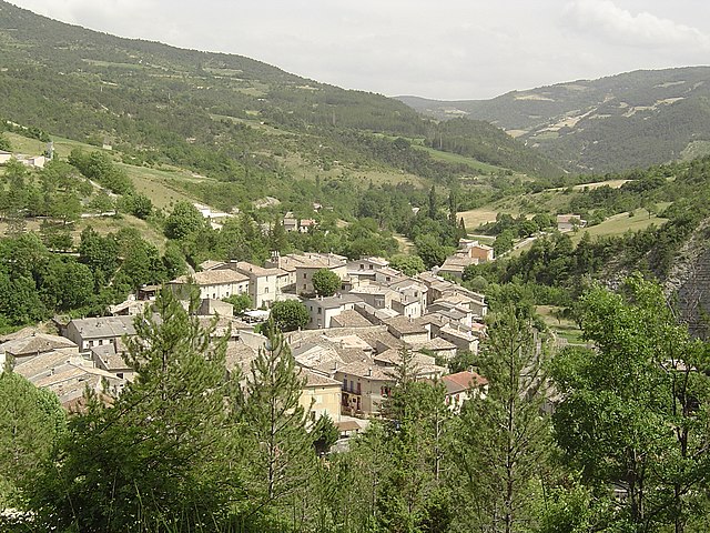
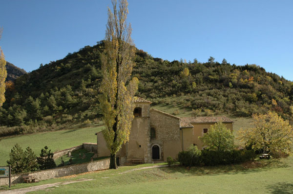
Pradelle (Pradelle)

- commune in Drôme, France
 Hiking in Pradelle
Pradelle, located in the Drôme department in southeastern France, offers a delightful setting for hiking enthusiasts. Nestled in the beautiful landscape of the Drôme Provençale region, it boasts picturesque views, rolling hills, and diverse flora and fauna.
Hiking Highlights in Pradelle:
-
Variety of Trails: The area around Pradelle offers a range of hiking trails suitable for various skill levels, from easy walks to more strenuous hikes. Some trails lead through vineyards, olive groves, and charming rural landscapes.
-
Scenic Views: Many hikes in the region provide stunning panoramic views of the surrounding countryside, the Alps to the east, and the famed lavender fields that bloom in the summer months.
-
Biodiversity: The Drôme region is known for its rich biodiversity. While hiking, you may encounter diverse wildlife, including birds, butterflies, and other native species, as well as a myriad of plant life.
-
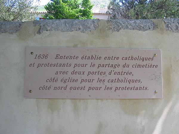
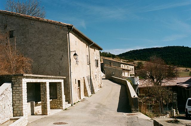
Cultural Sites: Along the hiking routes, you can discover historical sites, such as old stone bridges, traditional villages, and local architectural gems that reflect the area’s rich history.
-
Seasonal Hiking: Each season in Pradelle brings its own beauty — spring wildflowers, summer greenery, autumn colors, and winter's tranquil landscape, making it an attractive destination year-round.
Practical Tips:
-
Trail Maps: Consider obtaining local trail maps or guides from the tourist information office for the best hiking routes and safety tips.
-
Preparation: Depending on the duration and difficulty of your hike, make sure to carry enough water, snacks, and sun protection, especially during the hotter summer months.
-
Leave No Trace: Practice Leave No Trace principles to protect the environment. Stay on marked trails and consider the local wildlife.
-
Weather Conditions: Always check the weather before heading out, as conditions can change quickly in mountainous areas.
Engaging in hiking in Pradelle allows you to experience the natural beauty and tranquility of the Drôme region while enjoying physical activity. Be sure to take your time to soak in the views and the peaceful atmosphere of this picturesque locale.
- Country:

- Postal Code: 26340
- Coordinates: 44° 36' 29" N, 5° 17' 31" E


- GPS tracks (wikiloc): [Link]
- Area: 12.92 sq km
- Population: 19
- Wikipedia en: wiki(en)
- Wikipedia: wiki(fr)
- Wikidata storage: Wikidata: Q473651
- Wikipedia Commons Category: [Link]
- Freebase ID: [/m/03h3qc9]
- GeoNames ID: Alt: [6430180]
- SIREN number: [212602544]
- BnF ID: [15253114x]
- INSEE municipality code: 26254
Shares border with regions:
Pennes-le-Sec
- commune in Drôme, France
Hiking in Pennes-le-Sec
Pennes-le-Sec, located in the southern French region of Provence, offers a unique and scenic environment for hiking enthusiasts. The area is characterized by its charming landscapes, diverse flora and fauna, and views of the surrounding mountains and valleys....
- Country:
- Postal Code: 26340
- Coordinates: 44° 38' 17" N, 5° 19' 6" E
- GPS tracks (wikiloc): [Link]
- Area: 9.31 sq km
- Population: 31

Saint-Nazaire-le-Désert
- commune in Drôme, France
Hiking in Saint-Nazaire-le-Désert
Saint-Nazaire-le-Désert is a charming commune located in the Drôme department in southeastern France. It offers a unique blend of natural beauty, historical significance, and outdoor activities, making it a great destination for hiking enthusiasts....
- Country:
- Postal Code: 26340
- Coordinates: 44° 34' 12" N, 5° 16' 33" E
- GPS tracks (wikiloc): [Link]
- Area: 46.62 sq km
- Population: 174


La Chaudière
- commune in Drôme, France
Hiking in La Chaudière
La Chaudière is a beautiful region located in Quebec, Canada, known for its stunning natural landscapes and outdoor recreational opportunities. Here are some key points about hiking in La Chaudière:...
- Country:
- Postal Code: 26340
- Coordinates: 44° 37' 54" N, 5° 12' 59" E
- GPS tracks (wikiloc): [Link]
- Area: 12.17 sq km
- Population: 21

Rochefourchat
- commune in Drôme, France
Hiking in Rochefourchat
Rochefourchat is a lesser-known destination in the Drôme region of southeastern France, offering a unique hiking experience amid stunning natural landscapes. Here's what you can expect when hiking in Rochefourchat:...
- Country:
- Postal Code: 26340
- Coordinates: 44° 35' 55" N, 5° 14' 50" E
- GPS tracks (wikiloc): [Link]
- Area: 12.74 sq km
- Population: 1

Brette
- commune in Drôme, France
Hiking in Brette
Hiking in Brette, which is part of the beautiful French region of Auvergne-Rhône-Alpes, offers stunning landscapes, diverse trails, and opportunities to experience nature at its finest. Here’s an overview of what you can expect:...
- Country:
- Postal Code: 26340
- Coordinates: 44° 35' 16" N, 5° 18' 39" E
- GPS tracks (wikiloc): [Link]
- Area: 15.5 sq km
- Population: 39

Rimon-et-Savel
- commune in Drôme, France
Hiking in Rimon-et-Savel
Rimon-et-Savel is a beautiful commune located in the Drôme department in the Auvergne-Rhône-Alpes region of southeastern France. It's known for its picturesque landscapes and outdoor activities, making it a great destination for hiking enthusiasts....
- Country:
- Postal Code: 26340
- Coordinates: 44° 39' 48" N, 5° 18' 27" E
- GPS tracks (wikiloc): [Link]
- Area: 12.31 sq km
- Population: 29


Saint-Benoit-en-Diois
- commune in Drôme, France
Hiking in Saint-Benoit-en-Diois
Saint-Benoit-en-Diois is a picturesque village located in the Drôme department in southeastern France, nestled in the heart of the Diois region of the French Alps. This area is known for its stunning natural landscapes, making it a great destination for hiking enthusiasts. Here are some highlights about hiking in and around Saint-Benoit-en-Diois:...
- Country:
- Postal Code: 26340
- Coordinates: 44° 39' 46" N, 5° 16' 20" E
- GPS tracks (wikiloc): [Link]
- Area: 11.17 sq km
- Population: 26


Aucelon
- commune in Drôme, France
Hiking in Aucelon
Aucelon is a small village located in the Ardèche region of France, known for its stunning natural beauty and diverse hiking opportunities. Here’s an overview of what to expect when hiking in Aucelon:...
- Country:
- Postal Code: 26340
- Coordinates: 44° 37' 27" N, 5° 20' 40" E
- GPS tracks (wikiloc): [Link]
- Area: 26.34 sq km
- Population: 14