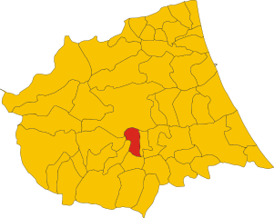
Basciano (Basciano)
- Italian comune
Basciano is a small town located in the Abruzzo region of Italy. While it may not be as widely known for hiking as some larger areas, it is surrounded by beautiful landscapes typical of the Abruzzo region, which is known for its natural parks, mountains, and outdoor activities.
When hiking in and around Basciano, you can expect to explore:
-
Scenic Trails: The area offers trails that cater to various skill levels. Whether you are a beginner or an experienced hiker, you can find suitable routes that showcase the natural beauty of the region.
-
Natural Parks: Nearby, you may have access to protected areas such as the Gran Sasso e Monti della Laga National Park. This park features rugged mountain terrain, diverse wildlife, and stunning panoramas, making it an ideal destination for hiking.
-
Cultural Experience: Hiking in this region can also provide opportunities to experience local culture, including rural villages, historical sites, and traditional cuisine. You might encounter charming stone villages and remnants of ancient architecture along the way.
-
Flora and Fauna: The region is home to diverse ecosystems, so hikers can enjoy spotting wildflowers, various plant species, and perhaps even some local wildlife, depending on the season.
-
Ideal Seasons: The best times for hiking in Basciano and the surrounding areas are typically in spring (April to June) and autumn (September to October). Summer can be quite warm, while winter brings snow to the higher elevations.
Before heading out, it’s always advisable to check local maps, trail conditions, and any regulations you need to follow, as well as to carry the necessary hiking gear, including water, snacks, and a first aid kit.
- Country:

- Postal Code: 64030
- Local Dialing Code: 0861
- Licence Plate Code: TE
- Coordinates: 42° 35' 47" N, 13° 44' 8" E


- GPS tracks (wikiloc): [Link]
- AboveSeaLevel: 388 м m
- Area: 18.85 sq km
- Population: 2373
- Web site: http://www.comune.basciano.te.it/
- Wikipedia en: wiki(en)
- Wikipedia: wiki(it)
- Wikidata storage: Wikidata: Q51421
- Wikipedia Commons Gallery: [Link]
- Wikipedia Commons Category: [Link]
- Freebase ID: [/m/0fs3t_]
- GeoNames ID: Alt: [6540714]
- OSM relation ID: [42084]
- UN/LOCODE: [ITBSB]
- ISTAT ID: 067005
- Italian cadastre code: A692
Shares border with regions:


Teramo
- Italian comune
Teramo, located in the Abruzzo region of Italy, is an excellent destination for hiking enthusiasts. The area is characterized by its diverse landscapes, which include rugged mountains, rolling hills, and beautiful coastlines. Here are some highlights and considerations for hiking in and around Teramo:...
- Country:

- Postal Code: 64100
- Local Dialing Code: 0861
- Licence Plate Code: TE
- Coordinates: 42° 39' 32" N, 13° 42' 14" E


- GPS tracks (wikiloc): [Link]
- AboveSeaLevel: 265 м m
- Area: 153 sq km
- Population: 54857
- Web site: [Link]


Castel Castagna
- Italian comune
Castel Castagna is a picturesque village located in the Teramo province of the Abruzzo region in Italy. Known for its stunning landscapes and rich natural heritage, it offers a variety of hiking opportunities for outdoor enthusiasts....
- Country:

- Postal Code: 64030
- Local Dialing Code: 0861
- Licence Plate Code: TE
- Coordinates: 42° 33' 0" N, 13° 43' 0" E


- GPS tracks (wikiloc): [Link]
- AboveSeaLevel: 452 м m
- Area: 18.16 sq km
- Population: 490
- Web site: [Link]


Colledara
- Italian comune
Colledara is a picturesque town located in the Abruzzo region of Italy, known for its stunning landscapes and outdoor activities, particularly hiking. The area is characterized by rolling hills, beautiful valleys, and proximity to the Gran Sasso and Monti della Laga National Park, which makes it an excellent destination for hikers of all levels....
- Country:

- Postal Code: 64042
- Local Dialing Code: 0861
- Licence Plate Code: TE
- Coordinates: 42° 32' 0" N, 13° 41' 0" E


- GPS tracks (wikiloc): [Link]
- AboveSeaLevel: 430 м m
- Area: 18.01 sq km
- Population: 2151
- Web site: [Link]
Montorio al Vomano
- Italian comune
Montorio al Vomano is a charming town located in the Abruzzo region of Italy, surrounded by beautiful landscapes that make it an excellent destination for hiking enthusiasts. The area features a mix of mountainous terrain, lush forests, and scenic views, making it ideal for both casual hikers and more experienced trekkers....
- Country:

- Postal Code: 64046
- Local Dialing Code: 0861
- Licence Plate Code: TE
- Coordinates: 42° 35' 0" N, 13° 38' 0" E


- GPS tracks (wikiloc): [Link]
- AboveSeaLevel: 262 м m
- Area: 53.57 sq km
- Population: 8013
- Web site: [Link]
Penna Sant'Andrea
- Italian comune
Penna Sant'Andrea, located in the Abruzzo region of Italy, is a hidden gem for hiking enthusiasts. Nestled in the picturesque Apennine Mountains, this area offers stunning landscapes, rich biodiversity, and a range of hiking trails suitable for different skill levels....
- Country:

- Postal Code: 64039
- Local Dialing Code: 0861
- Licence Plate Code: TE
- Coordinates: 42° 36' 0" N, 13° 46' 0" E


- GPS tracks (wikiloc): [Link]
- AboveSeaLevel: 413 м m
- Area: 11.1 sq km
- Population: 1763
- Web site: [Link]

