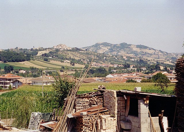
Colledara (Colledara)
.svg)
- Italian comune
 Hiking in Colledara
Colledara is a picturesque town located in the Abruzzo region of Italy, known for its stunning landscapes and outdoor activities, particularly hiking. The area is characterized by rolling hills, beautiful valleys, and proximity to the Gran Sasso and Monti della Laga National Park, which makes it an excellent destination for hikers of all levels.
Hiking Opportunities
-
Trails and Routes: There are several hiking trails in and around Colledara, ranging from easy walks to more challenging hikes. Many trails provide breathtaking views of the surrounding mountains and valleys. Popular routes might include paths that lead to scenic viewpoints, waterfalls, or through lush forests.
-
Gran Sasso and Monti della Laga National Park: This nearby national park features numerous trails that cater to different skill levels. Hiking in the park allows you to explore its diverse flora and fauna, rocky terrains, and high-altitude landscapes.
-
Scenic Views: The area offers stunning panoramas of the Apennine mountains and the beautiful landscapes of Abruzzo. Don’t forget to carry your camera to capture these views.
-
Historical Sites: Some hiking routes may lead you to historical sites, including old churches or ruins, adding a cultural aspect to your hiking experience.
Tips for Hiking in Colledara
- Gear Up: Wear suitable hiking boots and carry a backpack with essential gear such as water, snacks, a first aid kit, and weather-appropriate clothing.
- Navigation: Make sure to have a good map or GPS device, as some trails may not be well marked.
- Weather Considerations: The weather can change quickly in the mountains, so check forecasts and be prepared for varying conditions.
- Local Guidance: Consider joining a guided hike or seeking advice from local hiking clubs or tourist information centers to discover the best routes and tips tailored to your interests.
- Respect Nature: Follow Leave No Trace principles to preserve the natural beauty of the area.
When to Visit
The best time for hiking in Colledara is during the spring and fall when temperatures are moderate, and the scenery is vibrant with wildflowers and fall colors. Summer can be quite hot, particularly at lower elevations, while winter may bring snow and require different gear and skills.
Overall, hiking in Colledara provides an excellent opportunity to experience the natural beauty of Abruzzo while enjoying the outdoors in a less-traveled, serene environment.
- Country:

- Postal Code: 64042
- Local Dialing Code: 0861
- Licence Plate Code: TE
- Coordinates: 42° 32' 0" N, 13° 41' 0" E


- GPS tracks (wikiloc): [Link]
- AboveSeaLevel: 430 м m
- Area: 18.01 sq km
- Population: 2151
- Web site: http://www.cmgransasso.it/colledara/contatti.aspx
- Wikipedia en: wiki(en)
- Wikipedia: wiki(it)
- Wikidata storage: Wikidata: Q51442
- Wikipedia Commons Category: [Link]
- Freebase ID: [/m/0fs40z]
- GeoNames ID: Alt: [6537457]
- VIAF ID: Alt: [139267600]
- OSM relation ID: [42074]
- DMOZ ID: Alt: [Regional/Europe/Italy/Abruzzo/Localities/Colledara/]
- ISTAT ID: 067018
- Italian cadastre code: C311
Shares border with regions:
Basciano
- Italian comune
Hiking in Basciano
Basciano is a small town located in the Abruzzo region of Italy. While it may not be as widely known for hiking as some larger areas, it is surrounded by beautiful landscapes typical of the Abruzzo region, which is known for its natural parks, mountains, and outdoor activities....
- Country:
- Postal Code: 64030
- Local Dialing Code: 0861
- Licence Plate Code: TE
- Coordinates: 42° 35' 47" N, 13° 44' 8" E
- GPS tracks (wikiloc): [Link]
- AboveSeaLevel: 388 м m
- Area: 18.85 sq km
- Population: 2373
- Web site: [Link]

Castel Castagna
- Italian comune
Hiking in Castel Castagna
Castel Castagna is a picturesque village located in the Teramo province of the Abruzzo region in Italy. Known for its stunning landscapes and rich natural heritage, it offers a variety of hiking opportunities for outdoor enthusiasts....
- Country:
- Postal Code: 64030
- Local Dialing Code: 0861
- Licence Plate Code: TE
- Coordinates: 42° 33' 0" N, 13° 43' 0" E
- GPS tracks (wikiloc): [Link]
- AboveSeaLevel: 452 м m
- Area: 18.16 sq km
- Population: 490
- Web site: [Link]

Isola del Gran Sasso d'Italia
- Italian comune
Hiking in Isola del Gran Sasso d'Italia
Isola del Gran Sasso d'Italia is a beautiful area in the Abruzzo region of Italy, known for its stunning mountainous landscapes, rich biodiversity, and a variety of hiking trails suitable for different skill levels. It’s part of the Gran Sasso e Monti della Laga National Park, the largest protected area in the Apennines....
- Country:
- Postal Code: 64045
- Local Dialing Code: 0861
- Licence Plate Code: TE
- Coordinates: 42° 30' 27" N, 13° 39' 28" E
- GPS tracks (wikiloc): [Link]
- AboveSeaLevel: 498 м m
- Area: 84.05 sq km
- Population: 4684
- Web site: [Link]
Montorio al Vomano
- Italian comune
Hiking in Montorio al Vomano
Montorio al Vomano is a charming town located in the Abruzzo region of Italy, surrounded by beautiful landscapes that make it an excellent destination for hiking enthusiasts. The area features a mix of mountainous terrain, lush forests, and scenic views, making it ideal for both casual hikers and more experienced trekkers....
- Country:
- Postal Code: 64046
- Local Dialing Code: 0861
- Licence Plate Code: TE
- Coordinates: 42° 35' 0" N, 13° 38' 0" E
- GPS tracks (wikiloc): [Link]
- AboveSeaLevel: 262 м m
- Area: 53.57 sq km
- Population: 8013
- Web site: [Link]
Tossicia
- Italian comune
Hiking in Tossicia
Tossicia is a charming town located in the Abruzzo region of Italy, surrounded by stunning landscapes and natural beauty, making it an appealing destination for hiking enthusiasts. The area features a variety of hiking trails suitable for different skill levels, allowing you to explore the picturesque mountains, forests, and valleys....
- Country:
- Postal Code: 64049
- Local Dialing Code: 0861
- Licence Plate Code: TE
- Coordinates: 42° 33' 0" N, 13° 39' 0" E
- GPS tracks (wikiloc): [Link]
- AboveSeaLevel: 409 м m
- Area: 27.14 sq km
- Population: 1333
- Web site: [Link]