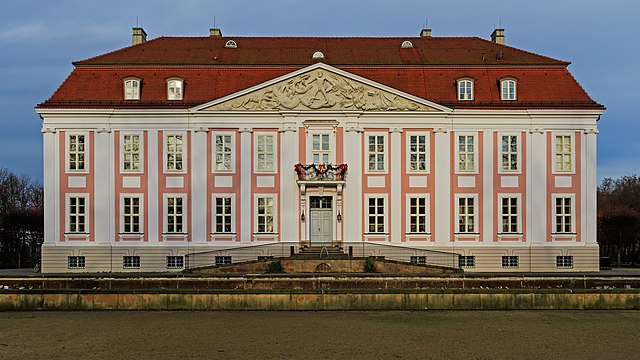
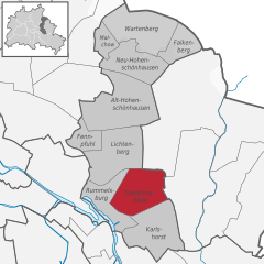
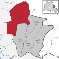
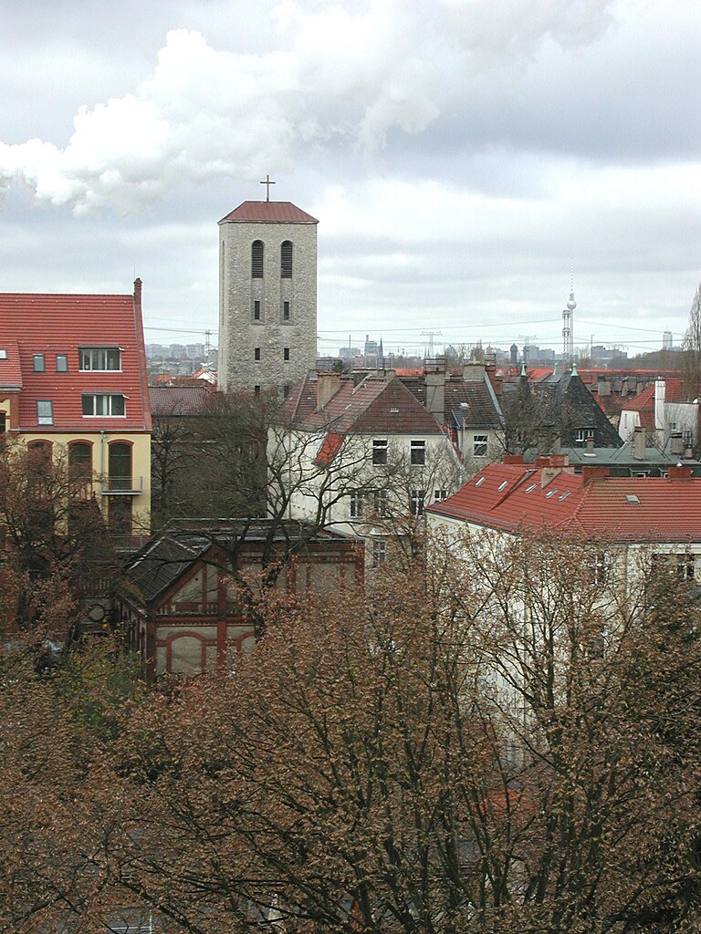
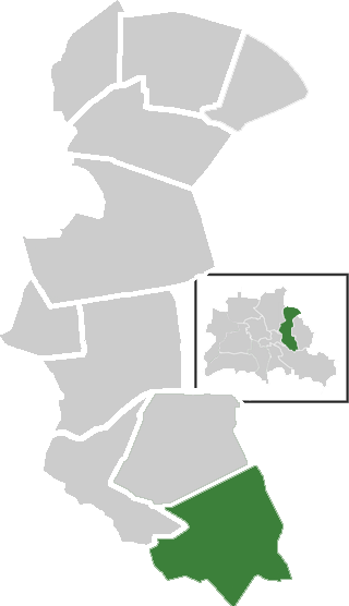
Biesdorf (Biesdorf)

- locality of Berlin
 Hiking in Biesdorf
Biesdorf is a district located in the eastern part of Berlin, Germany. While it is primarily an urban area, there are still outdoor opportunities for walking and enjoying nature. Here are some highlights for hiking or walking in and around Biesdorf:
-
Biesdorf Park (Biesdorfer Park): This is a central green space in the area, featuring a beautiful landscape with meadows, water features, and walking paths. It can be a great place for leisurely hikes or walks, enjoying the peaceful environment.
-
Rudower Teich: Located near Biesdorf, this pond area is surrounded by walking paths and is excellent for a nature-focused hike. You can often spot various birds and local wildlife.
-
Walking Trails: While Biesdorf itself isn't known for extensive hiking trails, you can connect to larger walking routes in surrounding districts, such as Mahlsdorf and Köpenick. These areas have more green spaces and trails leading through forests and along rivers.
-
Nearby Natural Spaces: Consider exploring nearby parks and forests, such as the Wuhlheide or the Müggelsee area, which offer more traditional hiking experiences with longer trails and diverse landscapes.
-
Urban Hiking: If you're interested in an urban hike, Biesdorf provides access to city pathways that link to broader Berlin attractions. You can enjoy the architecture and city vibe while walking.
When planning your hike, always check local maps and guides for the best trails and any updates on park access or features. Always wear comfortable shoes and bring water, especially if you're planning to explore for a while!
- Country:

- Postal Code: 12683
- Coordinates: 52° 30' 33" N, 13° 33' 19" E


- GPS tracks (wikiloc): [Link]
- AboveSeaLevel: 44 м m
- Area: 12.44 sq km
- Population: 25622
- Wikipedia en: wiki(en)
- Wikipedia: wiki(de)
- Wikidata storage: Wikidata: Q666141
- Wikipedia Commons Gallery: [Link]
- Wikipedia Commons Category: [Link]
- Wikipedia Commons Maps Category: [Link]
- Freebase ID: [/m/0bwj0l3]
- GeoNames ID: Alt: [2949073]
- VIAF ID: Alt: [246275405]
- OSM relation ID: [409208]
- GND ID: Alt: [4492426-4]
- archINFORM location ID: [43345]
Shares border with regions:


Köpenick
- locality of Berlin
Hiking in Köpenick
Köpenick is a district in the southeast of Berlin, Germany, and is known for its beautiful natural landscapes, historic architecture, and proximity to water. While Köpenick itself is more urban than rural, there are several opportunities for hiking and outdoor activities in and around the area. Here are some highlights for hiking in Köpenick:...
- Country:
- Postal Code: 12587; 12559; 12557; 12555; 12459
- Coordinates: 52° 26' 45" N, 13° 34' 38" E
- GPS tracks (wikiloc): [Link]
- AboveSeaLevel: 32 м m
- Area: 34.9 sq km
- Population: 62569
Friedrichsfelde
- locality of Berlin
Hiking in Friedrichsfelde
Friedrichsfelde is a district located in the eastern part of Berlin, Germany. It is known for its parkland and green spaces, making it a lovely area for hiking and outdoor activities. If you’re looking to hike in Friedrichsfelde, here are some details you might find useful:...
- Country:
- Coordinates: 52° 30' 21" N, 13° 31' 9" E
- GPS tracks (wikiloc): [Link]
- AboveSeaLevel: 39 м m
- Area: 5.55 sq km
- Population: 52502


Kaulsdorf
- locality of Berlin
Hiking in Kaulsdorf
Kaulsdorf is a district in the borough of Marzahn-Hellersdorf in Berlin, and while it may not be as well-known for hiking as some of the natural parks outside the city, there are still opportunities to explore the outdoors in and around the area. Here are some points to consider if you’re looking to hike in or near Kaulsdorf:...
- Country:
- Postal Code: 12619; 12621
- Coordinates: 52° 30' 29" N, 13° 34' 51" E
- GPS tracks (wikiloc): [Link]
- AboveSeaLevel: 55 м m
- Area: 8.81 sq km
- Population: 18656

Marzahn
- locality of Berlin
Hiking in Marzahn
Marzahn, a district located in the northeastern part of Berlin, Germany, is not typically known as a hiking destination in the traditional sense, as it is more urbanized compared to other areas. However, there are still opportunities for walking and exploring nature in and around this district....
- Country:
- Postal Code: 12689; 12687; 12685; 12681; 12679
- Coordinates: 52° 32' 45" N, 13° 33' 45" E
- GPS tracks (wikiloc): [Link]
- AboveSeaLevel: 62 м m
- Area: 19.54 sq km
- Population: 106640
Karlshorst
- locality of Berlin
Hiking in Karlshorst
Karlshorst, a district in Berlin, Germany, is not typically known as a traditional hiking destination, as it is more urbanized compared to rural nature areas. However, there are opportunities for walking and enjoying the outdoors in and around the area. Here are some details and suggestions for a hiking-like experience in Karlshorst:...
- Country:
- Coordinates: 52° 28' 57" N, 13° 31' 33" E
- GPS tracks (wikiloc): [Link]
- AboveSeaLevel: 36 м m
- Area: 6.6 sq km


Hellersdorf
- locality of Berlin
Hiking in Hellersdorf
Hellersdorf, a district in the eastern part of Berlin, Germany, is not traditionally known for hiking in the way that more rural or mountainous areas are. However, it offers some pleasant routes for walking and exploring nature....
- Country:
- Postal Code: 12683; 12629; 12627; 12619
- Coordinates: 52° 32' 15" N, 13° 36' 15" E
- GPS tracks (wikiloc): [Link]
- AboveSeaLevel: 60 м m
- Area: 8.1 sq km
- Population: 78683