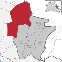
Friedrichsfelde (Friedrichsfelde)

- locality of Berlin
 Hiking in Friedrichsfelde
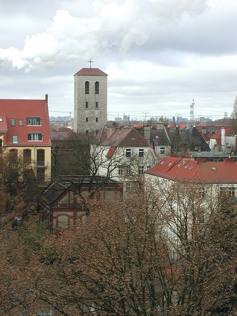
Friedrichsfelde is a district located in the eastern part of Berlin, Germany. It is known for its parkland and green spaces, making it a lovely area for hiking and outdoor activities. If you’re looking to hike in Friedrichsfelde, here are some details you might find useful:
Attractions
-
Tierpark Berlin: One of the largest animal parks in Europe, Tierpark Berlin is located in Friedrichsfelde. While it’s primarily a zoo, the surrounding park areas offer lovely walking paths and picnic spots. You can enjoy leisurely walks that let you experience the local flora, fauna, and beautiful historical architecture.
-
Friedrichsfelde Palace: The historical palace and its surrounding gardens can provide a scenic backdrop to your hikes. The palace park has trails and allows for relaxed exploration.
-
Public Parks: There are several small parks and green spaces within Friedrichsfelde, such as the Volkspark Friedrichshain. Although it’s a bit further outside of Friedrichsfelde, it’s worth visiting for a variety of trails and recreational opportunities.
Hiking Trails
-
Local Trails: The area has various walking paths and trails that weave through parks and residential neighborhoods. While these may not be challenging trails, they provide an excellent setting for easy hikes, nature walks, or casual strolls.
-
Connecting Areas: Friedrichsfelde is well-connected to larger parks and nature reserves in Berlin. You can venture a bit further to connect with trails leading to the nearby Müggelberge or the Spreewald region for more adventurous hiking experiences.
Tips for Hiking in Friedrichsfelde
-
Best Time to Visit: Spring and fall are ideal times for hiking, as the weather is pleasant, and you can enjoy beautiful seasonal colors.
-
Stay Hydrated: Bring water, especially if you plan to hike for an extended period or during warmer months.
-
Wear Comfortable Footwear: Good hiking shoes can enhance your experience significantly, especially if you plan on exploring less developed paths.
-
Public Transport: Friedrichsfelde is accessible via public transport, making it easy to reach various starting points for your hikes.
-
Safety: As with all hiking, it’s a good idea to inform someone of your plans and expected return time, especially if venturing into less populated areas.
Overall, hiking in Friedrichsfelde can be a delightful way to explore the natural beauty and historical elements of the area while enjoying the outdoors. Let me know if you need more specific information or assistance with planning your hike!
- Country:

- Coordinates: 52° 30' 21" N, 13° 31' 9" E


- GPS tracks (wikiloc): [Link]
- AboveSeaLevel: 39 м m
- Area: 5.55 sq km
- Population: 52502
- Wikipedia en: wiki(en)
- Wikipedia: wiki(de)
- Wikidata storage: Wikidata: Q563588
- Wikipedia Commons Gallery: [Link]
- Wikipedia Commons Category: [Link]
- Wikipedia Commons Maps Category: [Link]
- Freebase ID: [/m/0bwmjhp]
- GeoNames ID: Alt: [2924599]
- VIAF ID: Alt: [148216986]
- OSM relation ID: [412167]
- GND ID: Alt: [4393353-1]
- archINFORM location ID: [43232]
- Library of Congress authority ID: Alt: [nr2002033795]
Shares border with regions:


Rummelsburg
- locality of Berlin
Hiking in Rummelsburg
Rummelsburg is a neighborhood in Berlin, Germany, known more for its urban environment than traditional hiking trails. However, if you're looking for hiking-like experiences in and around Rummelsburg, there are a few options worth considering:...
- Country:
- Coordinates: 52° 30' 0" N, 13° 29' 33" E
- GPS tracks (wikiloc): [Link]
- AboveSeaLevel: 40 м m
- Area: 4.52 sq km


Biesdorf
- locality of Berlin
Hiking in Biesdorf
Biesdorf is a district located in the eastern part of Berlin, Germany. While it is primarily an urban area, there are still outdoor opportunities for walking and enjoying nature. Here are some highlights for hiking or walking in and around Biesdorf:...
- Country:
- Postal Code: 12683
- Coordinates: 52° 30' 33" N, 13° 33' 19" E
- GPS tracks (wikiloc): [Link]
- AboveSeaLevel: 44 м m
- Area: 12.44 sq km
- Population: 25622

Marzahn
- locality of Berlin
Hiking in Marzahn
Marzahn, a district located in the northeastern part of Berlin, Germany, is not typically known as a hiking destination in the traditional sense, as it is more urbanized compared to other areas. However, there are still opportunities for walking and exploring nature in and around this district....
- Country:
- Postal Code: 12689; 12687; 12685; 12681; 12679
- Coordinates: 52° 32' 45" N, 13° 33' 45" E
- GPS tracks (wikiloc): [Link]
- AboveSeaLevel: 62 м m
- Area: 19.54 sq km
- Population: 106640
Karlshorst
- locality of Berlin
Hiking in Karlshorst
Karlshorst, a district in Berlin, Germany, is not typically known as a traditional hiking destination, as it is more urbanized compared to rural nature areas. However, there are opportunities for walking and enjoying the outdoors in and around the area. Here are some details and suggestions for a hiking-like experience in Karlshorst:...
- Country:
- Coordinates: 52° 28' 57" N, 13° 31' 33" E
- GPS tracks (wikiloc): [Link]
- AboveSeaLevel: 36 м m
- Area: 6.6 sq km


Lichtenberg
- locality of borough Lichtenberg of Berlin, Germany
Hiking in Lichtenberg
Lichtenberg is a picturesque locality located in the region of Brandenburg, Germany. It is situated near the capital city, Berlin, making it a popular destination for day-trippers and hikers looking to escape the urban environment....
- Country:
- Coordinates: 52° 31' 16" N, 13° 28' 48" E
- GPS tracks (wikiloc): [Link]
- AboveSeaLevel: 52 м m
- Area: 7.22 sq km
- Population: 39121