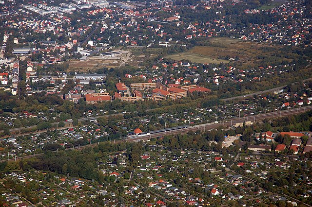
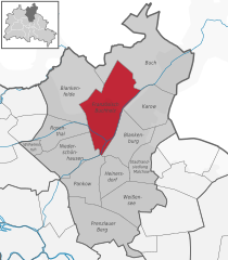
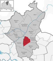
Blankenburg (Blankenburg)
- locality of Berlin
 Hiking in Blankenburg
Blankenburg, a district in the northeastern part of Berlin, is not typically known for traditional hiking trails like those found in more mountainous or rural areas. However, it still offers opportunities for outdoor exploration and walking in a more urban and suburban environment. Here are some highlights and suggestions for enjoying the area:
-
Parks and Green Spaces: Blankenburg has several parks and green areas that are ideal for leisurely walks. The Blankenburger Grünzug is a green corridor that connects various parks and natural spaces within the district.
-
Nearby Hiking Areas: While Blankenburg itself is somewhat limited in hiking opportunities, you can venture to nearby areas such as the Tegeler Forest or Schönhausen Palace Gardens. Both locations offer more extensive walking trails and a more natural setting.
-
Lake Wandering: The nearby Lake Tegel and its surrounding areas provide excellent walking opportunities, with scenic views and pathways around the water. This area is great for a relaxing day hike and can be combined with picnicking or other recreational activities.
-
Exploration of Historical Trails: Consider exploring the historical trails in and around Blankenburg which may lead you through interesting neighborhoods and along significant historical sites.
-
Public Transport Access: Blankenburg is well connected by public transport, making it easy to access other walking and hiking areas within Berlin and beyond. Consider taking a short trip to other districts that have designated hiking trails.
-
Local Culture: Combine your outdoor activities with visits to local cafés, shops, and cultural sites within Blankenburg to create a well-rounded day.
Before heading out, it's always good to check local maps or use hiking apps to find the most suitable routes and parks, especially since hiking options in urban areas may differ greatly from those in rural or mountainous locations. Enjoy your exploration!
- Country:

- Coordinates: 52° 35' 35" N, 13° 27' 15" E


- GPS tracks (wikiloc): [Link]
- AboveSeaLevel: 47 м m
- Area: 6.03 sq km
- Population: 6536
- Wikipedia en: wiki(en)
- Wikipedia: wiki(de)
- Wikidata storage: Wikidata: Q693582
- Wikipedia Commons Gallery: [Link]
- Wikipedia Commons Category: [Link]
- Wikipedia Commons Maps Category: [Link]
- Freebase ID: [/m/0bwg39p]
- GeoNames ID: Alt: [2948069]
- archINFORM location ID: [43339]
Shares border with regions:


Pankow
- locality of the borough Pankow of Berlin
Hiking in Pankow
Pankow is a district in northeastern Berlin, Germany, known for its charming neighborhoods, parks, and green areas. While it is more urban compared to rural hiking destinations, there are still opportunities for enjoyable walks and hikes within and around the area....
- Country:
- Coordinates: 52° 34' 0" N, 13° 24' 0" E
- GPS tracks (wikiloc): [Link]
- AboveSeaLevel: 47 м m
- Area: 5.66 sq km
- Population: 57113


Stadtrandsiedlung Malchow
- locality of Berlin
Hiking in Stadtrandsiedlung Malchow
Stadtrandsiedlung Malchow is a charming area located in the outskirts of Berlin, characterized by its natural beauty and access to various outdoor activities, including hiking. Here’s a breakdown of what you can expect when hiking in this area:...
- Country:
- Coordinates: 52° 34' 20" N, 13° 28' 0" E
- GPS tracks (wikiloc): [Link]
- AboveSeaLevel: 47 м m
- Area: 5.68 sq km
Französisch Buchholz
- locality of Berlin
Hiking in Französisch Buchholz
Französisch Buchholz is a charming district located in the northern part of Berlin, Germany. While it may not be a traditional hiking destination like some of Germany's national parks, there are still several beautiful spots and trails in and around this area that offer pleasant walking and hiking experiences....
- Country:
- Coordinates: 52° 36' 0" N, 13° 26' 0" E
- GPS tracks (wikiloc): [Link]
- AboveSeaLevel: 46 м m
- Area: 12 sq km

Heinersdorf
- locality of Berlin
Hiking in Heinersdorf
Heinersdorf, a charming district on the outskirts of Berlin, offers a unique opportunity for hiking enthusiasts to explore a blend of natural landscapes and quaint, urban settings. While Heinersdorf itself may not have extensive hiking trails like those found in more rugged areas, it serves as an excellent base for accessing nearby natural areas....
- Country:
- Coordinates: 52° 34' 1" N, 13° 26' 24" E
- GPS tracks (wikiloc): [Link]
- AboveSeaLevel: 50 м m
- Area: 3.95 sq km

Karow
- locality of Berlin
Hiking in Karow
Karow, located in the northeastern part of Berlin, is primarily a residential district, but it offers some opportunities for nature walks and light hiking. While it may not be a primary destination for serious hikers, there are several parks and green spaces nearby that can make for pleasant outdoor activities....
- Country:
- Coordinates: 52° 36' 45" N, 13° 29' 0" E
- GPS tracks (wikiloc): [Link]
- AboveSeaLevel: 55 м m
- Area: 6.65 sq km