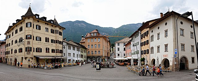
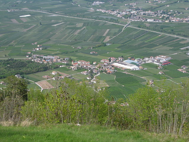
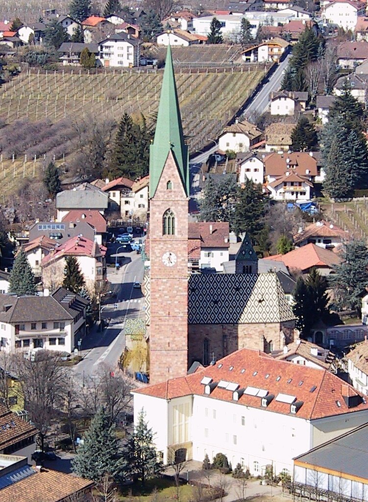
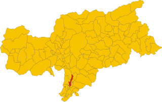
Eppan an der Weinstraße (Appiano sulla Strada del Vino)
- Italian comune
 Hiking in Eppan an der Weinstraße
Eppan an der Weinstraße, located in the South Tyrol region of northern Italy, is a beautiful destination for hiking enthusiasts. Nestled amidst vineyards and rolling hills, this area offers a variety of trails suitable for all levels of hikers, from easy walks to more challenging treks. Here are some highlights of hiking in Eppan:
Hiking Trails
-
The Wine Trail (Weinweg): This scenic trail winds through vineyards and offers stunning views of the surrounding landscape, including the nearby mountains. It’s a relatively easy hike, making it perfect for families and those looking to enjoy a leisurely stroll.
-
The Mendel Pass (Mendelpass): For more experienced hikers, the Mendel Pass provides access to a range of trails with varying difficulty. The hike to the Mendel mountain itself rewards you with panoramic views of the Adige Valley and the Dolomites.
-
The Kaltern Lake (Kalternsee): A short hike from Eppan leads to Kaltern Lake, a popular spot for swimming and picnicking. The area around the lake is tranquil and beautiful, making it an excellent choice for a shorter hike or a leisurely day out.
-
The Hike to the Rastenbachklamm (Rastenbach Gorge): This trail takes you through a fascinating gorge with impressive rock formations and natural beauty. The hike is moderate in difficulty and ideal for adventurers looking to immerse themselves in nature.
Scenic Views
Eppan is known for its beautiful landscapes, which include vineyards, orchards, and striking mountain backdrops. Many trails offer spectacular views, especially during the autumn when the vineyards turn vibrant shades of red and yellow.
Cultural Sites
While hiking, you can also explore the region's cultural sites, such as the numerous castles (like Schloss Campan) and charming villages that dot the landscape. The area is rich in history and provides a glimpse into the local traditions.
Best Time to Hike
The best times for hiking in Eppan are late spring through early autumn (May to October), when the weather is typically mild. Summer months can be warm, so it’s essential to carry plenty of water and sun protection.
Tips for Hiking in Eppan
- Footwear: Wear sturdy hiking shoes, as some trails can be rocky or uneven.
- Preparation: Always check the weather forecast before heading out, and inform someone of your plans.
- Navigation: Consider downloading hiking maps or using a GPS device, as some trails may not be well marked.
Overall, hiking in Eppan offers a fantastic blend of natural beauty, culture, and opportunity for outdoor adventure. Whether you're a seasoned hiker or just starting, there's something for everyone in this picturesque region.
- Country:

- Postal Code: 39050; 39057
- Local Dialing Code: 0471
- Licence Plate Code: BZ
- Coordinates: 46° 27' 0" N, 11° 16' 0" E


- GPS tracks (wikiloc): [Link]
- AboveSeaLevel: 239 м m
- Area: 59.45 sq km
- Population: 14941
- Web site: http://www.comune.appiano.bz.it
- Wikipedia en: wiki(en)
- Wikipedia: wiki(it)
- Wikidata storage: Wikidata: Q252343
- Wikipedia Commons Gallery: [Link]
- Wikipedia Commons Category: [Link]
- Freebase ID: [/m/0g9fh4]
- GeoNames ID: Alt: [6535987]
- OSM relation ID: [47203]
- GND ID: Alt: [4015069-0]
- archINFORM location ID: [12846]
- Library of Congress authority ID: Alt: [n2001008141]
- MusicBrainz area ID: [19b855fc-454c-4ccb-b933-4f927fb26479]
- UN/LOCODE: [ITIAP]
- Digital Atlas of the Roman Empire ID: [16597]
- NKCR AUT ID: [ge975183]
- ISTAT ID: 021004
- Italian cadastre code: A332
Shares border with regions:
Cavareno
- Italian comune
Cavareno, a small town located in the Trentino region of northern Italy, is surrounded by the stunning natural landscapes of the Dolomites. This area is known for its beautiful hiking trails that cater to various skill levels, making it an excellent destination for outdoor enthusiasts....
- Country:

- Postal Code: 38011
- Local Dialing Code: 0463
- Licence Plate Code: TN
- Coordinates: 46° 25' 0" N, 11° 8' 0" E


- GPS tracks (wikiloc): [Link]
- AboveSeaLevel: 973 м m
- Area: 9.48 sq km
- Population: 1074
- Web site: [Link]


Kaltern an der Weinstraße
- Italian comune
 Hiking in Kaltern an der Weinstraße
Kaltern an der Weinstraße, located in South Tyrol, Italy, is a picturesque village nestled amid vineyards and rolling hills. It’s an excellent destination for hiking enthusiasts, offering a range of trails suitable for different skill levels, along with stunning views of the surrounding landscape, including Lake Kaltern and the impressive Dolomites....
- Country:

- Postal Code: 39052
- Local Dialing Code: 0471
- Licence Plate Code: BZ
- Coordinates: 46° 24' 48" N, 11° 14' 46" E


- GPS tracks (wikiloc): [Link]
- AboveSeaLevel: 425 м m
- Area: 48.04 sq km
- Population: 8046
- Web site: [Link]

Fondo
- Italian comune
Fondo is a picturesque village located in the heart of the Val di Non region in northern Italy. It’s surrounded by stunning landscapes, including mountains, forests, and charming meadows, making it an excellent destination for hiking enthusiasts. Here's what you should know about hiking in Fondo:...
- Country:

- Postal Code: 38013
- Local Dialing Code: 0463
- Licence Plate Code: TN
- Coordinates: 46° 26' 20" N, 11° 8' 14" E


- GPS tracks (wikiloc): [Link]
- AboveSeaLevel: 982 м m
- Area: 30.63 sq km
- Population: 1419
- Web site: [Link]

Malosco
- Italian comune
Malosco is a charming village located in the Trentino-Alto Adige/Südtirol region of northern Italy. It's situated in the Val di Non, an area characterized by its beautiful landscapes, apple orchards, and proximity to the stunning mountains of the Dolomites....
- Country:

- Postal Code: 38013
- Local Dialing Code: 0463
- Licence Plate Code: TN
- Coordinates: 46° 26' 0" N, 11° 9' 0" E


- GPS tracks (wikiloc): [Link]
- AboveSeaLevel: 1041 м m
- Area: 6.73 sq km
- Population: 433
- Web site: [Link]


Ronzone
- Italian comune
Ronzone is a picturesque village located in the Trentino region of northern Italy, known for its stunning landscapes and excellent hiking opportunities. Nestled in the Val di Non, Ronzone offers a range of trails that cater to hikers of all skill levels, from leisurely strolls to challenging alpine routes....
- Country:

- Postal Code: 38010
- Local Dialing Code: 0463
- Licence Plate Code: TN
- Coordinates: 46° 25' 0" N, 11° 9' 0" E


- GPS tracks (wikiloc): [Link]
- AboveSeaLevel: 1085 м m
- Area: 5.3 sq km
- Population: 436
- Web site: [Link]


Sarnonico
- Italian comune
Sarnonico, located in the Trentino-Alto Adige region of northern Italy, offers stunning landscapes and a variety of hiking opportunities. It's a charming village nestled in the Non Valley, surrounded by the picturesque mountains of the Brenta Dolomites and the Maddalene Range....
- Country:

- Postal Code: 38010
- Local Dialing Code: 0463
- Licence Plate Code: TN
- Coordinates: 46° 25' 0" N, 11° 9' 0" E


- GPS tracks (wikiloc): [Link]
- AboveSeaLevel: 980 м m
- Area: 12.19 sq km
- Population: 778
- Web site: [Link]


Andrian
- Italian comune
Hiking in Andrian, a charming village in South Tyrol, Italy, offers a unique blend of stunning landscapes, rich culture, and a variety of trails suitable for different skill levels. Located near Merano, Andrian is surrounded by beautiful vineyards, orchards, and the backdrop of the majestic Alps, making it an ideal destination for outdoor enthusiasts....
- Country:

- Postal Code: 39010
- Local Dialing Code: 0471
- Licence Plate Code: BZ
- Coordinates: 46° 31' 3" N, 11° 13' 53" E


- GPS tracks (wikiloc): [Link]
- AboveSeaLevel: 285 м m
- Area: 4.89 sq km
- Population: 1024
- Web site: [Link]


Nals
- Italian comune
Nals, located in South Tyrol, Italy, is a great destination for hiking enthusiasts. Nestled in the picturesque Adige Valley near Bolzano, Nals offers a mix of scenic trails, stunning alpine views, and the unique charm of vineyards and orchards....
- Country:

- Postal Code: 39010
- Local Dialing Code: 0471
- Licence Plate Code: BZ
- Coordinates: 46° 32' 36" N, 11° 12' 22" E


- GPS tracks (wikiloc): [Link]
- AboveSeaLevel: 321 м m
- Area: 12.24 sq km
- Population: 1975
- Web site: [Link]


Unsere Liebe Frau im Walde-St. Felix
- Italian comune
 Hiking in Unsere Liebe Frau im Walde-St. Felix
Unsere Liebe Frau im Walde-St. Felix is a picturesque village located in the South Tyrol region of Italy, surrounded by stunning natural scenery, making it a fantastic destination for hiking enthusiasts. The area is characterized by its beautiful landscapes, including rolling hills, dense forests, and majestic mountains, providing a diverse range of hiking opportunities for all skill levels....
- Country:

- Postal Code: 39010
- Local Dialing Code: 0463
- Licence Plate Code: BZ
- Coordinates: 46° 29' 39" N, 11° 7' 49" E


- GPS tracks (wikiloc): [Link]
- AboveSeaLevel: 1315 м m
- Area: 27.63 sq km
- Population: 769
- Web site: [Link]


Terlan
- Italian comune
Terlan, located in South Tyrol, Italy, is a beautiful destination for hiking enthusiasts. Nestled at the foothills of the Alps and surrounded by vineyards and rolling hills, Terlan offers a variety of trails suitable for all levels, from leisurely walks to challenging mountain hikes....
- Country:

- Postal Code: 39018
- Local Dialing Code: 0471
- Licence Plate Code: BZ
- Coordinates: 46° 31' 56" N, 11° 14' 49" E


- GPS tracks (wikiloc): [Link]
- AboveSeaLevel: 250 м m
- Area: 18.57 sq km
- Population: 4391
- Web site: [Link]


Vadena
- Italian comune
Vadena, located in the South Tyrol region of northern Italy, is a lesser-known but beautiful area that offers a variety of hiking opportunities. Here’s an overview of what to expect when hiking in this region:...
- Country:

- Postal Code: 39051
- Local Dialing Code: 0471
- Licence Plate Code: BZ
- Coordinates: 46° 25' 0" N, 11° 18' 0" E


- GPS tracks (wikiloc): [Link]
- AboveSeaLevel: 243 м m
- Area: 15.22 sq km
- Population: 1015
- Web site: [Link]


Bolzano
- Italian comune in South Tyrol
Bolzano, located in the northern part of Italy in the South Tyrol region, offers stunning hiking opportunities amidst the picturesque backdrop of the Dolomites and surrounding mountains. Here are some highlights and tips for hiking in Bolzano:...
- Country:

- Postal Code: 39100
- Local Dialing Code: 0471
- Licence Plate Code: BZ
- Coordinates: 46° 30' 0" N, 11° 21' 0" E


- GPS tracks (wikiloc): [Link]
- AboveSeaLevel: 232 м m
- Area: 52.29 sq km
- Population: 106951
- Web site: [Link]
