
Briançon (Briançon)
- commune in Hautes-Alpes, France
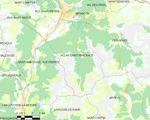
 Hiking in Briançon
Briançon, located in the French Alps, is renowned for its stunning natural beauty and rich history. It sits at an elevation of about 1,326 meters (4,347 feet) and is surrounded by impressive mountain ranges, making it an ideal destination for hiking enthusiasts.
Popular Hiking Trails:
-
La Casse du Boucharde: This moderate hike offers breathtaking views of the surrounding valleys and peaks. The trail is well-marked, and you can explore various paths leading to the top.
-
The Fortifications Trail: This route takes you past the historic forts of Briançon. It combines cultural heritage with outdoor activity, allowing hikers to immerse themselves in the area's history while enjoying beautiful landscapes.
-
The GR5 Trail: For more ambitious hikers, the GR5 is part of a long-distance route that traverses the French Alps. Sections of this trail around Briançon offer a mix of challenging terrains and spectacular views.
-
Col de l'Escudella: This hike offers a steep ascent with panoramic views at the summit. It’s a great way to experience the rugged beauty of the region.
-
Le Thabor: For those seeking a day hike, this route provides a moderate challenge and leads to a beautiful alpine lake, perfect for a quiet picnic.
Tips for Hiking in Briançon:
- Gear Up: Ensure you have appropriate hiking gear, including sturdy boots, weather-appropriate clothing, and enough water and snacks.
- Check the Weather: Conditions can change rapidly in the mountains, so always check the weather forecast before heading out.
- Stay on Marked Trails: To preserve the environment and your safety, stick to designated paths.
- Understand the Altitude: Be mindful of altitude sickness; acclimatization is important as you gain elevation.
- Local Guides: Consider hiring a local hiking guide who can provide valuable insights and ensure safety on more challenging hikes.
- Wildlife Awareness: The region is home to diverse wildlife; be respectful of their habitats and maintain a safe distance.
When to Hike:
The best time to hike around Briançon is generally from late spring (around May) to early autumn (September). Summer months can provide the best weather, but trails can also be busier during that time. Early in the hiking season, you might encounter snow on higher trails, while late summer hikes offer vibrant wildflowers.
Accessibility:
Briançon is well-connected by road and rail, making it accessible for hikers from various regions. It also boasts a range of accommodations, from hotels to more rustic mountain huts.
Whether you're a novice hiker or an experienced trekker, Briançon has trails that cater to all levels, offering an unforgettable hiking experience in one of France's most picturesque settings.
- Country:

- Postal Code: 05100
- Coordinates: 44° 53' 45" N, 6° 38' 6" E


- GPS tracks (wikiloc): [Link]
- AboveSeaLevel: 1325 м m
- Area: 28.07 sq km
- Population: 12370
- Web site: http://www.ville-briancon.fr
- Wikipedia en: wiki(en)
- Wikipedia: wiki(fr)
- Wikidata storage: Wikidata: Q203298
- Wikipedia Commons Gallery: [Link]
- Wikipedia Commons Category: [Link]
- Freebase ID: [/m/029d2z]
- Freebase ID: [/m/029d2z]
- GeoNames ID: Alt: [3030142]
- GeoNames ID: Alt: [3030142]
- SIREN number: [210500237]
- SIREN number: [210500237]
- BnF ID: [11938518v]
- BnF ID: [11938518v]
- VIAF ID: Alt: [233874917]
- VIAF ID: Alt: [233874917]
- GND ID: Alt: [4526841-1]
- GND ID: Alt: [4526841-1]
- Quora topic ID: [Briançon]
- Quora topic ID: [Briançon]
- Encyclopædia Britannica Online ID: [place/Briancon]
- Encyclopædia Britannica Online ID: [place/Briancon]
- Gran Enciclopèdia Catalana ID: [0012235]
- Gran Enciclopèdia Catalana ID: [0012235]
- INSEE municipality code: 05023
- INSEE municipality code: 05023
Shares border with regions:

Cervières
- commune in Hautes-Alpes, France
Hiking in Cervières
Cervières is a picturesque valley located in the Hautes-Alpes region of France, renowned for its stunning natural beauty, diverse landscapes, and rich cultural heritage. It offers a variety of hiking opportunities suited for all levels, from casual strolls to more challenging treks. Here are some highlights of hiking in this area:...
- Country:
- Postal Code: 05100
- Coordinates: 44° 52' 11" N, 6° 43' 19" E
- GPS tracks (wikiloc): [Link]
- Area: 109.68 sq km
- Population: 183

Val-des-Prés
- commune in Hautes-Alpes, France
Hiking in Val-des-Prés
Val-des-Prés is a picturesque commune located in the Alpes-de-Haute-Provence region of France, known for its stunning landscapes and outdoor recreational opportunities, particularly hiking. Here are some key points to consider if you're planning to hike in Val-des-Prés:...
- Country:
- Postal Code: 05100
- Coordinates: 44° 56' 54" N, 6° 40' 42" E
- GPS tracks (wikiloc): [Link]
- Area: 44.77 sq km
- Population: 656
- Web site: [Link]

Saint-Chaffrey
- commune in Hautes-Alpes, France
Hiking in Saint-Chaffrey
Saint-Chaffrey is a charming commune located in the Hautes-Alpes region of France, and it's part of the broader area known for its stunning alpine scenery and outdoor activities, particularly hiking. Here are some key points about hiking in and around Saint-Chaffrey:...
- Country:
- Postal Code: 05330
- Coordinates: 44° 55' 34" N, 6° 36' 24" E
- GPS tracks (wikiloc): [Link]
- Area: 25.88 sq km
- Population: 1643
- Web site: [Link]

Puy-Saint-André
- commune in Hautes-Alpes, France
Hiking in Puy-Saint-André
Puy-Saint-André is a charming village located in the Hautes-Alpes region of southeastern France, and it serves as a wonderful base for hiking enthusiasts. Nestled near the Écrins National Park, the area boasts stunning alpine scenery, diverse flora and fauna, and a range of trails suitable for various skill levels....
- Country:
- Postal Code: 05100
- Coordinates: 44° 52' 44" N, 6° 35' 55" E
- GPS tracks (wikiloc): [Link]
- Area: 15.37 sq km
- Population: 466

Puy-Saint-Pierre
- commune in Hautes-Alpes, France
Hiking in Puy-Saint-Pierre
Puy-Saint-Pierre is a charming commune located in the Hautes-Alpes region of southeastern France. It's surrounded by stunning landscapes and offers a range of hiking opportunities, perfect for both beginner and experienced hikers. Here are some highlights about hiking in Puy-Saint-Pierre:...
- Country:
- Postal Code: 05100
- Coordinates: 44° 53' 27" N, 6° 37' 26" E
- GPS tracks (wikiloc): [Link]
- Area: 7.74 sq km
- Population: 529

Villar-Saint-Pancrace
- commune in Hautes-Alpes, France
Hiking in Villar-Saint-Pancrace
Villar-Saint-Pancrace is a charming alpine village located in the Provence-Alpes-Côte d'Azur region of France, near the town of Briançon. The area is known for its stunning landscapes, rich biodiversity, and a variety of hiking trails that cater to different skill levels. Here are some highlights for hiking in this region:...
- Country:
- Postal Code: 05100
- Coordinates: 44° 52' 23" N, 6° 37' 38" E
- GPS tracks (wikiloc): [Link]
- AboveSeaLevel: 1260 м m
- Area: 42.53 sq km
- Population: 1457