
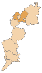
Burgenland (Burgenland)


- state of Austria
 Hiking in Burgenland
Burgenland, located in the eastern part of Austria, is a fantastic destination for hiking enthusiasts. This region is known for its diverse landscapes, including rolling hills, vineyards, and scenic views of Lake Neusiedl, which is Central Europe's largest steppe lake. Here are some key aspects of hiking in Burgenland:
1.
- Neusiedler See-Seewinkel National Park: This park features unique wetlands and is an excellent spot for bird-watching, especially for migratory birds. There are various trails that allow hikers to explore the diverse ecosystems.
- Burgenland Nature Park: Offering a mix of forests, vineyards, and picturesque views, this area is great for a variety of hiking routes.
2.
- The Burgenland Trail: This long-distance hiking path stretches approximately 150 kilometers and takes you through scenic villages, vineyards, and highlights of cultural significance.
- Wine Hiking Trails: Burgenland is famous for its wine, and many trails wind through vineyards. These paths often lead to wine taverns where hikers can stop for tastings.
3.
- Lakeside Trails: The paths around Lake Neusiedl are popular for both leisurely walks and more vigorous hikes. You can enjoy the stunning views of the lake, especially during sunrise or sunset.
- Water Sports: In addition to hiking, the lake area offers opportunities for cycling, bird-watching, and various water sports.
4.
- Exploring the small towns, castles, and historical sites along the hiking routes can add cultural enrichment to your hiking experience. Towns like Eisenstadt, the capital of Burgenland, have charming squares, cafes, and historical significance.
5.
- Spring and Fall: These seasons are ideal for hiking in Burgenland, with mild temperatures and vibrant landscapes. Spring brings blooming wildflowers, while fall showcases colorful foliage in the vineyards.
6.
- Make sure to wear sturdy hiking boots and carry sufficient water and snacks. Additionally, check the weather before heading out, as conditions can change quickly, especially around the lake.
- It's advisable to have a map or a GPS device as some trails may not be well-marked.
Hiking in Burgenland offers a unique combination of natural beauty, outdoor activities, and cultural exploration. Whether you are an experienced hiker or just looking for a scenic walk, Burgenland has plenty to offer.
- Country:

- Capital: Eisenstadt
- Coordinates: 47° 30' 0" N, 16° 25' 0" E


- GPS tracks (wikiloc): [Link]
- AboveSeaLevel: 333 м m
- Area: 3961.8 sq km
- Population: 291023
- Web site: http://www.bgld.gv.at/
- Wikipedia en: wiki(en)
- Wikipedia: wiki(de)
- Wikidata storage: Wikidata: Q43210
- Wikipedia Commons Gallery: [Link]
- Wikipedia Commons Category: [Link]
- Wikipedia Commons Maps Category: [Link]
- Freebase ID: [/m/0p99b]
- GeoNames ID: Alt: [2781194]
- BnF ID: [119340980]
- VIAF ID: Alt: [146572408]
- OSM relation ID: [76909]
- GND ID: Alt: [4009114-4]
- archINFORM location ID: [2713]
- MusicBrainz area ID: [8df1819e-ba9b-44a4-9550-3a099c691a4c]
- TGN ID: [7003023]
- Encyclopædia Britannica Online ID: [place/Burgenland]
- NKCR AUT ID: [ge134093]
- DMOZ ID: Alt: [Regional/Europe/Austria/Provinces/Burgenland/]
- NUTS code: [AT11]
- YSO ID: [158738]
- Klexikon article ID: [Burgenland]
- BabelNet ID: [03887237n]
- STW Thesaurus for Economics ID: [16943-1]
- ISO 3166-2 code: AT-1
- FIPS 10-4 (countries and regions): AU01
Includes regions:
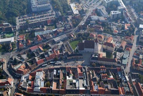
Eisenstadt
- town in Austria
Hiking in Eisenstadt
Eisenstadt, the capital of Burgenland in Austria, offers several hiking opportunities that showcase its beautiful natural landscapes, historical sites, and charming vineyards. Here are some highlights for hiking in and around Eisenstadt:...
- Country:
- Postal Code: 7000
- Local Dialing Code: 02682
- Licence Plate Code: E
- Coordinates: 47° 50' 44" N, 16° 31' 8" E
- GPS tracks (wikiloc): [Link]
- AboveSeaLevel: 182 м m
- Area: 42.84 sq km
- Population: 14476
- Web site: [Link]

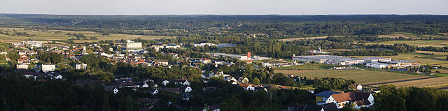
Rust
- city in Austria
Hiking in Rust
Rust, located in Burgenland, Austria, is a charming town known for its scenic landscapes and proximity to Lake Neusiedl. The area offers a variety of hiking opportunities that showcase the beauty of both the natural surroundings and the unique cultural heritage of the region....
- Country:
- Postal Code: 7071
- Local Dialing Code: 02685
- Licence Plate Code: E
- Coordinates: 47° 48' 3" N, 16° 40' 33" E
- GPS tracks (wikiloc): [Link]
- AboveSeaLevel: 123 м m
- Area: 20.01 sq km
- Population: 1921
- Web site: [Link]

Eisenstadt-Umgebung District
- district of Austria
Hiking in Eisenstadt-Umgebung District
Eisenstadt-Umgebung District, located in Austria, is a great destination for hiking enthusiasts. It offers a diverse landscape that includes rolling hills, vineyards, and stunning views of the adjacent Parndorfer Platte and the nearby Leithagebirge mountains....
- Country:
- Licence Plate Code: EU
- Coordinates: 47° 50' 17" N, 16° 32' 24" E
- GPS tracks (wikiloc): [Link]
- AboveSeaLevel: 137 м m
- Population: 42066


Oberwart District
- district of Austria
Hiking in Oberwart District
Oberwart District, located in the Burgenland region of Austria, offers a variety of hiking opportunities amid picturesque landscapes, rolling hills, and vineyards. Here are some key points to consider if you’re planning a hiking trip in this area:...
- Country:
- Licence Plate Code: OW
- Coordinates: 47° 17' 38" N, 16° 14' 35" E
- GPS tracks (wikiloc): [Link]
- AboveSeaLevel: 314 м m
- Population: 53955


Güssing District
- district of Austria
Hiking in Güssing District
Hiking in the Güssing District of Austria offers a variety of scenic trails and beautiful landscapes, ideal for outdoor enthusiasts. Located in the southeastern part of Burgenland, near the Hungarian border, Güssing is known for its rolling hills, vineyards, and historical sites....
- Country:
- Licence Plate Code: GS
- Coordinates: 47° 7' 5" N, 16° 15' 40" E
- GPS tracks (wikiloc): [Link]
- AboveSeaLevel: 240 м m
- Population: 26266


Neusiedl am See District
- district in Austria
Hiking in Neusiedl am See District
Neusiedl am See District, located in the Burgenland region of Austria, is known for its stunning landscapes, diverse habitats, and a unique blend of cultural influences. The area is primarily characterized by the Neusiedler See, a large steppe lake, which is surrounded by rolling hills, vineyards, and expansive grasslands. Here are some highlights for hiking in this region:...
- Country:
- Licence Plate Code: ND
- Coordinates: 47° 55' 41" N, 16° 56' 2" E
- GPS tracks (wikiloc): [Link]
- AboveSeaLevel: 121 м m
- Population: 58007


Mattersburg District
- district of Austria
Hiking in Mattersburg District
Mattersburg District, located in the eastern part of Austria, is known for its diverse landscapes, charming villages, and picturesque countryside, making it a great destination for hiking enthusiasts. Here are some highlights and tips for hiking in the area:...
- Country:
- Licence Plate Code: MA
- Coordinates: 47° 44' 46" N, 16° 25' 1" E
- GPS tracks (wikiloc): [Link]
- AboveSeaLevel: 243 м m
- Area: 237.84 sq km
- Population: 39599


Oberpullendorf District
- district of Austria
Hiking in Oberpullendorf District
Oberpullendorf District, located in the eastern part of Austria's Burgenland region, offers a variety of hiking opportunities that showcase its natural beauty and cultural heritage. The area is characterized by rolling hills, vineyards, forests, and charming villages, making it a delightful destination for outdoor enthusiasts....
- Country:
- Capital: Oberpullendorf
- Licence Plate Code: OP
- Coordinates: 47° 32' 2" N, 16° 29' 46" E
- GPS tracks (wikiloc): [Link]
- AboveSeaLevel: 243 м m
- Population: 37692
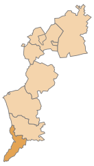
Jennersdorf District
- district of Austria
Hiking in Jennersdorf District
Jennersdorf District, located in the southern part of Austria, is known for its beautiful landscapes and hiking opportunities. Nestled in the province of Burgenland, this area features a mix of rolling hills, vineyards, and serene countryside, making it a great destination for both seasoned hikers and casual walkers....
- Country:
- Capital: Jennersdorf
- Licence Plate Code: JE
- Coordinates: 46° 56' 53" N, 16° 8' 24" E
- GPS tracks (wikiloc): [Link]
- AboveSeaLevel: 331 м m
- Area: 253 sq km
- Population: 17289
Shares border with regions:


Styria
- federated state in Austria
Hiking in Styria
Styria, a beautiful region in Austria, is a fantastic destination for hiking enthusiasts. Known for its diverse landscapes, lush forests, rolling hills, and stunning alpine views, Styria offers a variety of trails suitable for all experience levels. Here’s what you can expect when hiking in Styria:...
- Country:
- Capital: Graz
- Coordinates: 47° 15' 0" N, 15° 10' 0" E
- GPS tracks (wikiloc): [Link]
- AboveSeaLevel: 2995 м m
- Area: 16400.75 sq km
- Population: 1231865
- Web site: [Link]

Lower Austria
- federated state of Austria
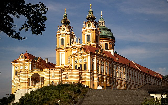
Hiking in Lower Austria
Lower Austria, known as Niederösterreich in German, is a fantastic destination for hiking enthusiasts. The region is characterized by its diverse landscapes, including rolling hills, vineyards, forests, and the scenic Danube River. Here are some highlights and popular hiking areas in Lower Austria:...
- Country:
- Capital: St. Pölten
- Coordinates: 48° 20' 0" N, 15° 45' 0" E
- GPS tracks (wikiloc): [Link]
- AboveSeaLevel: 279 м m
- Area: 19186.0 sq km
- Population: 1653419
- Web site: [Link]