canton of Niederbronn-les-Bains (canton de Niederbronn-les-Bains)
- canton of France (until March 2015)
- Country:

- Capital: Niederbronn-les-Bains
- Coordinates: 48° 54' 19" N, 7° 37' 21" E


- GPS tracks (wikiloc): [Link]
- Area: 210.32 sq km
- Population: 27928
- Wikidata storage: Wikidata: Q1397704
- INSEE canton code: [6715]
Includes regions:


Bitschhoffen
- commune in Bas-Rhin, France
- Country:
- Postal Code: 67350
- Coordinates: 48° 51' 33" N, 7° 37' 12" E
- GPS tracks (wikiloc): [Link]
- Area: 2.54 sq km
- Population: 445

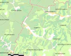
Dambach
- commune in Bas-Rhin, France
- Country:
- Postal Code: 67110
- Coordinates: 49° 0' 11" N, 7° 37' 52" E
- GPS tracks (wikiloc): [Link]
- Area: 30.5 sq km
- Population: 753
- Web site: [Link]

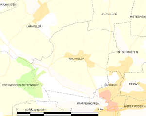
Kindwiller
- commune in Bas-Rhin, France
- Country:
- Postal Code: 67350
- Coordinates: 48° 51' 46" N, 7° 35' 53" E
- GPS tracks (wikiloc): [Link]
- Area: 5.97 sq km
- Population: 626


Reichshoffen
- commune in Bas-Rhin, France
- Country:
- Postal Code: 67110
- Coordinates: 48° 56' 4" N, 7° 39' 58" E
- GPS tracks (wikiloc): [Link]
- Area: 17.64 sq km
- Population: 5397
- Web site: [Link]

Oberbronn
- commune in Bas-Rhin, France
- Country:
- Postal Code: 67110
- Coordinates: 48° 56' 28" N, 7° 36' 25" E
- GPS tracks (wikiloc): [Link]
- Area: 21.15 sq km
- Population: 1542
- Web site: [Link]


Windstein
- commune in Bas-Rhin, France
- Country:
- Postal Code: 67110
- Coordinates: 48° 59' 41" N, 7° 41' 2" E
- GPS tracks (wikiloc): [Link]
- Area: 11.97 sq km
- Population: 169


Engwiller
- commune in Bas-Rhin, France
- Country:
- Postal Code: 67350
- Coordinates: 48° 53' 6" N, 7° 36' 55" E
- GPS tracks (wikiloc): [Link]
- Area: 3.74 sq km
- Population: 496
- Web site: [Link]

Offwiller
- commune in Bas-Rhin, France
- Country:
- Postal Code: 67340
- Coordinates: 48° 54' 37" N, 7° 32' 35" E
- GPS tracks (wikiloc): [Link]
- Area: 15.92 sq km
- Population: 811
- Web site: [Link]
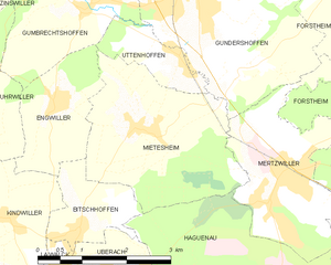
Mietesheim
- commune in Bas-Rhin, France
- Country:
- Postal Code: 67580
- Coordinates: 48° 52' 41" N, 7° 38' 29" E
- GPS tracks (wikiloc): [Link]
- Area: 8.49 sq km
- Population: 669


Niederbronn-les-Bains
- commune in Bas-Rhin, France
- Country:
- Postal Code: 67110
- Coordinates: 48° 57' 0" N, 7° 38' 38" E
- GPS tracks (wikiloc): [Link]
- Area: 31.4 sq km
- Population: 4355
- Web site: [Link]

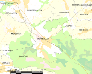
Mertzwiller
- commune in Bas-Rhin, France
- Country:
- Postal Code: 67580
- Coordinates: 48° 51' 47" N, 7° 40' 47" E
- GPS tracks (wikiloc): [Link]
- Area: 6.96 sq km
- Population: 3371
- Web site: [Link]


Zinswiller
- commune in Bas-Rhin, France
- Country:
- Postal Code: 67110
- Coordinates: 48° 55' 12" N, 7° 35' 27" E
- GPS tracks (wikiloc): [Link]
- AboveSeaLevel: 260 м m
- Area: 7.14 sq km
- Population: 774


Rothbach
- commune in Bas-Rhin, France
- Country:
- Postal Code: 67340
- Coordinates: 48° 54' 24" N, 7° 31' 44" E
- GPS tracks (wikiloc): [Link]
- Area: 7.99 sq km
- Population: 475
- Web site: [Link]
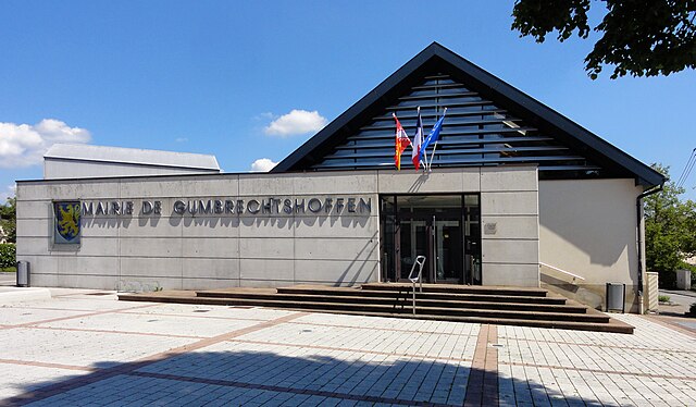
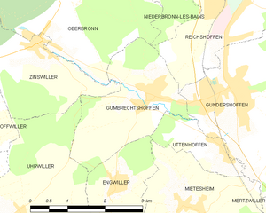
Gumbrechtshoffen
- commune in Bas-Rhin, France
- Country:
- Postal Code: 67110
- Coordinates: 48° 54' 18" N, 7° 37' 49" E
- GPS tracks (wikiloc): [Link]
- Area: 5.74 sq km
- Population: 1160
- Web site: [Link]

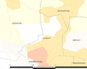
La Walck
- former commune in Bas-Rhin, France
- Country:
- Postal Code: 67350
- Coordinates: 48° 50' 59" N, 7° 36' 39" E
- GPS tracks (wikiloc): [Link]
- Area: 0.68 sq km
- Population: 1100


Uttenhoffen
- commune in Bas-Rhin, France
- Country:
- Postal Code: 67110
- Coordinates: 48° 53' 33" N, 7° 39' 18" E
- GPS tracks (wikiloc): [Link]
- Area: 1.95 sq km
- Population: 195


Gundershoffen
- commune in Bas-Rhin, France
- Country:
- Postal Code: 67110
- Coordinates: 48° 54' 20" N, 7° 39' 47" E
- GPS tracks (wikiloc): [Link]
- Area: 17.55 sq km
- Population: 3633
- Web site: [Link]


Uberach
- former commune in Bas-Rhin, France
- Country:
- Postal Code: 67350
- Coordinates: 48° 50' 58" N, 7° 37' 43" E
- GPS tracks (wikiloc): [Link]
- Area: 2.01 sq km
- Population: 1166
- Web site: [Link]


Uhrwiller
- commune in Bas-Rhin, France
- Country:
- Postal Code: 67350
- Coordinates: 48° 52' 40" N, 7° 34' 43" E
- GPS tracks (wikiloc): [Link]
- Area: 11.02 sq km
- Population: 706
- Web site: [Link]