canton of Saint-Christophe-en-Bazelle (canton de Saint-Christophe-en-Bazelle)

- canton of France (until March 2015)
- Country:

- Capital: Saint-Christophe-en-Bazelle
- Coordinates: 47° 11' 34" N, 1° 42' 45" E


- GPS tracks (wikiloc): [Link]
- Wikidata storage: Wikidata: Q628670
- Wikipedia Commons Category: [Link]
- INSEE canton code: [3618]
Includes regions:


Anjouin
- commune in Indre, France
- Country:
- Postal Code: 36210
- Coordinates: 47° 11' 22" N, 1° 48' 4" E
- GPS tracks (wikiloc): [Link]
- Area: 28.91 sq km
- Population: 335

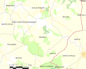
Bagneux
- commune in Indre, France
- Country:
- Postal Code: 36210
- Coordinates: 47° 10' 59" N, 1° 45' 11" E
- GPS tracks (wikiloc): [Link]
- Area: 25.3 sq km
- Population: 175
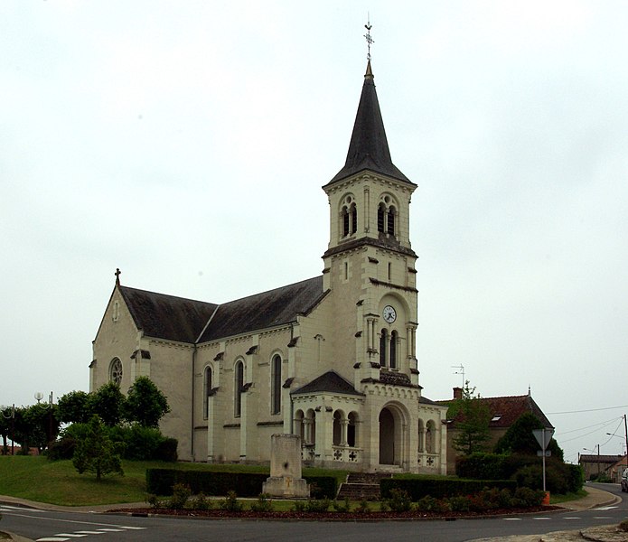
Saint-Christophe-en-Bazelle
- commune in Indre, France
- Country:
- Postal Code: 36210
- Coordinates: 47° 11' 31" N, 1° 42' 42" E
- GPS tracks (wikiloc): [Link]
- Area: 13.94 sq km
- Population: 400


Chabris
- commune in Indre, France
- Country:
- Postal Code: 36210
- Coordinates: 47° 15' 18" N, 1° 39' 12" E
- GPS tracks (wikiloc): [Link]
- Area: 41.22 sq km
- Population: 2737
Sembleçay
- commune in Indre, France
- Country:
- Postal Code: 36210
- Coordinates: 47° 13' 19" N, 1° 40' 56" E
- GPS tracks (wikiloc): [Link]
- Area: 8.08 sq km
- Population: 102
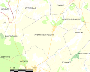
Varennes-sur-Fouzon
- former commune in Indre, France
- Country:
- Postal Code: 36210
- Coordinates: 47° 12' 47" N, 1° 36' 21" E
- GPS tracks (wikiloc): [Link]
- Area: 22.85 sq km
- Population: 705
Sainte-Cécile
- former commune in Indre, France
- Country:
- Postal Code: 36210
- Coordinates: 47° 11' 15" N, 1° 40' 11" E
- GPS tracks (wikiloc): [Link]
- Area: 9.5 sq km
- Population: 87
Parpeçay
- former commune in Indre, France
- Country:
- Postal Code: 36210
- Coordinates: 47° 12' 28" N, 1° 39' 8" E
- GPS tracks (wikiloc): [Link]
- Area: 14.55 sq km
- Population: 219
Orville
- commune in Indre, France
- Country:
- Postal Code: 36210
- Coordinates: 47° 9' 8" N, 1° 47' 28" E
- GPS tracks (wikiloc): [Link]
- Area: 9.35 sq km
- Population: 136
Menetou-sur-Nahon
- commune in Indre, France
- Country:
- Postal Code: 36210
- Coordinates: 47° 13' 7" N, 1° 38' 56" E
- GPS tracks (wikiloc): [Link]
- Area: 6.98 sq km
- Population: 119


Dun-le-Poëlier
- commune in Indre, France
- Country:
- Postal Code: 36210
- Coordinates: 47° 12' 14" N, 1° 45' 13" E
- GPS tracks (wikiloc): [Link]
- Area: 22.56 sq km
- Population: 447
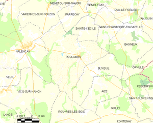
Poulaines
- commune in Indre, France
- Country:
- Postal Code: 36210
- Coordinates: 47° 9' 7" N, 1° 39' 48" E
- GPS tracks (wikiloc): [Link]
- Area: 46.32 sq km
- Population: 895