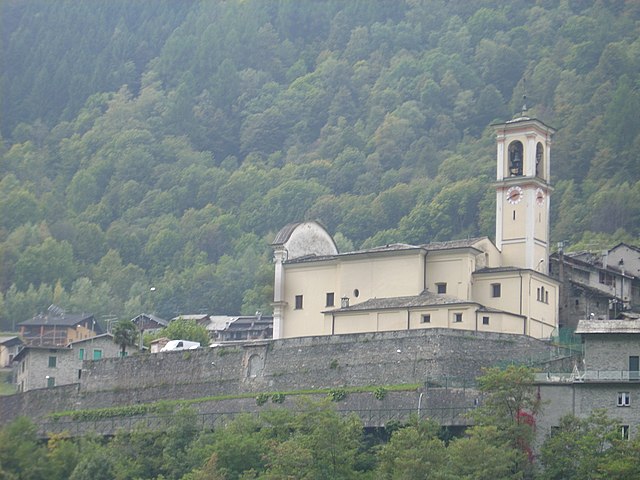
Caspoggio (Caspoggio)
.svg)
- Italian comune
 Hiking in Caspoggio
Caspoggio is a charming village located in the Valtellina valley in the Lombardy region of northern Italy, known for its stunning natural landscapes and outdoor recreational opportunities. Hiking in and around Caspoggio provides breathtaking views, diverse trails, and the chance to explore the rich flora and fauna of the area.
Popular Hiking Trails
-
Sentiero del Mera: This is a scenic trail that follows the Mera River and offers a moderate hike with beautiful views of the surrounding mountains and valleys. The trail typically showcases lush greenery and picturesque landscapes.
-
Caspoggio to Alpe Cova: A more challenging hike that leads to the Alpe Cova, where hikers can enjoy panoramic views of the nearby peaks. The trail takes you through lush forests and alpine meadows.
-
Val di Mello: While not directly in Caspoggio, this nearby valley is famous for its breathtaking scenery and various hiking routes. The trails in Val di Mello cater to different skill levels, making it a great option for hikers of all abilities.
Tips for Hiking in Caspoggio
- Check Weather Conditions: Mountain weather can change rapidly, so it’s essential to check forecasts and be prepared.
- Stay Hydrated: Always carry enough water, especially on longer hikes.
- Wear Appropriate Gear: Good hiking boots, layered clothing, and a backpack with essentials will enhance your experience.
- Map and Navigation: Make sure to have a map or a GPS device, as some trails may not be well-marked.
- Wildlife Awareness: Respect the local wildlife and maintain a safe distance if you encounter animals on your hikes.
Seasonal Considerations
- Summer: Ideal for hiking with clear trails and blooming wildflowers. Be mindful of altitude and possible weather changes.
- Autumn: Offers stunning fall foliage, a great time for hiking with cooler temperatures.
- Winter: While some trails may be closed, there are winter hiking and snowshoeing options available for those who enjoy winter sports.
Conclusion
Caspoggio is an excellent base for hiking enthusiasts wanting to explore the stunning landscapes of the Lombardy region. With a mix of easy and challenging trails, beautiful scenery, and a welcoming mountain village atmosphere, it’s a perfect destination for both casual and serious hikers. Always ensure you follow local guidelines and respect the environment during your hikes.
- Country:

- Postal Code: 23020
- Local Dialing Code: 0342
- Licence Plate Code: SO
- Coordinates: 46° 16' 0" N, 9° 52' 0" E


- GPS tracks (wikiloc): [Link]
- AboveSeaLevel: 1098 м m
- Area: 7.31 sq km
- Population: 1377
- Web site: http://www.comune.caspoggio.so.it
- Wikipedia en: wiki(en)
- Wikipedia: wiki(it)
- Wikidata storage: Wikidata: Q40290
- Wikipedia Commons Category: [Link]
- Freebase ID: [/m/0gj2qd]
- GeoNames ID: Alt: [6536124]
- VIAF ID: Alt: [308726707]
- OSM relation ID: [47059]
- GND ID: Alt: [1051545277]
- WOEID: [713145]
- ISTAT ID: 014013
- Italian cadastre code: B993
Shares border with regions:


Montagna in Valtellina
- Italian comune
Hiking in Montagna in Valtellina
Montagna in Valtellina, located in the Sondrio province of Lombardy, Italy, is an excellent destination for hiking enthusiasts. This area is part of the Valtellina Valley, which is known for its stunning landscapes, charming villages, and rich cultural heritage....
- Country:
- Postal Code: 23020
- Local Dialing Code: 0342
- Licence Plate Code: SO
- Coordinates: 46° 11' 0" N, 9° 54' 0" E
- GPS tracks (wikiloc): [Link]
- AboveSeaLevel: 567 м m
- Area: 44.97 sq km
- Population: 3041
- Web site: [Link]

Torre di Santa Maria
- Italian comune
Hiking in Torre di Santa Maria
Torre di Santa Maria, located in the beautiful region of Lombardy in northern Italy, is an excellent destination for hiking enthusiasts. Nestled in the Valtellina valley, it is surrounded by stunning landscapes, including mountains, valleys, and lush forests....
- Country:
- Postal Code: 23020
- Local Dialing Code: 0342
- Licence Plate Code: SO
- Coordinates: 46° 14' 0" N, 9° 51' 0" E
- GPS tracks (wikiloc): [Link]
- AboveSeaLevel: 795 м m
- Area: 44.24 sq km
- Population: 752
- Web site: [Link]
Lanzada
- Italian comune
Hiking in Lanzada
Lanzada, located on the beautiful Galician coast in Spain, is known for its stunning beaches, picturesque landscapes, and vibrant natural surroundings, making it a great destination for hiking enthusiasts. Here’s an overview of what to expect when hiking in the Lanzada area:...
- Country:
- Postal Code: 23020
- Local Dialing Code: 0342
- Licence Plate Code: SO
- Coordinates: 46° 16' 0" N, 9° 52' 0" E
- GPS tracks (wikiloc): [Link]
- AboveSeaLevel: 1000 м m
- Area: 117.17 sq km
- Population: 1335
- Web site: [Link]


Chiesa in Valmalenco
- Italian comune
Hiking in Chiesa in Valmalenco
Chiesa in Valmalenco is a beautiful destination for hiking, located in the Italian Alps within the Lombardy region. It is characterized by stunning landscapes, rich biodiversity, and a variety of trails suitable for hikers of all levels. Here’s an overview of what you can expect when hiking in Chiesa in Valmalenco:...
- Country:
- Postal Code: 23023
- Local Dialing Code: 0342
- Licence Plate Code: SO
- Coordinates: 46° 16' 0" N, 9° 51' 0" E
- GPS tracks (wikiloc): [Link]
- AboveSeaLevel: 800 м m
- Area: 107.6 sq km
- Population: 2482
- Web site: [Link]