Montagna in Valtellina (Montagna in Valtellina)
- Italian comune
 Hiking in Montagna in Valtellina
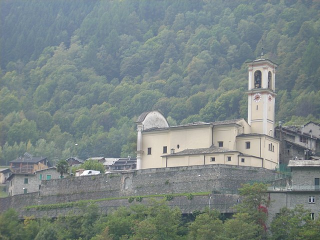
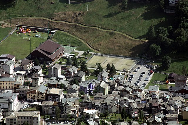
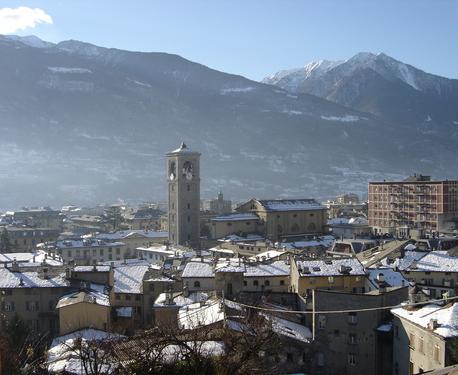
Montagna in Valtellina, located in the Sondrio province of Lombardy, Italy, is an excellent destination for hiking enthusiasts. This area is part of the Valtellina Valley, which is known for its stunning landscapes, charming villages, and rich cultural heritage.
Key Features for Hiking in Montagna in Valtellina
-
Natural Beauty: The region offers breathtaking views of the surrounding mountains, including the Rhaetian Alps. Hikers can enjoy lush valleys, crystal-clear rivers, and diverse flora and fauna.
-
Trail Variety: There are numerous trails to suit hikers of different skill levels. Whether you're looking for a leisurely walk or a challenging hike, there are options available:
- Easy Trails: Suitable for families and beginners, these paths often lead to scenic viewpoints or historical sites.
- Moderate Trails: These hikes may involve some elevation gain and are suitable for those with a bit more experience.
- Challenging Trails: For experienced hikers, the area offers steep and rugged paths that require good physical condition and proper equipment.
-
Local Highlights:
- Cultural Sites: Many trails pass by historical landmarks, including old churches, traditional farms, and ancient ruins.
- Gastronomy: Montagna in Valtellina is known for its local cuisine, including dishes like pizzoccheri (buckwheat pasta) and bresaola (cured beef). Consider planning a hike that allows you to enjoy local specialties at a mountain hut or village restaurant.
-
Seasonal Hiking:
- Summer: Ideal for hiking, with plenty of sunshine and accessible trails.
- Autumn: The fall foliage offers stunning views and great photo opportunities.
- Winter: Depending on your preferences, winter hiking or snowshoeing can be an adventurous alternative, but it requires special gear and knowledge of the conditions.
-
Access and Facilities: Montagna in Valtellina is easily reachable by car or public transport from major cities like Sondrio. The area has various accommodations, including hotels, guesthouses, and campsites, making it suitable for multi-day hiking excursions.
-
Safety Considerations: Always check weather conditions before embarking on a hike. Carry enough water, wear appropriate footwear, and bring a map or GPS device, as some areas may have limited signage.
Recommended Hikes
- Sentiero dei Ghiacciai: This trail leads to beautiful views of glacial landscapes. It's a moderate hike suitable for most fitness levels.
- Hike to Monte Nudo: Offers panoramic views and is great for experienced hikers looking for a challenge.
- Local Nature Reserves: Explore the nearby protected areas, where you can often find well-marked trails and informative signs about the local ecology.
In summary, Montagna in Valtellina provides a fantastic hiking experience combining natural beauty with cultural richness. Whether you're a novice or an experienced hiker, you'll find trails that cater to your interests and abilities. Happy hiking!
- Country:

- Postal Code: 23020
- Local Dialing Code: 0342
- Licence Plate Code: SO
- Coordinates: 46° 11' 0" N, 9° 54' 0" E


- GPS tracks (wikiloc): [Link]
- AboveSeaLevel: 567 м m
- Area: 44.97 sq km
- Population: 3041
- Web site: http://www.comune.montagnainvaltellina.so.it
- Wikipedia en: wiki(en)
- Wikipedia: wiki(it)
- Wikidata storage: Wikidata: Q39056
- Wikipedia Commons Gallery: [Link]
- Wikipedia Commons Category: [Link]
- Freebase ID: [/m/0gj3c7]
- GeoNames ID: Alt: [6543120]
- VIAF ID: Alt: [249423143]
- OSM relation ID: [46964]
- ISTAT ID: 014044
- Italian cadastre code: F393
Shares border with regions:


Torre di Santa Maria
- Italian comune
 Hiking in Torre di Santa Maria
Torre di Santa Maria, located in the beautiful region of Lombardy in northern Italy, is an excellent destination for hiking enthusiasts. Nestled in the Valtellina valley, it is surrounded by stunning landscapes, including mountains, valleys, and lush forests....
- Country:

- Postal Code: 23020
- Local Dialing Code: 0342
- Licence Plate Code: SO
- Coordinates: 46° 14' 0" N, 9° 51' 0" E


- GPS tracks (wikiloc): [Link]
- AboveSeaLevel: 795 м m
- Area: 44.24 sq km
- Population: 752
- Web site: [Link]
Ponte in Valtellina
- Italian comune
Ponte in Valtellina is a picturesque town located in the Valtellina Valley in northern Italy, known for its stunning alpine scenery and a variety of outdoor activities, including hiking. Here are some key points about hiking in and around Ponte in Valtellina:...
- Country:

- Postal Code: 23026
- Local Dialing Code: 0342
- Licence Plate Code: SO
- Coordinates: 46° 11' 0" N, 9° 59' 0" E


- GPS tracks (wikiloc): [Link]
- AboveSeaLevel: 500 м m
- Area: 67.73 sq km
- Population: 2294
- Web site: [Link]
Lanzada
- Italian comune
Lanzada, located on the beautiful Galician coast in Spain, is known for its stunning beaches, picturesque landscapes, and vibrant natural surroundings, making it a great destination for hiking enthusiasts. Here’s an overview of what to expect when hiking in the Lanzada area:...
- Country:

- Postal Code: 23020
- Local Dialing Code: 0342
- Licence Plate Code: SO
- Coordinates: 46° 16' 0" N, 9° 52' 0" E


- GPS tracks (wikiloc): [Link]
- AboveSeaLevel: 1000 м m
- Area: 117.17 sq km
- Population: 1335
- Web site: [Link]
Faedo Valtellino
- Italian comune
Faedo Valtellino is a picturesque area located in the Lombardy region of northern Italy, known for its stunning landscapes, charming villages, and proximity to the Alps. Hiking in this region offers a variety of trails that cater to different skill levels, making it a great destination for both casual walkers and experienced hikers....
- Country:

- Postal Code: 23020
- Local Dialing Code: 0342
- Licence Plate Code: SO
- Coordinates: 46° 9' 0" N, 9° 54' 0" E


- GPS tracks (wikiloc): [Link]
- AboveSeaLevel: 557 м m
- Area: 4.8 sq km
- Population: 556
- Web site: [Link]
Albosaggia
- Italian comune
Albosaggia, located in the Lombardy region of Italy, offers beautiful hiking opportunities with stunning views of the surrounding mountains and valleys. Here are some highlights and tips for hiking in this picturesque area:...
- Country:

- Postal Code: 23010
- Local Dialing Code: 0342
- Licence Plate Code: SO
- Coordinates: 46° 9' 0" N, 9° 51' 0" E


- GPS tracks (wikiloc): [Link]
- AboveSeaLevel: 490 м m
- Area: 34.35 sq km
- Population: 3020
- Web site: [Link]


Chiuro
- Italian comune
Chiuro, located in the Valtellina region of northern Italy, is surrounded by stunning landscapes that make it a great destination for hiking enthusiasts. Here’s what you can expect when hiking in and around Chiuro:...
- Country:

- Postal Code: 23030
- Local Dialing Code: 0342
- Licence Plate Code: SO
- Coordinates: 46° 10' 0" N, 9° 59' 0" E


- GPS tracks (wikiloc): [Link]
- AboveSeaLevel: 390 м m
- Area: 51.76 sq km
- Population: 2552
- Web site: [Link]


Caspoggio
- Italian comune
Caspoggio is a charming village located in the Valtellina valley in the Lombardy region of northern Italy, known for its stunning natural landscapes and outdoor recreational opportunities. Hiking in and around Caspoggio provides breathtaking views, diverse trails, and the chance to explore the rich flora and fauna of the area....
- Country:

- Postal Code: 23020
- Local Dialing Code: 0342
- Licence Plate Code: SO
- Coordinates: 46° 16' 0" N, 9° 52' 0" E


- GPS tracks (wikiloc): [Link]
- AboveSeaLevel: 1098 м m
- Area: 7.31 sq km
- Population: 1377
- Web site: [Link]
Spriana
- Italian comune
Spriana, a charming village in the Lombardy region of Italy, is set against the stunning backdrop of the Italian Alps. It offers a variety of hiking opportunities suitable for all skill levels, with scenic trails that showcase the natural beauty of the area....
- Country:

- Postal Code: 23020
- Local Dialing Code: 0342
- Licence Plate Code: SO
- Coordinates: 46° 13' 0" N, 9° 52' 0" E


- GPS tracks (wikiloc): [Link]
- AboveSeaLevel: 754 м m
- Area: 7.69 sq km
- Population: 87
- Web site: [Link]


Poggiridenti
- Italian comune
Poggiridenti, a charming village located in the province of Sondrio in the Italian region of Lombardy, offers a unique hiking experience surrounded by the beautiful landscapes of the Valtellina valley and the foothills of the Alps. Here are some highlights and tips for hiking in and around Poggiridenti:...
- Country:

- Postal Code: 23020
- Local Dialing Code: 0342
- Licence Plate Code: SO
- Coordinates: 46° 10' 0" N, 9° 55' 0" E


- GPS tracks (wikiloc): [Link]
- AboveSeaLevel: 564 м m
- Area: 2.9 sq km
- Population: 1906
- Web site: [Link]
Piateda
- Italian comune
Piateda is a charming village located in the Lombardy region of northern Italy, nestled in the picturesque Valtellina Valley. For hiking enthusiasts, the area offers a variety of trails that cater to different skill levels, allowing you to immerse yourself in stunning Alpine landscapes, lush forests, and panoramic views of the surrounding mountains....
- Country:

- Postal Code: 23020
- Local Dialing Code: 0342
- Licence Plate Code: SO
- Coordinates: 46° 9' 35" N, 9° 56' 6" E


- GPS tracks (wikiloc): [Link]
- AboveSeaLevel: 304 м m
- Area: 70.8 sq km
- Population: 2158
- Web site: [Link]

Tresivio
- Italian comune
Tresivio is a charming town located in the Valtellina valley in northern Italy, surrounded by stunning alpine landscapes. It is a fantastic destination for hiking enthusiasts, offering a variety of trails suitable for different skill levels. Here are some highlights and tips for hiking in and around Tresivio:...
- Country:

- Postal Code: 23020
- Local Dialing Code: 0342
- Licence Plate Code: SO
- Coordinates: 46° 10' 0" N, 9° 57' 0" E


- GPS tracks (wikiloc): [Link]
- AboveSeaLevel: 520 м m
- Area: 15.01 sq km
- Population: 1998
- Web site: [Link]


Sondrio
- Italian city in Valtellina
Sondrio, located in the Lombardy region of northern Italy, offers a variety of stunning hiking opportunities, particularly in the surrounding Valtellina Valley and the adjacent Stelvio National Park. Here are some highlights and essential information for hiking in the Sondrio area:...
- Country:

- Postal Code: 23100
- Local Dialing Code: 0342
- Licence Plate Code: SO
- Coordinates: 46° 10' 11" N, 9° 52' 12" E


- GPS tracks (wikiloc): [Link]
- AboveSeaLevel: 360 м m
- Area: 20.88 sq km
- Population: 21642
- Web site: [Link]
