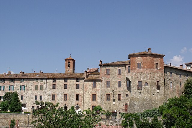
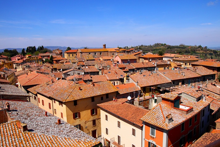
Castiglione del Lago (Castiglione del Lago)
.svg)
- town in Italy
 Hiking in Castiglione del Lago
Castiglione del Lago is a charming town located on the shores of Lake Trasimeno in the Umbria region of Italy. It's a beautiful destination for hiking enthusiasts, offering scenic landscapes, historical sites, and a variety of terrains.
Hiking Trails and Areas
-
Lake Trasimeno Circuit: A popular route that circles the lake, offering stunning views of the water and surrounding hills. The entire loop is about 65 km, but you can choose shorter segments to hike, depending on your fitness level and available time.
-
Parco del Lago Trasimeno: This natural park encompasses the area around the lake and has numerous trails for hiking. The trails vary in difficulty and length, making it suitable for both casual walkers and experienced hikers.
-
Castello di Zocco: A hike up to this ancient castle offers not only a bit of exercise but also a chance to delve into the region's history. The views from the castle are breathtaking, overlooking the lake and surrounding countryside.
-
Monti del Trasimeno: To the east of Castiglione del Lago, the hills provide more challenging terrain for avid hikers. Several trails meander through forests and picturesque villages, showcasing the local flora and fauna.
Points of Interest
- Scenic Views: Many trails offer panoramic views of Lake Trasimeno and the surrounding hills. The sunset over the lake is particularly magical.
- Wildlife: The area is home to diverse wildlife, so keep an eye out for birds, especially around the wetlands near the lake.
- Historical Sites: Along the hiking routes, you can encounter charming villages and historical landmarks, such as churches and castles that tell the story of the region.
Tips for Hiking in Castiglione del Lago
- Plan Ahead: Check the weather and trail conditions before setting out.
- Stay Hydrated: Carry enough water, especially during the warmer months.
- Footwear: Wear sturdy hiking shoes for better grip and comfort on various terrains.
- Local Guidance: Consider joining a hiking group or hiring a local guide to enhance your experience, especially if you want to learn more about the area's history and ecology.
Overall, Castiglione del Lago offers a wonderful blend of natural beauty and cultural heritage, making it a great destination for hiking. Be sure to take your time to soak in the views and enjoy the tranquility of the surroundings!
- Country:

- Postal Code: 06061
- Local Dialing Code: 075
- Licence Plate Code: PG
- Coordinates: 43° 7' 38" N, 12° 2' 43" E


- GPS tracks (wikiloc): [Link]
- AboveSeaLevel: 304 м m
- Area: 205.26 sq km
- Population: 15479
- Web site: http://www.comune.castiglione-del-lago.pg.it
- Wikipedia en: wiki(en)
- Wikipedia: wiki(it)
- Wikidata storage: Wikidata: Q20390
- Wikipedia Commons Gallery: [Link]
- Wikipedia Commons Category: [Link]
- Freebase ID: [/m/0937_p]
- GeoNames ID: Alt: [6541109]
- VIAF ID: Alt: [159495183]
- OSM relation ID: [42285]
- MusicBrainz area ID: [4f60fb36-0821-45ec-876e-3a36e22a905b]
- TGN ID: [7005065]
- UN/LOCODE: [ITCG3]
- Gran Enciclopèdia Catalana ID: [0264757]
- Facebook Places ID: [108792815805252]
- Digital Atlas of the Roman Empire ID: [37148]
- ISTAT ID: 054009
- Italian cadastre code: C309
Shares border with regions:


Città della Pieve
- Italian comune
Hiking in Città della Pieve
Città della Pieve, located in the Umbria region of Italy, is a charming hilltop town known for its stunning landscapes, historic architecture, and rich cultural heritage. Hiking in this area offers a mix of scenic views, rolling hills, vineyards, and olive groves, making it an appealing destination for outdoor enthusiasts....
- Country:
- Postal Code: 06062
- Local Dialing Code: 0578
- Licence Plate Code: PG
- Coordinates: 42° 57' 14" N, 12° 0' 28" E
- GPS tracks (wikiloc): [Link]
- AboveSeaLevel: 508 м m
- Area: 110.94 sq km
- Population: 7686
- Web site: [Link]


Magione
- Italian comune
Hiking in Magione
Magione, located in the Umbria region of Italy, is a charming town situated near the western shore of Lake Trasimeno, surrounded by beautiful landscapes, vineyards, and charming rural areas. While Magione itself is not a renowned hiking destination, it offers access to a variety of trails and outdoor activities that are popular with locals and visitors alike....
- Country:
- Postal Code: 06063
- Local Dialing Code: 075
- Licence Plate Code: PG
- Coordinates: 43° 8' 30" N, 12° 12' 42" E
- GPS tracks (wikiloc): [Link]
- AboveSeaLevel: 299 м m
- Area: 129.73 sq km
- Population: 14815
- Web site: [Link]

Paciano
- Italian comune
Hiking in Paciano
Paciano is a charming hilltop village located in the Umbria region of Italy, known for its stunning landscapes, rich history, and vibrant local culture. Hiking in and around Paciano offers a fantastic way to explore the natural beauty of the area while experiencing its picturesque surroundings....
- Country:
- Postal Code: 06060
- Local Dialing Code: 075
- Licence Plate Code: PG
- Coordinates: 43° 1' 0" N, 12° 4' 0" E
- GPS tracks (wikiloc): [Link]
- AboveSeaLevel: 391 м m
- Area: 16.91 sq km
- Population: 986
- Web site: [Link]


Panicale
- Italian comune
Hiking in Panicale
Panicale, a charming medieval village located in the Umbria region of Italy, offers a variety of hiking opportunities that showcase the natural beauty and scenic landscapes of the area. Here are some highlights for hiking in and around Panicale:...
- Country:
- Postal Code: 06068; 06064
- Local Dialing Code: 075
- Licence Plate Code: PG
- Coordinates: 43° 2' 0" N, 12° 6' 0" E
- GPS tracks (wikiloc): [Link]
- AboveSeaLevel: 441 м m
- Area: 79.26 sq km
- Population: 5606
- Web site: [Link]


Passignano sul Trasimeno
- Italian comune
Hiking in Passignano sul Trasimeno
Passignano sul Trasimeno is a charming town located on the shores of Lake Trasimeno in Umbria, Italy. Its picturesque setting and surrounding landscapes offer great opportunities for hiking and outdoor activities. Here are some highlights for hiking in the area:...
- Country:
- Postal Code: 06065
- Local Dialing Code: 075
- Licence Plate Code: PG
- Coordinates: 43° 11' 0" N, 12° 8' 0" E
- GPS tracks (wikiloc): [Link]
- AboveSeaLevel: 289 м m
- Area: 81.33 sq km
- Population: 5712
- Web site: [Link]


Tuoro sul Trasimeno
- Italian comune
Hiking in Tuoro sul Trasimeno
Tuoro sul Trasimeno, located in the province of Perugia in the Umbria region of Italy, is a beautiful destination for hiking enthusiasts. Nestled near Lake Trasimeno, the area offers diverse landscapes, historic sites, and a rich natural environment....
- Country:
- Postal Code: 06069
- Local Dialing Code: 075
- Licence Plate Code: PG
- Coordinates: 43° 12' 25" N, 12° 4' 29" E
- GPS tracks (wikiloc): [Link]
- AboveSeaLevel: 309 м m
- Area: 55.89 sq km
- Population: 3769
- Web site: [Link]


Cortona
- Italian town and comune
Hiking in Cortona
Cortona, a charming hilltop town in Tuscany, Italy, is known not only for its historical architecture and stunning views but also for its scenic hiking opportunities. Here are some key points about hiking in and around Cortona:...
- Country:
- Postal Code: 52044
- Local Dialing Code: 0575
- Licence Plate Code: AR
- Coordinates: 43° 16' 32" N, 11° 59' 17" E
- GPS tracks (wikiloc): [Link]
- AboveSeaLevel: 494 м m
- Area: 342.97 sq km
- Population: 22057
- Web site: [Link]

Chiusi
- Italian comune
Hiking in Chiusi
Chiusi, a charming town in the Tuscany region of Italy, is not only rich in history and culture but also offers some beautiful hiking opportunities. Nestled in the rolling hills and surrounded by picturesque landscapes, Chiusi serves as an excellent base for exploring the natural beauty of the area. Here are some highlights and tips for hiking in and around Chiusi:...
- Country:
- Postal Code: 53043
- Local Dialing Code: 0578
- Licence Plate Code: SI
- Coordinates: 43° 1' 0" N, 11° 57' 0" E
- GPS tracks (wikiloc): [Link]
- AboveSeaLevel: 398 м m
- Area: 58.15 sq km
- Population: 8558
- Web site: [Link]


Montepulciano
- Italian comune
Hiking in Montepulciano
Hiking in Montepulciano, a historic town in the Tuscany region of Italy, offers a unique blend of natural beauty, rich history, and stunning landscapes. Here are some key points to consider when planning a hiking trip in this picturesque area:...
- Country:
- Postal Code: 53045
- Local Dialing Code: 0578
- Licence Plate Code: SI
- Coordinates: 43° 6' 0" N, 11° 47' 0" E
- GPS tracks (wikiloc): [Link]
- AboveSeaLevel: 605 м m
- Area: 165.33 sq km
- Population: 13984
- Web site: [Link]