
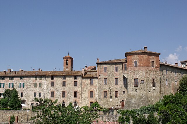
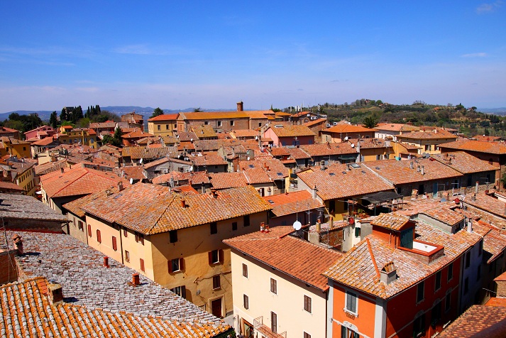
Città della Pieve (Città della Pieve)
.svg)
- Italian comune
 Hiking in Città della Pieve
Città della Pieve, located in the Umbria region of Italy, is a charming hilltop town known for its stunning landscapes, historic architecture, and rich cultural heritage. Hiking in this area offers a mix of scenic views, rolling hills, vineyards, and olive groves, making it an appealing destination for outdoor enthusiasts.
Hiking Opportunities:
-
Surrounding Trails:
- The area around Città della Pieve features a variety of trails catering to different skill levels. You can find well-marked paths that lead through picturesque countryside, forests, and vineyards.
- A popular option is to hike along the Sentiero della Bonifica, which is a longer trail that runs through the Val di Chiana, offering beautiful views and numerous picnic spots.
-
Nature Reserves:
- The nearby Monte Petrichio and the surrounding natural parks provide opportunities for more advanced hiking experiences. Trails in these areas often lead to panoramic viewpoints with breathtaking vistas of the Umbrian landscape.
-
Historical and Cultural Walks:
- Many trails connect Città della Pieve to other nearby historic towns, allowing hikers to explore the region’s art and history. For example, you could plan a route that takes you to the nearby towns of Paciano or Piegaro.
-
Wine and Olive Oil Trails:
- Consider hiking through the vineyards and olive groves of the region. Many local producers offer guided tours that include hiking and tastings, combining the experience of the outdoors with local culinary delights.
Tips for Hiking in Città della Pieve:
- Best Time to Visit: The best seasons for hiking in this region are spring (April to June) and autumn (September to October) when the weather is mild and the landscapes are vibrant.
- Prepare Adequately: Ensure you have good hiking shoes, enough water, and snacks. The terrain can vary, and some paths may be steep.
- Stay Informed: Check local maps and guides for trail conditions. The local tourist office can provide updated information and resources.
- Respect the Environment: Adhere to Leave No Trace principles, and be mindful of local wildlife and plants.
Overall, hiking in and around Città della Pieve allows you to experience the beautiful Umbrian landscape, engage with local culture, and enjoy a variety of terrains and trails tailored to different hiking experiences.
- Country:

- Postal Code: 06062
- Local Dialing Code: 0578
- Licence Plate Code: PG
- Coordinates: 42° 57' 14" N, 12° 0' 28" E


- GPS tracks (wikiloc): [Link]
- AboveSeaLevel: 508 м m
- Area: 110.94 sq km
- Population: 7686
- Web site: http://www.comune.cittadellapieve.pg.it
- Wikipedia en: wiki(en)
- Wikipedia: wiki(it)
- Wikidata storage: Wikidata: Q20409
- Wikipedia Commons Gallery: [Link]
- Wikipedia Commons Category: [Link]
- Freebase ID: [/m/0gm1tl]
- GeoNames ID: Alt: [6536868]
- VIAF ID: Alt: [155207784]
- OSM relation ID: [42207]
- Library of Congress authority ID: Alt: [nr89000877]
- MusicBrainz area ID: [0a6c1014-6865-4155-b3bf-3f92017107a4]
- UN/LOCODE: [ITCDJ]
- ISTAT ID: 054012
- Italian cadastre code: C744
Shares border with regions:

Monteleone d'Orvieto
- town in the region Umbria, in Italy
Hiking in Monteleone d'Orvieto
Monteleone d'Orvieto is a charming hilltop town located in the Umbria region of Italy. It's surrounded by beautiful landscapes and offers a variety of hiking opportunities that cater to different skill levels. Here are some details about hiking in this picturesque area:...
- Country:
- Postal Code: 05017
- Local Dialing Code: 0763
- Licence Plate Code: TR
- Coordinates: 42° 55' 0" N, 12° 3' 0" E
- GPS tracks (wikiloc): [Link]
- AboveSeaLevel: 500 м m
- Area: 24.1 sq km
- Population: 1429
- Web site: [Link]
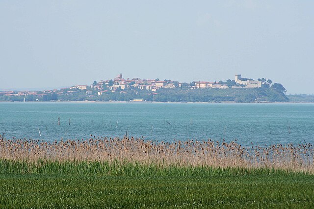

Castiglione del Lago
- town in Italy
Hiking in Castiglione del Lago
Castiglione del Lago is a charming town located on the shores of Lake Trasimeno in the Umbria region of Italy. It's a beautiful destination for hiking enthusiasts, offering scenic landscapes, historical sites, and a variety of terrains....
- Country:
- Postal Code: 06061
- Local Dialing Code: 075
- Licence Plate Code: PG
- Coordinates: 43° 7' 38" N, 12° 2' 43" E
- GPS tracks (wikiloc): [Link]
- AboveSeaLevel: 304 м m
- Area: 205.26 sq km
- Population: 15479
- Web site: [Link]

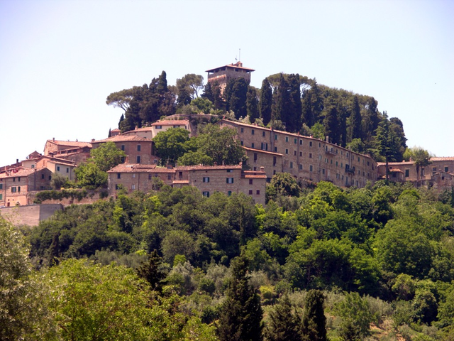
Paciano
- Italian comune
Hiking in Paciano
Paciano is a charming hilltop village located in the Umbria region of Italy, known for its stunning landscapes, rich history, and vibrant local culture. Hiking in and around Paciano offers a fantastic way to explore the natural beauty of the area while experiencing its picturesque surroundings....
- Country:
- Postal Code: 06060
- Local Dialing Code: 075
- Licence Plate Code: PG
- Coordinates: 43° 1' 0" N, 12° 4' 0" E
- GPS tracks (wikiloc): [Link]
- AboveSeaLevel: 391 м m
- Area: 16.91 sq km
- Population: 986
- Web site: [Link]


Piegaro
- Italian comune
Hiking in Piegaro
Piegaro, located in the province of Perugia in the Umbria region of Italy, offers beautiful hiking opportunities amidst stunning landscapes, charming villages, and rich cultural heritage. While the region is not as widely known as some other hiking hotspots in Italy, it features several trails that showcase its natural beauty and historical significance....
- Country:
- Postal Code: 06066
- Local Dialing Code: 075
- Licence Plate Code: PG
- Coordinates: 42° 58' 0" N, 12° 5' 0" E
- GPS tracks (wikiloc): [Link]
- AboveSeaLevel: 356 м m
- Area: 99.18 sq km
- Population: 3574
- Web site: [Link]


Allerona
- town in the region Umbria, in Italy
Hiking in Allerona
Allerona is a charming town located in the province of Terni, in the Umbria region of Italy. It is set in a beautiful natural landscape, characterized by rolling hills, vineyards, olive groves, and lush forests, making it a fantastic destination for hikers and nature lovers....
- Country:
- Postal Code: 05011
- Local Dialing Code: 0763
- Licence Plate Code: TR
- Coordinates: 42° 49' 0" N, 11° 58' 0" E
- GPS tracks (wikiloc): [Link]
- AboveSeaLevel: 472 м m
- Area: 82.61 sq km
- Population: 1769
- Web site: [Link]


Fabro
- town in the region Umbria, in Italy
Hiking in Fabro
Fabro is a charming medieval town located in the Umbria region of Italy. While it may not be as widely recognized for hiking as some larger national parks, it offers access to beautiful landscapes, picturesque trails, and a rich cultural backdrop that can make for a unique hiking experience....
- Country:
- Postal Code: 05015
- Local Dialing Code: 0763
- Licence Plate Code: TR
- Coordinates: 42° 52' 0" N, 12° 1' 0" E
- GPS tracks (wikiloc): [Link]
- AboveSeaLevel: 364 м m
- Area: 34.55 sq km
- Population: 2828
- Web site: [Link]

Cetona
- Italian comune
Hiking in Cetona
Cetona is a beautiful town located in the Tuscany region of Italy, known for its stunning landscapes and rich history. The area surrounding Cetona offers several hiking opportunities that cater to different skill levels, making it a great destination for outdoor enthusiasts....
- Country:
- Postal Code: 53040
- Local Dialing Code: 0578
- Licence Plate Code: SI
- Coordinates: 42° 58' 0" N, 11° 54' 0" E
- GPS tracks (wikiloc): [Link]
- AboveSeaLevel: 350 м m
- Area: 53.57 sq km
- Population: 2678
- Web site: [Link]

Chiusi
- Italian comune
Hiking in Chiusi
Chiusi, a charming town in the Tuscany region of Italy, is not only rich in history and culture but also offers some beautiful hiking opportunities. Nestled in the rolling hills and surrounded by picturesque landscapes, Chiusi serves as an excellent base for exploring the natural beauty of the area. Here are some highlights and tips for hiking in and around Chiusi:...
- Country:
- Postal Code: 53043
- Local Dialing Code: 0578
- Licence Plate Code: SI
- Coordinates: 43° 1' 0" N, 11° 57' 0" E
- GPS tracks (wikiloc): [Link]
- AboveSeaLevel: 398 м m
- Area: 58.15 sq km
- Population: 8558
- Web site: [Link]


San Casciano dei Bagni
- Italian comune
Hiking in San Casciano dei Bagni
San Casciano dei Bagni, located in the stunning region of Tuscany, Italy, is not only known for its relaxing thermal baths but also for its beautiful hiking opportunities. The surrounding landscape is characterized by rolling hills, charming vineyards, olive groves, and the picturesque Val d'Orcia. Here’s a guide to hiking in this picturesque area:...
- Country:
- Postal Code: 53040
- Local Dialing Code: 0578
- Licence Plate Code: SI
- Coordinates: 42° 52' 0" N, 11° 53' 0" E
- GPS tracks (wikiloc): [Link]
- AboveSeaLevel: 582 м m
- Area: 92.14 sq km
- Population: 1601
- Web site: [Link]