Chiusi (Chiusi)
- Italian comune
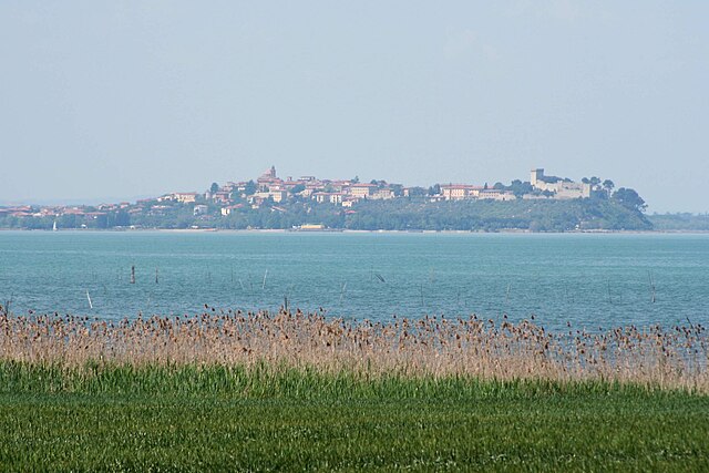
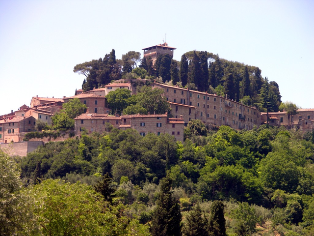
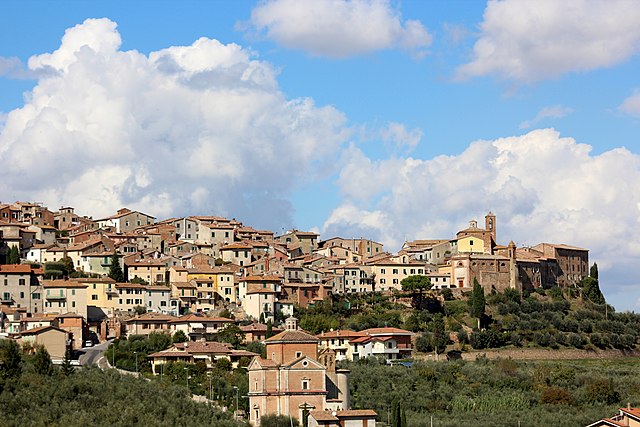
Chiusi, a charming town in the Tuscany region of Italy, is not only rich in history and culture but also offers some beautiful hiking opportunities. Nestled in the rolling hills and surrounded by picturesque landscapes, Chiusi serves as an excellent base for exploring the natural beauty of the area. Here are some highlights and tips for hiking in and around Chiusi:
Trails and Hiking Areas
-
The Chiusi Lake Trail: This is a relatively easy hike that circles around Lago di Chiusi. It's perfect for birdwatching and offers stunning views of the surrounding hills and countryside. The trail is about 5 kilometers and can be done in a couple of hours.
-
Parco Archeologico di Chiusi: While this is more of an archaeological park than a hiking trail, many trails in the vicinity lead to this area where you can explore ancient Etruscan tombs and artifacts, combined with pleasant walks through the woods.
-
Via Francigena: Part of this historic pilgrimage route passes near Chiusi. Hiking a segment of the Via Francigena allows you to experience the rich cultural heritage of the region while enjoying scenic landscapes.
-
Monte Cetona: A short drive from Chiusi, Monte Cetona offers more challenging hikes. The trails here lead to the summit, where you can enjoy breathtaking vistas of the Val d'Orcia and Val di Chiana.
-
Tuscany’s Vineyards: Many trails wind through the vineyards and olive groves surrounding Chiusi. These are typically gentle hikes that provide stunning views of the landscape and opportunities to taste local wines.
Tips for Hiking in Chiusi
-
Season: The best time to hike in Chiusi is during the spring (April to June) and fall (September to October) when the weather is pleasant and the scenery is vibrant.
-
Footwear: Wear sturdy hiking boots, as some trails may be uneven or rocky.
-
Water and Snacks: Always carry enough water and some snacks, especially if you're planning a longer hike.
-
Maps and Apps: Consider downloading hiking apps with GPS capabilities or carry physical maps of the area.
-
Guided Tours: If you're unfamiliar with the area or want to enhance your experience, consider joining a guided hiking tour that can provide insights into the local flora, fauna, and history.
-
Respect Nature: Stick to marked trails and pack out any trash to preserve the natural beauty of Chiusi.
Hiking in Chiusi offers a wonderful combination of nature, history, and local culture, making it a perfect destination for outdoor enthusiasts. Enjoy your hike!
- Country:

- Postal Code: 53043
- Local Dialing Code: 0578
- Licence Plate Code: SI
- Coordinates: 43° 1' 0" N, 11° 57' 0" E


- GPS tracks (wikiloc): [Link]
- AboveSeaLevel: 398 м m
- Area: 58.15 sq km
- Population: 8558
- Web site: http://www.comune.chiusi.siena.it
- Wikipedia en: wiki(en)
- Wikipedia: wiki(it)
- Wikidata storage: Wikidata: Q91185
- Wikipedia Commons Category: [Link]
- Freebase ID: [/m/071htw]
- GeoNames ID: Alt: [6539740]
- BnF ID: [119704681]
- VIAF ID: Alt: [142885898]
- OSM relation ID: [42269]
- GND ID: Alt: [4085259-3]
- UN/LOCODE: [ITUSI]
- Gran Enciclopèdia Catalana ID: [0017616]
- ISTAT ID: 052011
- Italian cadastre code: C662
Shares border with regions:


Castiglione del Lago
- town in Italy
 Hiking in Castiglione del Lago
Castiglione del Lago is a charming town located on the shores of Lake Trasimeno in the Umbria region of Italy. It's a beautiful destination for hiking enthusiasts, offering scenic landscapes, historical sites, and a variety of terrains....
- Country:

- Postal Code: 06061
- Local Dialing Code: 075
- Licence Plate Code: PG
- Coordinates: 43° 7' 38" N, 12° 2' 43" E


- GPS tracks (wikiloc): [Link]
- AboveSeaLevel: 304 м m
- Area: 205.26 sq km
- Population: 15479
- Web site: [Link]


Città della Pieve
- Italian comune
Città della Pieve, located in the Umbria region of Italy, is a charming hilltop town known for its stunning landscapes, historic architecture, and rich cultural heritage. Hiking in this area offers a mix of scenic views, rolling hills, vineyards, and olive groves, making it an appealing destination for outdoor enthusiasts....
- Country:

- Postal Code: 06062
- Local Dialing Code: 0578
- Licence Plate Code: PG
- Coordinates: 42° 57' 14" N, 12° 0' 28" E


- GPS tracks (wikiloc): [Link]
- AboveSeaLevel: 508 м m
- Area: 110.94 sq km
- Population: 7686
- Web site: [Link]


Cetona
- Italian comune
Cetona is a beautiful town located in the Tuscany region of Italy, known for its stunning landscapes and rich history. The area surrounding Cetona offers several hiking opportunities that cater to different skill levels, making it a great destination for outdoor enthusiasts....
- Country:

- Postal Code: 53040
- Local Dialing Code: 0578
- Licence Plate Code: SI
- Coordinates: 42° 58' 0" N, 11° 54' 0" E


- GPS tracks (wikiloc): [Link]
- AboveSeaLevel: 350 м m
- Area: 53.57 sq km
- Population: 2678
- Web site: [Link]


Chianciano Terme
- Italian comune
Chianciano Terme is a charming town in the Tuscany region of Italy, known primarily for its thermal spas, but it also offers beautiful hiking opportunities in the surrounding countryside. Here's an overview of what you can expect when hiking in and around Chianciano Terme:...
- Country:

- Postal Code: 53042
- Local Dialing Code: 0578
- Licence Plate Code: SI
- Coordinates: 43° 4' 0" N, 11° 50' 0" E


- GPS tracks (wikiloc): [Link]
- AboveSeaLevel: 475 м m
- Area: 36.58 sq km
- Population: 7050
- Web site: [Link]


Montepulciano
- Italian comune
Hiking in Montepulciano, a historic town in the Tuscany region of Italy, offers a unique blend of natural beauty, rich history, and stunning landscapes. Here are some key points to consider when planning a hiking trip in this picturesque area:...
- Country:

- Postal Code: 53045
- Local Dialing Code: 0578
- Licence Plate Code: SI
- Coordinates: 43° 6' 0" N, 11° 47' 0" E


- GPS tracks (wikiloc): [Link]
- AboveSeaLevel: 605 м m
- Area: 165.33 sq km
- Population: 13984
- Web site: [Link]


Sarteano
- Italian comune
Sarteano is a charming town located in the Valdichiana area of Tuscany, Italy. Known for its stunning landscapes, medieval architecture, and rich history, Sarteano is an excellent base for hiking enthusiasts looking to explore the picturesque Tuscan countryside....
- Country:

- Postal Code: 53047
- Local Dialing Code: 0578
- Licence Plate Code: SI
- Coordinates: 42° 59' 0" N, 11° 52' 0" E


- GPS tracks (wikiloc): [Link]
- AboveSeaLevel: 525 м m
- Area: 84.81 sq km
- Population: 4705
- Web site: [Link]
