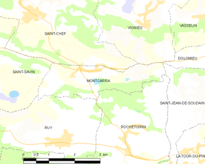
Rochetoirin (Rochetoirin)

- commune in Isère, France
 Hiking in Rochetoirin
Rochetoirin, located in the Auvergne-Rhône-Alpes region of France, is a charming destination for hiking enthusiasts. Nestled near the foothills of the Chartreuse Mountains, the area offers a variety of natural landscapes, from rolling hills to picturesque forests, and a glimpse of local flora and fauna.
Hiking Trails
-
Nature Trails: Many marked trails wind through Rochetoirin and nearby areas. These trails vary in difficulty, making it suitable for both beginner and experienced hikers. Always check local maps for trail conditions and distances.
-
Scenic Views: The region is known for its stunning vistas, especially from higher elevations. Some trails may lead you to viewpoints that offer panoramic views of the surrounding mountains and valleys.
-
Themed Trails: Look out for nature and historical trails that can provide context to the area’s flora, fauna, and history, enriching your hiking experience.
Best Time to Hike
-
Spring (March to June): This is an ideal time to hike, as the weather is generally mild, and the landscape is bursting with wildflowers.
-
Fall (September to November): Autumn brings beautiful foliage and cooler temperatures, making for a pleasant hike.
Safety Tips
-
Weather: Be sure to check the weather before heading out and dress in layers. The weather can change quickly in mountainous areas.
-
Footwear: Wear sturdy, comfortable hiking boots with good grip to ensure stability on various terrain types.
-
Stay on the Trails: To protect the local ecosystem, make sure to stick to marked trails and respect wildlife.
-
Hydration and Nutrition: Carry enough water and snacks, especially if you're planning to hike for several hours.
Local Attractions
After your hike, you can explore local history or enjoy regional cuisine in nearby villages. This area is also known for its peaceful atmosphere, giving you a chance to relax and recharge after an adventurous day in nature.
Make sure to check local regulations, hiking maps, and specific trail information before your visit, and enjoy the natural beauty Rochetoirin has to offer!
- Country:

- Postal Code: 38110
- Coordinates: 45° 34' 54" N, 5° 25' 5" E


- GPS tracks (wikiloc): [Link]
- Area: 10.62 sq km
- Population: 1115
- Web site: http://www.rochetoirin.fr
- Wikipedia en: wiki(en)
- Wikipedia: wiki(fr)
- Wikidata storage: Wikidata: Q661392
- Wikipedia Commons Category: [Link]
- Freebase ID: [/m/03nvjnz]
- GeoNames ID: Alt: [6433306]
- SIREN number: [213803414]
- BnF ID: [15258152p]
- INSEE municipality code: 38341
Shares border with regions:


Cessieu
- commune in Isère, France
Hiking in Cessieu
Cessieu is a charming commune located in the Auvergne-Rhône-Alpes region of France, nestled between the Rhône River and the foothills of the Alps. Although it may not be as widely recognized as some other hiking destinations, it offers various opportunities for outdoor enthusiasts....
- Country:
- Postal Code: 38110
- Coordinates: 45° 34' 0" N, 5° 22' 36" E
- GPS tracks (wikiloc): [Link]
- Area: 14.35 sq km
- Population: 2886
- Web site: [Link]

Montcarra
- commune in Isère, France
Hiking in Montcarra
Montcarra, located in the Isère department of southeastern France, is a beautiful area known for its scenic landscapes and outdoor activities. While it may not be as widely recognized as some of the larger national parks in the Alps, it offers a variety of hiking opportunities that can cater to different skill levels and preferences....
- Country:
- Postal Code: 38890
- Coordinates: 45° 36' 47" N, 5° 23' 29" E
- GPS tracks (wikiloc): [Link]
- Area: 4.9 sq km
- Population: 519
- Web site: [Link]
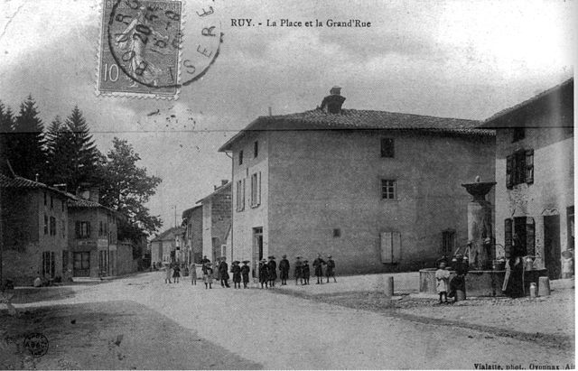

Ruy-Montceau
- commune in Isère, France
Hiking in Ruy-Montceau
Ruy, located in the Isère department of southeastern France, is a charming area that offers a variety of hiking opportunities, taking advantage of the beautiful natural landscapes of the region. Although Ruy itself may not be as widely recognized for hiking as some other areas in the Alps, it's conveniently located near various trails and natural parks that are ideal for outdoor enthusiasts....
- Country:
- Postal Code: 38300
- Coordinates: 45° 35' 18" N, 5° 19' 4" E
- GPS tracks (wikiloc): [Link]
- Area: 20.81 sq km
- Population: 4434
- Web site: [Link]


Saint-Jean-de-Soudain
- commune in Isère, France
Hiking in Saint-Jean-de-Soudain
Saint-Jean-de-Soudain is a picturesque village located in the Isère department of the Auvergne-Rhône-Alpes region in southeastern France. It's an excellent base for hikers looking to explore the natural landscapes and mountainous terrain nearby....
- Country:
- Postal Code: 38110
- Coordinates: 45° 34' 21" N, 5° 25' 44" E
- GPS tracks (wikiloc): [Link]
- Area: 7.48 sq km
- Population: 1572
- Web site: [Link]