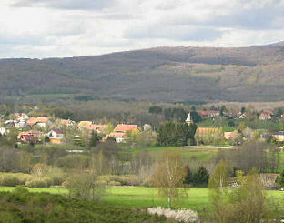
Frahier-et-Chatebier (Frahier-et-Chatebier)

- commune in Haute-Saône, France
- Country:

- Postal Code: 70400
- Coordinates: 47° 39' 37" N, 6° 44' 51" E


- GPS tracks (wikiloc): [Link]
- Area: 17.39 sq km
- Population: 1360
- Web site: http://frahier.ccrc70.fr/
- Wikipedia en: wiki(en)
- Wikipedia: wiki(fr)
- Wikidata storage: Wikidata: Q617625
- Wikipedia Commons Category: [Link]
- Freebase ID: [/m/03nvtps]
- GeoNames ID: Alt: [6614331]
- SIREN number: [217002484]
- BnF ID: [15272641c]
- INSEE municipality code: 70248
Shares border with regions:


Échavanne
- commune in Haute-Saône, France
- Country:
- Postal Code: 70400
- Coordinates: 47° 39' 25" N, 6° 43' 53" E
- GPS tracks (wikiloc): [Link]
- Area: 3.21 sq km
- Population: 205
- Web site: [Link]

Évette-Salbert
- commune in Territoire de Belfort, France
- Country:
- Postal Code: 90350
- Coordinates: 47° 40' 30" N, 6° 47' 54" E
- GPS tracks (wikiloc): [Link]
- AboveSeaLevel: 391 м m
- Area: 9.16 sq km
- Population: 2073
- Web site: [Link]

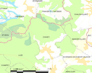
Chagey
- commune in Haute-Saône, France
 Hiking in Chagey
Chagey, located in the Haute-Saône department of France, offers a unique hiking experience characterized by its picturesque landscapes and natural beauty. While it is a small village, the surrounding area provides various trails that showcase the region's charming countryside, including rolling hills, forests, and rivers....
- Country:
- Postal Code: 70400
- Coordinates: 47° 36' 43" N, 6° 44' 6" E
- GPS tracks (wikiloc): [Link]
- Area: 6.99 sq km
- Population: 651

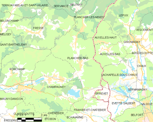
Plancher-Bas
- commune in Haute-Saône, France
- Country:
- Postal Code: 70290
- Coordinates: 47° 43' 16" N, 6° 43' 58" E
- GPS tracks (wikiloc): [Link]
- Area: 29.12 sq km
- Population: 1963
- Web site: [Link]


Champagney
- commune in Haute-Saône, France
- Country:
- Postal Code: 70290
- Coordinates: 47° 42' 21" N, 6° 40' 56" E
- GPS tracks (wikiloc): [Link]
- AboveSeaLevel: 388 м m
- Area: 36.71 sq km
- Population: 3811
- Web site: [Link]

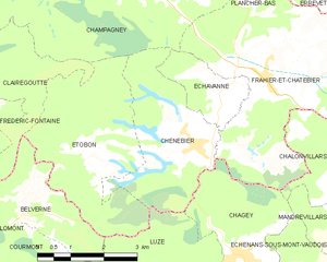
Chenebier
- commune in Haute-Saône, France
- Country:
- Postal Code: 70400
- Coordinates: 47° 38' 30" N, 6° 43' 7" E
- GPS tracks (wikiloc): [Link]
- Area: 9.05 sq km
- Population: 706
- Web site: [Link]

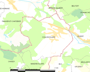
Châlonvillars
- commune in Haute-Saône, France
- Country:
- Postal Code: 70400
- Coordinates: 47° 38' 22" N, 6° 47' 11" E
- GPS tracks (wikiloc): [Link]
- Area: 7.6 sq km
- Population: 1256
- Web site: [Link]


Errevet
- commune in Haute-Saône, France
- Country:
- Postal Code: 70400
- Coordinates: 47° 41' 6" N, 6° 46' 33" E
- GPS tracks (wikiloc): [Link]
- Area: 3.28 sq km
- Population: 251
- Web site: [Link]