Eguenigue (Eguenigue)
- commune in Territoire de Belfort, France
It seems there might be a misunderstanding, as "Eguenigue" doesn't appear to correspond to any well-known hiking destination or region that I'm familiar with. It's possible that the name may be misspelled or it refers to a lesser-known location.
If you're looking for hiking information, perhaps you meant a different place? Common hiking areas include national parks, mountainous regions, or specific trails where hikers gather for nature walks and challenging hikes. Please provide more context or double-check the name, and I'd be happy to help with information on hiking in that area.
- Country:

- Postal Code: 90150
- Coordinates: 47° 40' 13" N, 6° 56' 5" E


- GPS tracks (wikiloc): [Link]
- Area: 2.49 sq km
- Population: 281
- Wikipedia en: wiki(en)
- Wikipedia: wiki(fr)
- Wikidata storage: Wikidata: Q616860
- Wikipedia Commons Category: [Link]
- Freebase ID: [/m/03mh9g9]
- Freebase ID: [/m/03mh9g9]
- Freebase ID: [/m/03mh9g9]
- GeoNames ID: Alt: [6451893]
- GeoNames ID: Alt: [6451893]
- GeoNames ID: Alt: [6451893]
- SIREN number: [219000361]
- SIREN number: [219000361]
- SIREN number: [219000361]
- BnF ID: [15279977w]
- BnF ID: [15279977w]
- BnF ID: [15279977w]
- INSEE municipality code: 90036
- INSEE municipality code: 90036
- INSEE municipality code: 90036
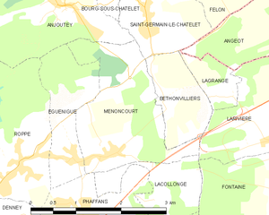
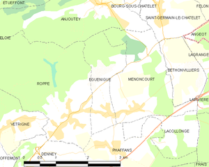
Shares border with regions:


Menoncourt
- commune in Territoire de Belfort, France
Menoncourt is a charming commune located in the Doubs department in eastern France, close to the border with Switzerland. While it may not be widely recognized as a hiking destination, the surrounding region offers a variety of trails and scenic landscapes ideal for outdoor enthusiasts....
- Country:

- Postal Code: 90150
- Coordinates: 47° 40' 14" N, 6° 56' 38" E


- GPS tracks (wikiloc): [Link]
- Area: 4.7 sq km
- Population: 397
- Web site: [Link]

Anjoutey
- commune in Territoire de Belfort, France
- Country:

- Postal Code: 90170
- Coordinates: 47° 42' 4" N, 6° 55' 57" E


- GPS tracks (wikiloc): [Link]
- Area: 7.69 sq km
- Population: 618


Roppe
- commune in Territoire de Belfort, France
Roppe, located in France's Haute-Saône department in the Bourgogne-Franche-Comté region, offers a charming environment for hiking enthusiasts. While it may not be as widely recognized as some larger hiking destinations, Roppe and its surroundings provide a peaceful experience for those looking to explore natural landscapes....
- Country:

- Postal Code: 90380
- Coordinates: 47° 40' 14" N, 6° 55' 10" E


- GPS tracks (wikiloc): [Link]
- Area: 7.43 sq km
- Population: 1005


Phaffans
- commune in Territoire de Belfort, France
It appears there may be a mix-up with the name "Phaffans," as I couldn't find any specific hiking locations or trails with that exact name. However, if you're referring to a specific region, place, or trail that might be commonly known by another name, please clarify, and I'd be happy to provide information....
- Country:

- Postal Code: 90150
- Coordinates: 47° 39' 37" N, 6° 56' 4" E


- GPS tracks (wikiloc): [Link]
- Area: 3.24 sq km
- Population: 442

