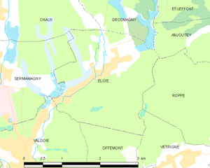
Roppe (Roppe)
- commune in Territoire de Belfort, France
Roppe, located in France's Haute-Saône department in the Bourgogne-Franche-Comté region, offers a charming environment for hiking enthusiasts. While it may not be as widely recognized as some larger hiking destinations, Roppe and its surroundings provide a peaceful experience for those looking to explore natural landscapes.
Hiking Opportunities in Roppe:
-
Scenic Trails: The area around Roppe features a mix of terrain, including forests, hills, and fields, making it perfect for various hiking levels. Look for local trails that meander through the countryside and offer lovely views of the surrounding landscapes.
-
Nature Reserves and Parks: Nearby parks and nature reserves can be excellent for hiking. These areas often have marked trails suitable for both beginners and more experienced hikers, providing an opportunity to spot local wildlife and enjoy the flora.
-
Local Amenities: Roppe is relatively small, but the nearby towns may have amenities such as shops, cafés, or accommodation options for hikers. It’s a good idea to plan your hike with access to food and water.
-
Cultural Exploration: While hiking, consider exploring the local culture and history. There may be historical sites, rural architecture, and local attractions that can enhance your hiking experience.
-
Weather Considerations: Always check the weather forecast before hiking. The region can have varied weather conditions, so it's important to dress appropriately and be prepared for sudden changes.
-
Safety: As with any hiking adventure, ensure you have a good map, appropriate gear, and inform someone of your plans. Pay attention to trail markers and local guidelines.
If you're looking to hike in Roppe, consider taking some time to explore the broader region as well, as there are often hidden gems and picturesque trails waiting to be discovered!
- Country:

- Postal Code: 90380
- Coordinates: 47° 40' 14" N, 6° 55' 10" E


- GPS tracks (wikiloc): [Link]
- Area: 7.43 sq km
- Population: 1005
- Wikipedia en: wiki(en)
- Wikipedia: wiki(fr)
- Wikidata storage: Wikidata: Q843443
- Wikipedia Commons Category: [Link]
- Freebase ID: [/m/03mhg_f]
- Freebase ID: [/m/03mhg_f]
- Freebase ID: [/m/03mhg_f]
- GeoNames ID: Alt: [6451931]
- GeoNames ID: Alt: [6451931]
- GeoNames ID: Alt: [6451931]
- SIREN number: [219000874]
- SIREN number: [219000874]
- SIREN number: [219000874]
- BnF ID: [152800287]
- BnF ID: [152800287]
- BnF ID: [152800287]
- INSEE municipality code: 90087
- INSEE municipality code: 90087
- INSEE municipality code: 90087
Shares border with regions:

Éloie
- commune in Territoire de Belfort, France
- Country:

- Postal Code: 90300
- Coordinates: 47° 41' 26" N, 6° 52' 25" E


- GPS tracks (wikiloc): [Link]
- Area: 5.55 sq km
- Population: 958
- Web site: [Link]

Anjoutey
- commune in Territoire de Belfort, France
- Country:

- Postal Code: 90170
- Coordinates: 47° 42' 4" N, 6° 55' 57" E


- GPS tracks (wikiloc): [Link]
- Area: 7.69 sq km
- Population: 618


Eguenigue
- commune in Territoire de Belfort, France
It seems there might be a misunderstanding, as "Eguenigue" doesn't appear to correspond to any well-known hiking destination or region that I'm familiar with. It's possible that the name may be misspelled or it refers to a lesser-known location....
- Country:

- Postal Code: 90150
- Coordinates: 47° 40' 13" N, 6° 56' 5" E


- GPS tracks (wikiloc): [Link]
- Area: 2.49 sq km
- Population: 281


Denney
- commune in Territoire de Belfort, France
Denney, located in the Territoire de Belfort in the Bourgogne-Franche-Comté region of France, offers a lovely outdoor experience for hikers. This area is characterized by its diverse landscapes, combining rolling hills, forests, and open countryside, making it suitable for hikes of varying lengths and difficulties....
- Country:

- Postal Code: 90160
- Coordinates: 47° 39' 32" N, 6° 55' 2" E


- GPS tracks (wikiloc): [Link]
- Area: 3.48 sq km
- Population: 772
- Web site: [Link]


Phaffans
- commune in Territoire de Belfort, France
It appears there may be a mix-up with the name "Phaffans," as I couldn't find any specific hiking locations or trails with that exact name. However, if you're referring to a specific region, place, or trail that might be commonly known by another name, please clarify, and I'd be happy to provide information....
- Country:

- Postal Code: 90150
- Coordinates: 47° 39' 37" N, 6° 56' 4" E


- GPS tracks (wikiloc): [Link]
- Area: 3.24 sq km
- Population: 442


Vétrigne
- commune in Territoire de Belfort, France
- Country:

- Postal Code: 90300
- Coordinates: 47° 40' 6" N, 6° 53' 38" E


- GPS tracks (wikiloc): [Link]
- Area: 2.46 sq km
- Population: 633
- Web site: [Link]

