Larivière (Larivière)
- commune in Territoire de Belfort, France
Larivière, located in the Territoire de Belfort region in eastern France, offers a variety of hiking opportunities that showcase the beautiful landscapes of this area. This region is characterized by its rolling hills, dense forests, and scenic views of the surrounding countryside.
Hiking Trails:
-
Local Trails: There are numerous marked trails around Larivière that cater to various skill levels. These trails often meander through forests and can take you past streams and small ponds, providing a peaceful hiking experience.
-
Mountagne du Fort: A popular destination for hikers in the vicinity, where you can find trails that lead to higher elevations with impressive panoramic views of the Belfort region and the nearby Vosges mountains.
-
Green Ways: The area is connected to several greenways and paths that offer a safe and pleasant hiking experience, ideal for families and leisure hikers.
Flora and Fauna:
Hiking in Larivière allows you to experience diverse ecosystems. Be on the lookout for various plant species and wildlife, including deer, wild boars, and numerous bird species that inhabit the region.
Best Time to Hike:
The best time for hiking in Larivière is from late spring to early autumn (May to September) when the weather is mild and the trails are dry. Fall can also be a beautiful time to hike due to the changing foliage.
Preparation Tips:
- Maps and Guides: Always carry a map of the area or a hiking guide, as some trails may not be well-signed.
- Sufficient Water and Snacks: Hydration and energy snacks are crucial for a comfortable hike.
- Appropriate Gear: Wear proper hiking shoes and weather-appropriate clothing. Check the weather forecast before heading out.
- Safety: Inform someone about your hiking plans and estimated return time.
Local Attractions:
After a day of hiking, you might want to explore nearby attractions such as the historic town of Belfort, known for its impressive citadel, or the natural parks and landscapes of the regional Vosges mountains.
Overall, hiking in Larivière provides a wonderful way to connect with nature in a relatively less crowded setting, ensuring a peaceful and rejuvenating outdoor experience.
- Country:

- Postal Code: 90150
- Coordinates: 47° 40' 35" N, 6° 59' 52" E


- GPS tracks (wikiloc): [Link]
- Area: 4.84 sq km
- Population: 325
- Wikipedia en: wiki(en)
- Wikipedia: wiki(fr)
- Wikidata storage: Wikidata: Q915252
- Wikipedia Commons Category: [Link]
- Freebase ID: [/m/03mhf9t]
- Freebase ID: [/m/03mhf9t]
- Freebase ID: [/m/03mhf9t]
- GeoNames ID: Alt: [6451912]
- GeoNames ID: Alt: [6451912]
- GeoNames ID: Alt: [6451912]
- SIREN number: [219000627]
- SIREN number: [219000627]
- SIREN number: [219000627]
- BnF ID: [15280003w]
- BnF ID: [15280003w]
- BnF ID: [15280003w]
- INSEE municipality code: 90062
- INSEE municipality code: 90062
- INSEE municipality code: 90062
Shares border with regions:

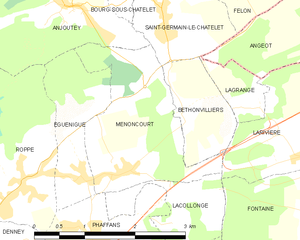
Menoncourt
- commune in Territoire de Belfort, France
Menoncourt is a charming commune located in the Doubs department in eastern France, close to the border with Switzerland. While it may not be widely recognized as a hiking destination, the surrounding region offers a variety of trails and scenic landscapes ideal for outdoor enthusiasts....
- Country:

- Postal Code: 90150
- Coordinates: 47° 40' 14" N, 6° 56' 38" E


- GPS tracks (wikiloc): [Link]
- Area: 4.7 sq km
- Population: 397
- Web site: [Link]


Angeot
- commune in Territoire de Belfort, France
It seems there might be a typo or confusion regarding "Angeot." If you meant "Angiot," it’s not a recognized location for hiking that I'm aware of up to 2023. However, if you meant to refer to a specific region or area known for hiking, such as a national park or a famous trail, please clarify so I can provide more tailored information....
- Country:

- Postal Code: 90150
- Coordinates: 47° 41' 47" N, 7° 0' 50" E


- GPS tracks (wikiloc): [Link]
- Area: 6.56 sq km
- Population: 336
- Web site: [Link]
Bethonvilliers
- commune in Territoire de Belfort, France
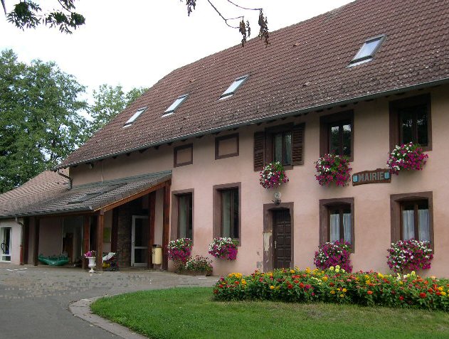
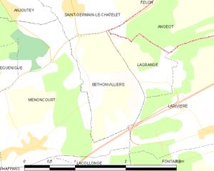
Bethonvilliers, a picturesque village in the French countryside, offers beautiful hiking opportunities for both beginners and experienced hikers. The surrounding area is characterized by rolling hills, lush forests, and charming rural landscapes, making it an ideal location for outdoor activities....
- Country:

- Postal Code: 90150
- Coordinates: 47° 40' 50" N, 6° 57' 44" E


- GPS tracks (wikiloc): [Link]
- Area: 1.9 sq km
- Population: 254
Fontaine
- commune in Territoire de Belfort, France
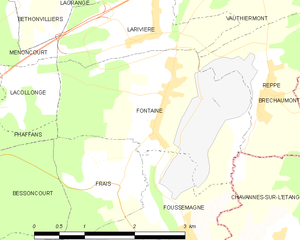
Fontaine, located in the Territoire de Belfort in the Bourgogne-Franche-Comté region of France, offers a picturesque backdrop for hiking enthusiasts. The area is characterized by its rolling landscapes, lush forests, and proximity to the Vosges Mountains and Jura region, making it an appealing destination for nature lovers....
- Country:

- Postal Code: 90150
- Coordinates: 47° 39' 34" N, 6° 59' 56" E


- GPS tracks (wikiloc): [Link]
- Area: 6.96 sq km
- Population: 611
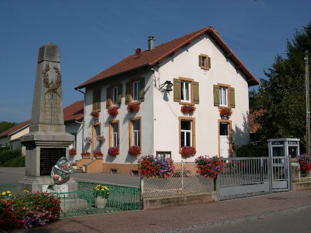
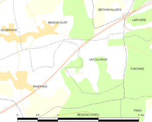
Lacollonge
- commune in Territoire de Belfort, France
Lacollonge is not a widely recognized hiking destination as of my last update, and it seems you might be referring to a lesser-known area. It could also be a misspelling or a specific local area that might not be well-documented in broader hiking resources. However, if you meant "La Collonge" or a similar-sounding area, please specify the location or region to provide you with relevant hiking tips, trails, and advice....
- Country:

- Postal Code: 90150
- Coordinates: 47° 39' 50" N, 6° 57' 36" E


- GPS tracks (wikiloc): [Link]
- Area: 1.92 sq km
- Population: 239


Vauthiermont
- commune in Territoire de Belfort, France
Vauthiermont is a lesser-known but beautiful hiking destination located in the region of the Vosges mountains in northeastern France. The area is ideal for nature lovers and offers a variety of trails suitable for different skill levels. Here are some highlights of hiking in Vauthiermont:...
- Country:

- Postal Code: 90150
- Coordinates: 47° 41' 6" N, 7° 1' 57" E


- GPS tracks (wikiloc): [Link]
- Area: 4.74 sq km
- Population: 227
- Web site: [Link]

Lagrange
- commune in Territoire de Belfort, France
Lagrange, located in the Territoire de Belfort region in France, offers a serene hiking experience amidst beautiful natural landscapes. This area is characterized by rolling hills, dense forests, and picturesque countryside, making it a wonderful destination for outdoor enthusiasts....
- Country:

- Postal Code: 90150
- Coordinates: 47° 40' 50" N, 6° 58' 45" E


- GPS tracks (wikiloc): [Link]
- Area: 0.93 sq km
- Population: 125

