
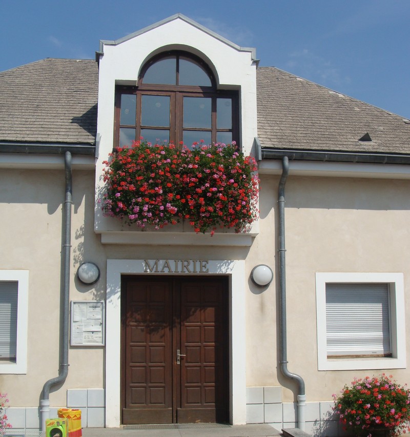
Gap (Gap)
- commune in Hautes-Alpes, France
 Hiking in Gap
Gap, located in the Hautes-Alpes region of southeastern France, is a wonderful destination for hiking enthusiasts. Surrounded by majestic mountains and alpine landscapes, it offers a variety of trails that cater to all levels of hikers, from beginners to experienced trekkers.
Highlights of Hiking in Gap and Surrounding Areas:
-
Diverse Terrain: The region features diverse landscapes, including lush valleys, rugged mountains, and beautiful lakes. The proximity to the Écrins National Park provides access to stunning alpine scenery and a wide range of trails.
-
Variety of Trails: There are numerous hiking trails in the area, which can be explored depending on your skill level. Some popular hikes include:
- Col de la Croix des Têtes: A moderate hike that provides panoramic views of the surrounding peaks.
- Lac de Rossa: A beautiful lake hike that's great for families and offers a scenic backdrop for a picnic.
- Le Parc National des Écrins: Offers more challenging trails that lead through breathtaking landscapes, ideal for seasoned hikers.
-
Accessibility: Gap serves as a central hub for hikers, with many trails starting from or passing through the town. This makes it easy to plan day hikes without needing extensive travel.
-
Wildlife and Flora: The Hautes-Alpes region is home to a rich variety of flora and fauna. Keep an eye out for marmots, chamois, and a variety of birds. The flora is diverse, with beautiful wildflowers in the spring and summer months.
-
Cultural Experience: Besides hiking, Gap has a charming town center with historical sites, local markets, and cafes where hikers can experience the local culture and cuisine.
Tips for Hiking in Gap:
- Weather Check: Always check the weather conditions before heading out, as mountain weather can change rapidly.
- Gear Up: Wear appropriate hiking shoes and carry a good backpack with water, snacks, maps, and a first-aid kit.
- Stay on Marked Trails: To preserve the natural environment and ensure safety, stick to marked trails and follow any local guidelines.
- Respect Wildlife: Keep a safe distance from wildlife and do not feed animals, as it can disrupt their natural behaviors.
Whether you're looking for a leisurely stroll through picturesque valleys or a challenging trek into the mountains, Gap offers a stunning backdrop and a range of options to make your hiking adventure unforgettable.
- Country:

- Postal Code: 05000
- Coordinates: 44° 33' 31" N, 6° 4' 40" E


- GPS tracks (wikiloc): [Link]
- Area: 110.43 sq km
- Population: 40776
- Web site: http://www.ville-gap.fr
- Wikipedia en: wiki(en)
- Wikipedia: wiki(fr)
- Wikidata storage: Wikidata: Q175081
- Wikipedia Commons Gallery: [Link]
- Wikipedia Commons Category: [Link]
- Wikipedia Commons Maps Category: [Link]
- Freebase ID: [/m/01_2rm]
- Freebase ID: [/m/01_2rm]
- Freebase ID: [/m/01_2rm]
- Freebase ID: [/m/01_2rm]
- Freebase ID: [/m/01_2rm]
- Freebase ID: [/m/01_2rm]
- Freebase ID: [/m/01_2rm]
- GeoNames ID: Alt: [3016702]
- GeoNames ID: Alt: [3016702]
- GeoNames ID: Alt: [3016702]
- GeoNames ID: Alt: [3016702]
- GeoNames ID: Alt: [3016702]
- GeoNames ID: Alt: [3016702]
- GeoNames ID: Alt: [3016702]
- SIREN number: [210500617]
- SIREN number: [210500617]
- SIREN number: [210500617]
- SIREN number: [210500617]
- SIREN number: [210500617]
- SIREN number: [210500617]
- SIREN number: [210500617]
- BnF ID: [11853941h]
- BnF ID: [11853941h]
- BnF ID: [11853941h]
- BnF ID: [11853941h]
- BnF ID: [11853941h]
- BnF ID: [11853941h]
- BnF ID: [11853941h]
- VIAF ID: Alt: [153138740]
- VIAF ID: Alt: [153138740]
- VIAF ID: Alt: [153138740]
- VIAF ID: Alt: [153138740]
- VIAF ID: Alt: [153138740]
- VIAF ID: Alt: [153138740]
- VIAF ID: Alt: [153138740]
- GND ID: Alt: [4237906-4]
- GND ID: Alt: [4237906-4]
- GND ID: Alt: [4237906-4]
- GND ID: Alt: [4237906-4]
- GND ID: Alt: [4237906-4]
- GND ID: Alt: [4237906-4]
- GND ID: Alt: [4237906-4]
- Library of Congress authority ID: Alt: [n82105403]
- Library of Congress authority ID: Alt: [n82105403]
- Library of Congress authority ID: Alt: [n82105403]
- Library of Congress authority ID: Alt: [n82105403]
- Library of Congress authority ID: Alt: [n82105403]
- Library of Congress authority ID: Alt: [n82105403]
- Library of Congress authority ID: Alt: [n82105403]
- PACTOLS thesaurus ID: [pcrtc0mvOyf7SS]
- PACTOLS thesaurus ID: [pcrtc0mvOyf7SS]
- PACTOLS thesaurus ID: [pcrtc0mvOyf7SS]
- PACTOLS thesaurus ID: [pcrtc0mvOyf7SS]
- PACTOLS thesaurus ID: [pcrtc0mvOyf7SS]
- PACTOLS thesaurus ID: [pcrtc0mvOyf7SS]
- PACTOLS thesaurus ID: [pcrtc0mvOyf7SS]
- MusicBrainz area ID: [33be41fa-af3f-4541-a82b-f59f6addf959]
- MusicBrainz area ID: [33be41fa-af3f-4541-a82b-f59f6addf959]
- MusicBrainz area ID: [33be41fa-af3f-4541-a82b-f59f6addf959]
- MusicBrainz area ID: [33be41fa-af3f-4541-a82b-f59f6addf959]
- MusicBrainz area ID: [33be41fa-af3f-4541-a82b-f59f6addf959]
- MusicBrainz area ID: [33be41fa-af3f-4541-a82b-f59f6addf959]
- MusicBrainz area ID: [33be41fa-af3f-4541-a82b-f59f6addf959]
- SUDOC authorities ID: [113617348]
- SUDOC authorities ID: [113617348]
- SUDOC authorities ID: [113617348]
- SUDOC authorities ID: [113617348]
- SUDOC authorities ID: [113617348]
- SUDOC authorities ID: [113617348]
- SUDOC authorities ID: [113617348]
- Encyclopædia Universalis ID: [gap]
- Encyclopædia Universalis ID: [gap]
- Encyclopædia Universalis ID: [gap]
- Encyclopædia Universalis ID: [gap]
- Encyclopædia Universalis ID: [gap]
- Encyclopædia Universalis ID: [gap]
- Encyclopædia Universalis ID: [gap]
- Digital Atlas of the Roman Empire ID: [189]
- Digital Atlas of the Roman Empire ID: [189]
- Digital Atlas of the Roman Empire ID: [189]
- Digital Atlas of the Roman Empire ID: [189]
- Digital Atlas of the Roman Empire ID: [189]
- Digital Atlas of the Roman Empire ID: [189]
- Digital Atlas of the Roman Empire ID: [189]
- ISNI: Alt: [0000 0001 0945 5624]
- ISNI: Alt: [0000 0001 0945 5624]
- ISNI: Alt: [0000 0001 0945 5624]
- ISNI: Alt: [0000 0001 0945 5624]
- ISNI: Alt: [0000 0001 0945 5624]
- ISNI: Alt: [0000 0001 0945 5624]
- ISNI: Alt: [0000 0001 0945 5624]
- YouTube channel ID: [UCcGxjbg82M9EE0_QF3zuGuQ]
- YouTube channel ID: [UCcGxjbg82M9EE0_QF3zuGuQ]
- YouTube channel ID: [UCcGxjbg82M9EE0_QF3zuGuQ]
- YouTube channel ID: [UCcGxjbg82M9EE0_QF3zuGuQ]
- YouTube channel ID: [UCcGxjbg82M9EE0_QF3zuGuQ]
- YouTube channel ID: [UCcGxjbg82M9EE0_QF3zuGuQ]
- YouTube channel ID: [UCcGxjbg82M9EE0_QF3zuGuQ]
- INSEE municipality code: 05061
- INSEE municipality code: 05061
- INSEE municipality code: 05061
- INSEE municipality code: 05061
- INSEE municipality code: 05061
- INSEE municipality code: 05061
- INSEE municipality code: 05061
Shares border with regions:

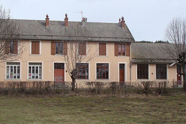
Châteauvieux
- commune in Hautes-Alpes, France
Hiking in Châteauvieux
Châteauvieux, located in the Hautes-Alpes region of France, is a charming village surrounded by stunning natural landscapes, making it an excellent destination for hiking enthusiasts. The area features a variety of trails that cater to different skill levels, offering opportunities to explore both gentle walks and more challenging hikes....
- Country:
- Postal Code: 05000
- Coordinates: 44° 29' 2" N, 6° 3' 4" E
- GPS tracks (wikiloc): [Link]
- AboveSeaLevel: 783 м m
- Area: 7.07 sq km
- Population: 485

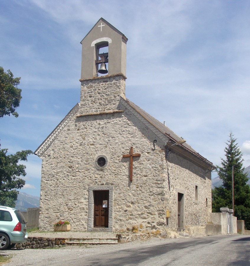
Rambaud
- commune in Hautes-Alpes, France
Hiking in Rambaud
Rambaud, located in the Hautes-Alpes region of southeastern France, is a beautiful destination for hiking enthusiasts. This area is known for its stunning alpine landscapes, diverse flora and fauna, and a variety of trails that cater to different skill levels. Here’s an overview of what you can expect when hiking in Rambaud:...
- Country:
- Postal Code: 05000
- Coordinates: 44° 32' 42" N, 6° 7' 56" E
- GPS tracks (wikiloc): [Link]
- Area: 10.71 sq km
- Population: 374
- Web site: [Link]

Saint-Laurent-du-Cros
- commune in Hautes-Alpes, France
Hiking in Saint-Laurent-du-Cros
Saint-Laurent-du-Cros is a charming village located in the Hautes-Alpes region of France. It’s an excellent base for outdoor enthusiasts, especially hikers, given its proximity to the Écrins National Park and the stunning landscapes of the Southern Alps....
- Country:
- Postal Code: 05500
- Coordinates: 44° 38' 38" N, 6° 6' 39" E
- GPS tracks (wikiloc): [Link]
- Area: 12.69 sq km
- Population: 520
Neffes
- commune in Hautes-Alpes, France
Hiking in Neffes
Neffes is not a widely recognized hiking destination, so it’s possible that you’re referring to a specific area or trail that's less known. If you’re referring to a particular region, here are a few general tips and considerations for hiking in lesser-known areas:...
- Country:
- Postal Code: 05000
- Coordinates: 44° 30' 16" N, 6° 1' 20" E
- GPS tracks (wikiloc): [Link]
- Area: 8.36 sq km
- Population: 744

Le Noyer
- commune in Hautes-Alpes, France
Hiking in Le Noyer
Le Noyer, located in the Hautes-Alpes region of southeastern France, is an excellent destination for hiking enthusiasts. This charming alpine village is situated near the Écrins National Park, which offers a diverse range of trails suitable for different skill levels, from beginners to more experienced hikers....
- Country:
- Postal Code: 05500
- Coordinates: 44° 41' 55" N, 6° 0' 45" E
- GPS tracks (wikiloc): [Link]
- Area: 21.5 sq km
- Population: 289

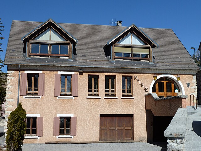
Pelleautier
- commune in Hautes-Alpes, France
Hiking in Pelleautier
Pelleautier is a beautiful commune located in the Hautes-Alpes region of southeastern France. Nestled near the foot of the Écrins mountains and close to the city of Gap, it offers a range of hiking opportunities that cater to various skill levels....
- Country:
- Postal Code: 05000
- Coordinates: 44° 31' 1" N, 6° 1' 0" E
- GPS tracks (wikiloc): [Link]
- Area: 12.81 sq km
- Population: 684

La Fare-en-Champsaur
- commune in Hautes-Alpes, France
Hiking in La Fare-en-Champsaur
La Fare-en-Champsaur is a picturesque village located in the French Alps, within the Hautes-Alpes department of the Provence-Alpes-Côte d'Azur region. It is an excellent base for hiking enthusiasts, offering a variety of trails that cater to different skill levels and preferences....
- Country:
- Postal Code: 05500
- Coordinates: 44° 40' 32" N, 6° 4' 19" E
- GPS tracks (wikiloc): [Link]
- Area: 10.27 sq km
- Population: 453

Jarjayes
- commune in Hautes-Alpes, France
Hiking in Jarjayes
Jarjayes is a charming commune located in the Provence-Alpes-Côte d'Azur region of southeastern France, near the city of Gap, which sits at a lovely elevation and provides beautiful views of the surrounding countryside. The area is characterized by its diverse landscapes, including mountains, forests, and meadows, making it a fantastic destination for hiking enthusiasts....
- Country:
- Postal Code: 05130
- Coordinates: 44° 30' 19" N, 6° 6' 38" E
- GPS tracks (wikiloc): [Link]
- Area: 22.67 sq km
- Population: 421
Poligny
- commune in Hautes-Alpes, France
Hiking in Poligny
Poligny, situated in the Hautes-Alpes region of southeastern France, is a fantastic destination for hikers, offering stunning landscapes, diverse trails, and a variety of outdoor activities....
- Country:
- Postal Code: 05500
- Coordinates: 44° 41' 30" N, 6° 2' 50" E
- GPS tracks (wikiloc): [Link]
- Area: 13.81 sq km
- Population: 302

La Roche-des-Arnauds
- commune in Hautes-Alpes, France
Hiking in La Roche-des-Arnauds
La Roche-des-Arnauds is a charming commune in the Hautes-Alpes department of southeastern France, known for its stunning natural landscapes and outdoor recreational opportunities, including hiking. Here are some key points to consider if you're planning to hike in this area:...
- Country:
- Postal Code: 05400
- Coordinates: 44° 33' 48" N, 5° 57' 23" E
- GPS tracks (wikiloc): [Link]
- Area: 53.75 sq km
- Population: 1498
Dévoluy
- commune in Hautes-Alpes, France
Hiking in Dévoluy
Le Dévoluy is a stunning mountain range located in the French Alps, known for its diverse landscapes, breathtaking scenery, and extensive hiking opportunities. Whether you're an experienced hiker or a beginner, there's something for everyone in this area....
- Country:
- Postal Code: 05250
- Coordinates: 44° 41' 33" N, 5° 56' 28" E
- GPS tracks (wikiloc): [Link]
- Area: 186.37 sq km
- Population: 1011
- Web site: [Link]

La Freissinouse
- commune in Hautes-Alpes, France
Hiking in La Freissinouse
La Freissinouse is a charming village located in the Hautes-Alpes department of southeastern France, nestled in the heart of the French Alps. The region is known for its stunning natural beauty, making it a great destination for hiking enthusiasts....
- Country:
- Postal Code: 05000
- Coordinates: 44° 32' 5" N, 6° 0' 35" E
- GPS tracks (wikiloc): [Link]
- Area: 8.32 sq km
- Population: 786

Forest-Saint-Julien
- commune in Hautes-Alpes, France
Hiking in Forest-Saint-Julien
Forest-Saint-Julien, located in the Rhône-Alpes region of France, is a picturesque area that offers a variety of hiking opportunities for outdoor enthusiasts. Known for its diverse landscapes, including lush forests, rolling hills, and scenic views of the surrounding mountains, it’s a great destination for nature lovers....
- Country:
- Postal Code: 05260
- Coordinates: 44° 38' 2" N, 6° 8' 8" E
- GPS tracks (wikiloc): [Link]
- Area: 6.95 sq km
- Population: 317

Rabou
- commune in Hautes-Alpes, France
Hiking in Rabou
Rabou is a charming village located in the French Alps, specifically within the Hautes-Alpes region. It is surrounded by stunning natural landscapes, making it an excellent destination for hiking enthusiasts. Here’s what you need to know about hiking in and around Rabou:...
- Country:
- Postal Code: 05400
- Coordinates: 44° 35' 28" N, 6° 0' 20" E
- GPS tracks (wikiloc): [Link]
- Area: 26.56 sq km
- Population: 77

Laye
- commune in Hautes-Alpes, France
Hiking in Laye
Laye, a charming commune in the Hautes-Alpes region of southeastern France, offers beautiful landscapes and a variety of hiking opportunities. Nestled in the French Alps, it boasts stunning mountain views, lush valleys, and diverse wildlife. Here are some key points to consider if you’re planning a hiking adventure in Laye:...
- Country:
- Postal Code: 05500
- Coordinates: 44° 39' 40" N, 6° 5' 3" E
- GPS tracks (wikiloc): [Link]
- Area: 10.55 sq km
- Population: 234

La Rochette
- commune in Hautes-Alpes, France
Hiking in La Rochette
La Rochette, located in the Hautes-Alpes region of southeastern France, offers a fantastic setting for hiking enthusiasts. The area is characterized by stunning alpine landscapes, diverse ecosystems, and a plethora of trails catering to various skill levels....
- Country:
- Postal Code: 05000
- Coordinates: 44° 35' 41" N, 6° 9' 22" E
- GPS tracks (wikiloc): [Link]
- Area: 10.34 sq km
- Population: 472

Saint-Étienne-en-Dévoluy
- former commune in Hautes-Alpes, France
Hiking in Saint-Étienne-en-Dévoluy
Saint-Étienne-en-Dévoluy is a lovely destination for hiking, located in the Dévoluy massif in the French Alps. This area offers a variety of trails suitable for all levels, from gentle walks to more challenging hikes, making it a perfect place for both beginners and experienced hikers....
- Country:
- Postal Code: 05250
- Coordinates: 44° 41' 36" N, 5° 56' 31" E
- GPS tracks (wikiloc): [Link]
- Population: 525
- Web site: [Link]

Lettret
- commune in Hautes-Alpes, France
Hiking in Lettret
Lettret, located in the French Alps, is a beautiful area known for its stunning natural landscapes, making it a fantastic destination for hiking enthusiasts. Here’s what you should know about hiking in Lettret:...
- Country:
- Postal Code: 05130
- Coordinates: 44° 28' 6" N, 6° 3' 40" E
- GPS tracks (wikiloc): [Link]
- Area: 4.2 sq km
- Population: 171
- Web site: [Link]