Dévoluy (Dévoluy)
- commune in Hautes-Alpes, France
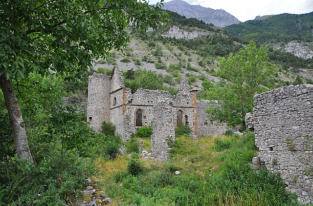
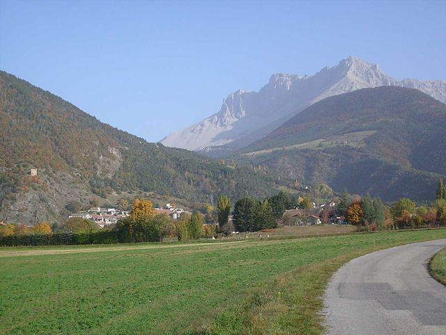
Le Dévoluy is a stunning mountain range located in the French Alps, known for its diverse landscapes, breathtaking scenery, and extensive hiking opportunities. Whether you're an experienced hiker or a beginner, there's something for everyone in this area.
Key Highlights of Hiking in Le Dévoluy:
-
Diverse Trails:
- Le Dévoluy offers a variety of trails that cater to different skill levels. From gentle walks suitable for families to challenging routes for seasoned hikers, you'll find it all here.
- Some popular hikes include the routes to Col de Festre, Pic de Bure, and the Plateau de Bure.
-
Stunning Views:
- Hikers are rewarded with panoramic views of the surrounding mountains, lush valleys, and unique geological formations. The iconic limestone cliffs and open pastures make for picturesque landscapes.
-
Flora and Fauna:
- The region is rich in biodiversity. As you hike, you may encounter a variety of alpine flowers, herbs, and wildlife, including chamois, ibexes, and various bird species.
-
Cultural Heritage:
- The area is dotted with charming villages and local farms, adding a cultural aspect to your hiking experience. You might find opportunities to taste local cheeses and other specialties.
-
Guided Tours and Maps:
- If you're unfamiliar with the area or prefer a guided experience, many local companies offer guided hikes. Maps and trail information are also readily available in tourist offices.
-
Best Time to Hike:
- The ideal time for hiking in Le Dévoluy is from late spring to early autumn (May to October), when the weather is milder and the trails are more accessible. Make sure to check the local weather conditions before heading out.
-
Safety Precautions:
- Always carry enough water, snacks, and a first-aid kit. It's a good idea to let someone know your hiking plans and estimated return time. Wear appropriate footwear and dress in layers for changing weather.
-
Accommodation:
- There are various accommodations available near hiking trails, from cozy mountain lodges to hotels in nearby villages, making it easy to plan an extended stay.
Conclusion
Hiking in Le Dévoluy is a rewarding experience for nature lovers and outdoor enthusiasts. With its combination of stunning scenery, rich biodiversity, and diverse hiking options, it's an excellent destination for your next hiking adventure. Remember to prepare adequately and respect the natural environment to ensure a safe and enjoyable experience. Happy hiking!
- Country:

- Postal Code: 05250
- Coordinates: 44° 41' 33" N, 5° 56' 28" E


- GPS tracks (wikiloc): [Link]
- Area: 186.37 sq km
- Population: 1011
- Web site: http://www.mairiedevoluy.fr
- Wikipedia en: wiki(en)
- Wikipedia: wiki(fr)
- Wikidata storage: Wikidata: Q3222599
- Wikipedia Commons Category: [Link]
- SIREN number: [200033694]
- SIREN number: [200033694]
- OpenCorporates ID: [fr/200033694]
- OpenCorporates ID: [fr/200033694]
- INSEE municipality code: 05139
- INSEE municipality code: 05139
Includes regions:

Agnières-en-Dévoluy
- former commune in Hautes-Alpes, France
Agnières-en-Dévoluy is a beautiful village located in the Dévoluy mountain range in the French Alps. This region is known for its stunning landscapes, diverse flora and fauna, and a variety of hiking trails that cater to different skill levels. Here are some key points about hiking in Agnières-en-Dévoluy:...
- Country:

- Postal Code: 05250
- Coordinates: 44° 41' 42" N, 5° 52' 56" E


- GPS tracks (wikiloc): [Link]
- Population: 287
- Web site: [Link]

La Cluse
- former commune in Hautes-Alpes, France
La Cluse, often referred to as La Cluse and its surrounding areas, is a beautiful destination for hikers looking for scenic views, diverse landscapes, and unique geological features. Located in the Jura region of France, it is characterized by rugged terrain, forests, and panoramic views of both mountains and valleys....
- Country:

- Postal Code: 05250
- Coordinates: 44° 38' 25" N, 5° 50' 56" E


- GPS tracks (wikiloc): [Link]
- Population: 43

Saint-Disdier
- former commune in Hautes-Alpes, France
Saint-Disdier, located in the Hautes-Alpes region of France, offers a wonderful environment for hiking enthusiasts. Surrounded by the stunning landscapes of the Southern French Alps, the area is known for its picturesque trails, diverse ecosystems, and breathtaking views....
- Country:

- Postal Code: 05250
- Coordinates: 44° 44' 0" N, 5° 54' 0" E


- GPS tracks (wikiloc): [Link]
- AboveSeaLevel: 1040 м m
- Population: 139

Saint-Étienne-en-Dévoluy
- former commune in Hautes-Alpes, France
 Hiking in Saint-Étienne-en-Dévoluy
Saint-Étienne-en-Dévoluy is a lovely destination for hiking, located in the Dévoluy massif in the French Alps. This area offers a variety of trails suitable for all levels, from gentle walks to more challenging hikes, making it a perfect place for both beginners and experienced hikers....
- Country:

- Postal Code: 05250
- Coordinates: 44° 41' 36" N, 5° 56' 31" E


- GPS tracks (wikiloc): [Link]
- Population: 525
- Web site: [Link]
Shares border with regions:

Le Glaizil
- commune in Hautes-Alpes, France
Le Glaizil is a picturesque commune located in the Hautes-Alpes department in southeastern France. The surrounding area is known for its stunning landscapes, including mountains, valleys, and diverse flora and fauna, which make it a great destination for hiking enthusiasts....
- Country:

- Postal Code: 05800
- Coordinates: 44° 45' 13" N, 5° 58' 59" E


- GPS tracks (wikiloc): [Link]
- Area: 21.93 sq km
- Population: 174


Monestier-d'Ambel
- commune in Isère, France
Monestier-d'Ambel is a picturesque commune located in the Isère department in the Auvergne-Rhône-Alpes region of southeastern France. Nestled in the French Alps, it offers a variety of hiking opportunities for outdoor enthusiasts. Here are some details about hiking in this area:...
- Country:

- Postal Code: 38970
- Coordinates: 44° 46' 40" N, 5° 55' 37" E


- GPS tracks (wikiloc): [Link]
- Area: 11.02 sq km
- Population: 22
- Web site: [Link]

Le Noyer
- commune in Hautes-Alpes, France
Le Noyer, located in the Hautes-Alpes region of southeastern France, is an excellent destination for hiking enthusiasts. This charming alpine village is situated near the Écrins National Park, which offers a diverse range of trails suitable for different skill levels, from beginners to more experienced hikers....
- Country:

- Postal Code: 05500
- Coordinates: 44° 41' 55" N, 6° 0' 45" E


- GPS tracks (wikiloc): [Link]
- Area: 21.5 sq km
- Population: 289


Pellafol
- commune in Isère, France
Pellafol, a picturesque village located in the Isère department of the Auvergne-Rhône-Alpes region in France, is a hidden gem for hiking enthusiasts. Nestled in the foothills of the French Alps, it offers stunning landscapes, diverse flora and fauna, and a variety of trails suitable for all skill levels....
- Country:

- Postal Code: 38970
- Coordinates: 44° 47' 51" N, 5° 54' 27" E


- GPS tracks (wikiloc): [Link]
- Area: 34.73 sq km
- Population: 137

La Roche-des-Arnauds
- commune in Hautes-Alpes, France
 Hiking in La Roche-des-Arnauds
La Roche-des-Arnauds is a charming commune in the Hautes-Alpes department of southeastern France, known for its stunning natural landscapes and outdoor recreational opportunities, including hiking. Here are some key points to consider if you're planning to hike in this area:...
- Country:

- Postal Code: 05400
- Coordinates: 44° 33' 48" N, 5° 57' 23" E


- GPS tracks (wikiloc): [Link]
- Area: 53.75 sq km
- Population: 1498

Gap
- commune in Hautes-Alpes, France
Gap, located in the Hautes-Alpes region of southeastern France, is a wonderful destination for hiking enthusiasts. Surrounded by majestic mountains and alpine landscapes, it offers a variety of trails that cater to all levels of hikers, from beginners to experienced trekkers....
- Country:

- Postal Code: 05000
- Coordinates: 44° 33' 31" N, 6° 4' 40" E


- GPS tracks (wikiloc): [Link]
- Area: 110.43 sq km
- Population: 40776
- Web site: [Link]

Aspres-sur-Buëch
- commune in Hautes-Alpes, France
Aspres-sur-Buëch is a charming commune located in the Hautes-Alpes region of France, offering a range of hiking opportunities amidst stunning natural landscapes. The area is characterized by its picturesque valleys, rugged terrain, and beautiful views of the surrounding mountains. Here are some highlights for hiking around Aspres-sur-Buëch:...
- Country:

- Postal Code: 05140
- Coordinates: 44° 31' 25" N, 5° 44' 59" E


- GPS tracks (wikiloc): [Link]
- Area: 42.65 sq km
- Population: 832


Lus-la-Croix-Haute
- commune in Drôme, France
Lus-la-Croix-Haute is a beautiful destination for hiking enthusiasts, located in the picturesque Alps of France. This charming village offers a variety of trails that cater to different levels of hikers, from beginners to experienced adventurers....
- Country:

- Postal Code: 26620
- Coordinates: 44° 39' 55" N, 5° 42' 20" E


- GPS tracks (wikiloc): [Link]
- Area: 87.2 sq km
- Population: 549

Saint-Julien-en-Beauchêne
- commune in Hautes-Alpes, France
 Hiking in Saint-Julien-en-Beauchêne
Saint-Julien-en-Beauchêne is a charming commune located in the Hautes-Alpes region of southeastern France. The area is known for its stunning natural landscapes, including mountains, forests, and picturesque valleys, making it an excellent destination for hikers of all levels....
- Country:

- Postal Code: 05140
- Coordinates: 44° 36' 58" N, 5° 42' 35" E


- GPS tracks (wikiloc): [Link]
- Area: 59.43 sq km
- Population: 124
- Web site: [Link]

Rabou
- commune in Hautes-Alpes, France
Rabou is a charming village located in the French Alps, specifically within the Hautes-Alpes region. It is surrounded by stunning natural landscapes, making it an excellent destination for hiking enthusiasts. Here’s what you need to know about hiking in and around Rabou:...
- Country:

- Postal Code: 05400
- Coordinates: 44° 35' 28" N, 6° 0' 20" E


- GPS tracks (wikiloc): [Link]
- Area: 26.56 sq km
- Population: 77

Montmaur
- commune in Hautes-Alpes, France
Montmaur, located in the Hautes-Alpes department of France, offers a range of hiking opportunities for outdoor enthusiasts. Nestled in the picturesque French Alps, this area is characterized by stunning landscapes, diverse flora and fauna, and a variety of trails suitable for different skill levels....
- Country:

- Postal Code: 05400
- Coordinates: 44° 34' 16" N, 5° 52' 27" E


- GPS tracks (wikiloc): [Link]
- Area: 48.77 sq km
- Population: 515


Tréminis
- commune in Isère, France
Tréminis is a charming village located in the Isère department of the Auvergne-Rhône-Alpes region in southeastern France. It’s known for its beautiful landscapes and outdoor activities, making it a great spot for hiking enthusiasts....
- Country:

- Postal Code: 38710
- Coordinates: 44° 44' 51" N, 5° 46' 8" E


- GPS tracks (wikiloc): [Link]
- Area: 49.4 sq km
- Population: 180